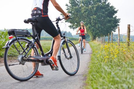
Schlossbrauhaus Schwangau - Brunnen - Hegratsriedsee - Greith - Kniebis - Illasbergsee - Roßhaupten - Rieden am Forggensee - Füssen - Schlossbrauhaus Schwangau.
Tourist Information Schwangau
- Strecke38,09 km
- Dauer2:55 h
- Aufstieg307 Hm
- Abstieg307 Hm
- Schwierigkeitmittel
Höhenprofil
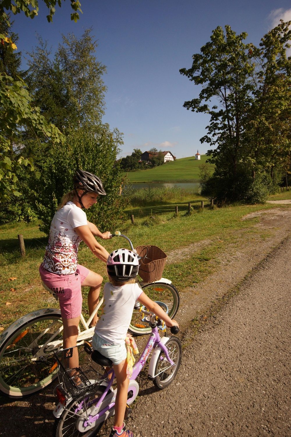
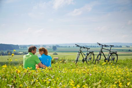
Varied round trip around the Forggensee lake with beautiful views of the landscape
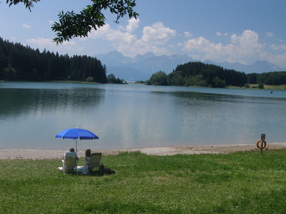
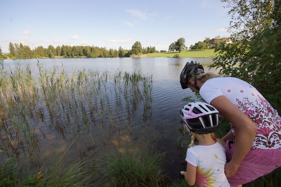
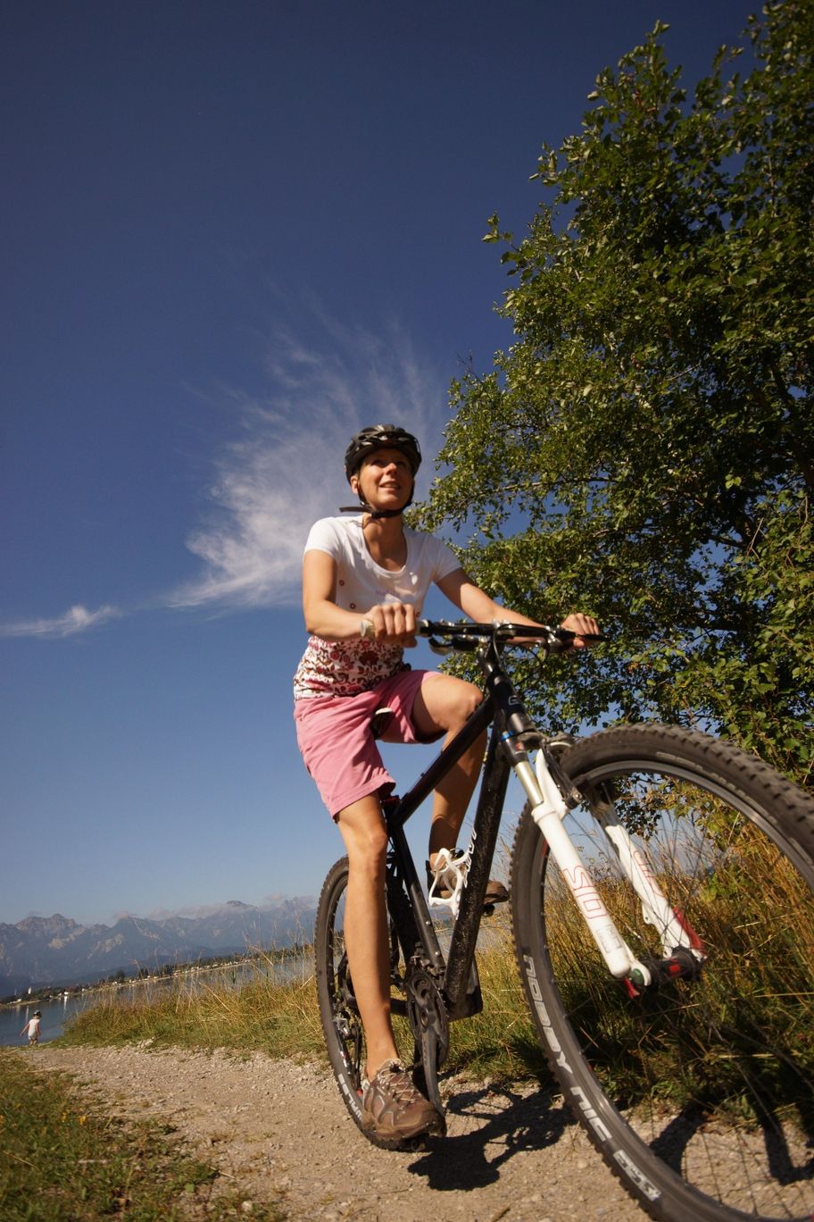
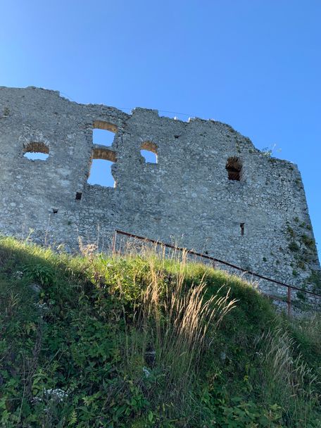
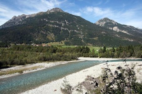
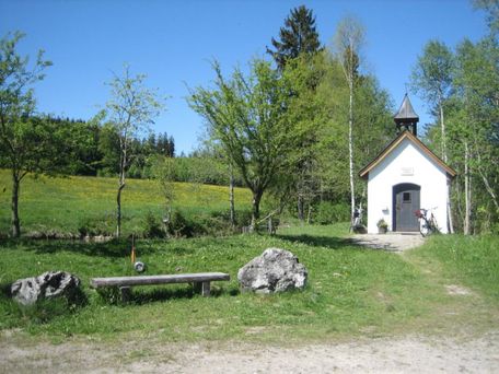
Begins at the Schlossbrauhaus and continue to the district of Brunnen. It's levelled ground all the way, after the Karbrücke bridge a small gradient begins. The meadows are full of flowers as you arrive at the Hegratsrieder See, one of the warmest lakes around Schwangau and Buching. Now you reach the hamlet of Kiebis and pass the Illasberg Lake you speed towards the next ascent. At the top, opens up an awesome view of the Alpine foothills. After a short descent, you can visit the information center in the power station, which offers an interesting insights of the construction and operation of this remarkable plant. When you leave, take the right to the next mountain. Maybe you would like to take a break and lean the bike against the Roman guards before hopefully mastering the last mountain stage.
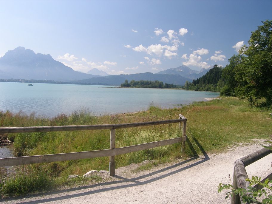
Afterwards, cycle on the path towards Roßhaupten. Before you reach the village, turn left towards Füssen. If you are exhausted, you can easily take the Forggensee boat ride up from 1st June and take a more relaxed approach to the way back. Through the villages of Dietringen and Osterreinen, you are already on the way back to Füssen. However, do not miss a detour to the Füssen Festival Theatre. Then it goes leisurely along the Lechweg to the junction to Schwangau. Before you proceed to the left, check out Füssen, the beautiful historic medieval town, worth a visit! Now continue through the so-called Überlandwerk, the dam, and feel the pure power of the water. Finally, continue the journey through Horn to Waltenhofen and back to Schwangau.
Anfahrt
You have to drive to the Schlossbrauhaus SchwangauParken
carpark near the Schlossbrauhaus Schwangau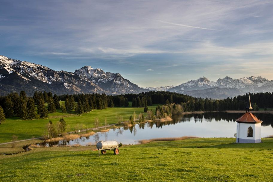
Christian Greither Photography
Outdooractive Redaktion
Outdooractive Redaktion
Tourist Information Schwangau
Tourist Information Schwangau
Sehenswürdigkeiten entlang der Tour
- SehenswertFüssen
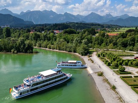
Forggensee-Schifffahrt
© Stadtwerke Füssen
mehr dazuSchiffsrundfahrten mit eindrucksvoller Aussicht auf dem Forggensee von Juni bis Oktober.
Ähnliche Touren
- Radtour
Kleine Allgäuer Seentour
© Pfronten Tourismus
Schwangau - Füssen - Rieden am Forggensee - Hopferwald - Hopfensee - Reinertshof - Hubmannsegg - Schwarzenbach - See - Weißensee - Alatsee - Bad Faulenbach - Füssen - Schwangau
mehr dazuDistanz 39,4 km Dauer 2:55 h Aufstieg 291 m Schwierigkeit mittel - Radtour
Mindelheims Norden
© Kneippland Unterallgäu
Schöne Radtour mit zahlreichen Höhepunkten entlang der Strecke. In Pfaffenhausen lohnt vor allem ein Besuch im Gesundheitszentrum. Dort kann ein Storchennest live auf einer Videoleinwand beobachtet werden. In Bedernau verspricht das Wasser der Natur-Therme ganz...
mehr dazuDistanz 37,3 km Dauer 2:10 h Aufstieg 370 m Schwierigkeit mittel - Radtour
Burgen- und Schlösserrunde
© Füssen
Auf dieser Tour lernen Sie fast alle Burgen und Schlösser der Region kennen – einsame und bekannte.
mehr dazuDistanz 42,1 km Dauer 3:00 h Aufstieg 379 m Schwierigkeit mittel - Radtour
Den Kemptner Wald erleben
© Stadtmarketing Kempten GmbH
Diese Rundtour verläuft immer wieder bergauf – zwar größtenteils auf asphaltierten Nebenstrecken, aber auch auf längeren Schotterpassagen. Nach Erreichen des höchsten Punktes in Oberschwarzenberg, der mit knapp 1000 m Höhe umfassende Bergsicht bietet, wird es wieder...
mehr dazuDistanz 41,7 km Dauer 3:45 h Aufstieg 609 m Schwierigkeit mittel - Radtour
Alpentäler-Runde
© Füssen
Abwechslungsreiche Radtour über Pfronten hinüber ins österreichische Tannheimer Tal.
mehr dazuDistanz 64,2 km Dauer 5:00 h Aufstieg 596 m Schwierigkeit mittel - Radtour
Radtour von Bad Wörishofen nach Altensteig
© Kur- und Tourismusbetrieb Bad Wörishofen
Radtour von Bad Wörishofen nach Altensteig
mehr dazuDistanz 24,6 km Dauer 1:57 h Aufstieg 242 m Schwierigkeit mittel - Radtour
Radtour zum Vogellehrpfad und rund um Oberbeuren
© Kur- und Tourismusbetrieb Bad Wörishofen
Aussichtsreiche Radtour mit einem Waldspaziergang der besonderen Art.
mehr dazuDistanz 46,3 km Dauer 3:15 h Aufstieg 269 m Schwierigkeit mittel - Radtour
Kleine Kemptener Wald-Runde
© Stadtmarketing Kempten GmbH
Die idyllisch gelegene Rundstrecke führt Sie zu beliebten Ausflugszielen der Kemptener, sei es der Bachtelweiher, der Kempter Wald oder der Wasserweg in Durach. Da Sie auf dieser Tour immer wieder an Spielplätzen (samt Minigolfplatz) vorbeikommen und sich gleich mehrere...
mehr dazuDistanz 22,3 km Dauer 1:59 h Aufstieg 406 m Schwierigkeit mittel - Radtour
Von Memmingen ins Grüne
© Kneippland Unterallgäu
Gemütliche Radtour, bei der bereits kurz nach Passieren der Stadtmauern die Fahrt ins Grüne beginnt. Auf naturbelassenen Wegen geht es von Memmingen fast bis Kronburg, wo die längste Steigung der Tour wartet. Auch der zweite Streckenabschnitt verläuft überwiegend auf...
mehr dazuDistanz 31,2 km Dauer 1:45 h Aufstieg 256 m Schwierigkeit mittel - Radtour
Um Kalzhofener Höhe und Sinswanger Moor
© Oberstaufen Tourismus Marketing GmbH
Diese aussichtsreiche Rundtour führt von Oberstaufen zur Kalzhofener Höhe und über das Hügelland um Stiefenhofen zurück.
mehr dazuDistanz 19,6 km Dauer 1:40 h Aufstieg 353 m Schwierigkeit mittel

Die Inhalte dieser Seite werden in Kooperation mit Outdooractive bereitgestellt.