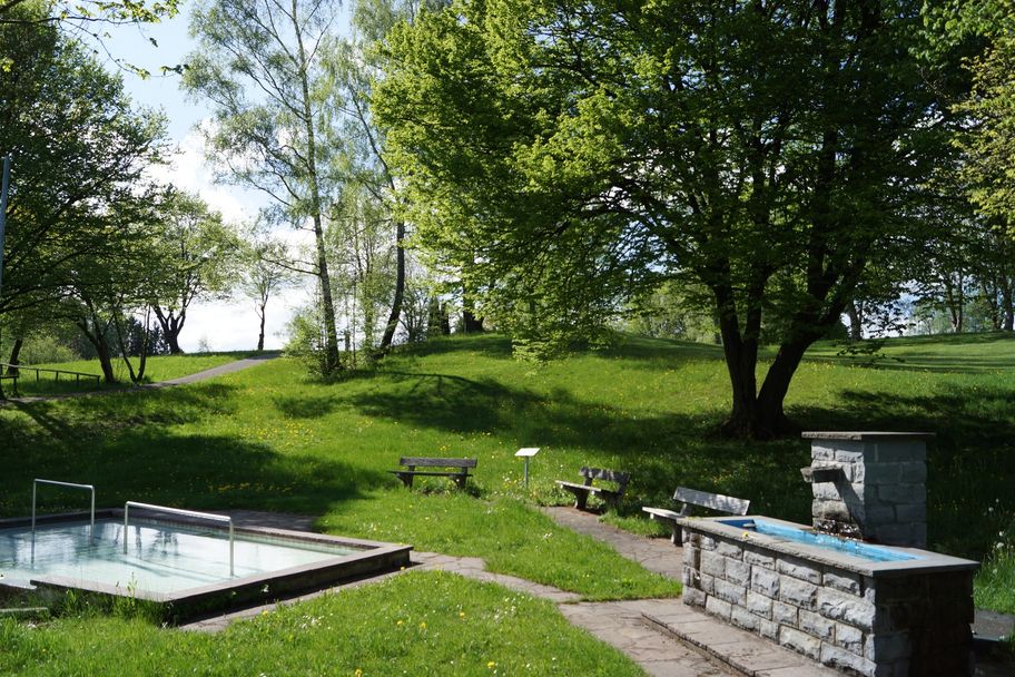
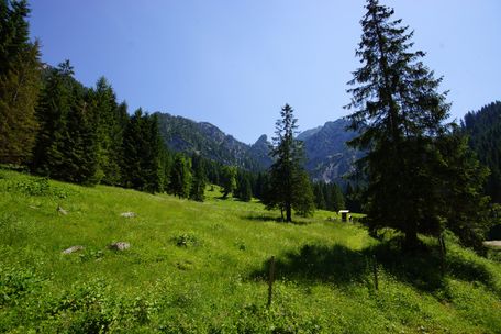
With its almost 5 km long network of paths, the Kurpark invites you to take relaxing walks. .
Tourist Information Schwangau
- Strecke6,55 km
- Dauer1:43 h
- Aufstieg26 Hm
- Abstieg21 Hm
- Schwierigkeit-
Höhenprofil
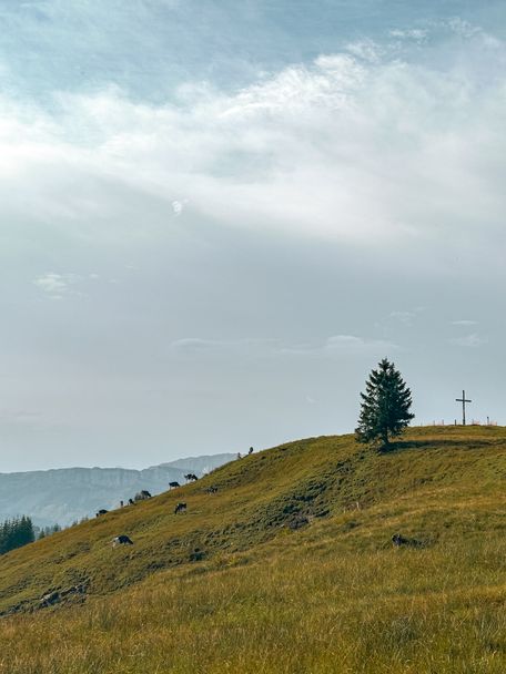
In 1824 the area was still used as a communal cattle pasture and only in 1936 it was redesigned as a recreation area for guests and locals. Today, the Kurpark is a certified terrain spa trail. Terrainkur trails are selected according to medical-therapeutic criteria (length, incline and decline) and classified according to difficulty. They must allow for a differentiated load capacity of the human organism.
Depending on which point (e.g. town hall or the roayal crystal spa) you start from, simply follow the signs to Kurpark. Already on the way there you will find some beautiful viewpoints. Information boards inform you about the native trees, shrubs and birds. Stroll leisurely through the park, rest on one of the benches and listen to the chirping of the birds.
Anfahrt
In the direction of Schwangau centerParken
Parking possibilities:
- At the Schlossbrauhaus (walking time approx. 5 min through the middle village)
- At the Royal Crystal Spa (walking time approx. 2 min)
- On the parking lot of the municipality (on the Schlossstraße) - walking time approx. 5 min
Öffentliche Verkehrsmittel
Bus:
- Rathaus bus stop (walking time approx. 5 min)
- Föhrenbergweg (walking time approx. 7 min)
- Hotel König Ludwig (walking time approx. 7 min)
Tourist Information Schwangau
Tourist Information Schwangau
Tourist Information Schwangau
Tourist Information Schwangau
Tourist Information Schwangau
Ähnliche Touren
- Wandertour
Krebsbach Runde ab Muderbolz
Der Charakter: Eine Wanderung durch den Krebsbachtobel, über Wiesen und durch das Tiefenberger Moos.
mehr dazuDistanz 6,5 km Dauer 2:00 h Aufstieg 70 m Schwierigkeit - - Wandertour
Kneippanlagen-Tour im Stadtgebiet Bad Wörishofen
© Kur- und Tourismusbetrieb Bad Wörishofen
Kurze Wanderroute zu allen Wassertretanlagen im Stadtgebiet Bad Wörishofen.
mehr dazuDistanz 7,2 km Dauer 1:45 h Aufstieg 4 m Schwierigkeit leicht - Wandertour
Schönkahler
© Tannheimer Tal
Eine gemütliche Wanderung von Zöblen auf den Schönkahler.
Von Zöblen ausgehend auf der Fahrstraße bis zur Oberen Halde, Gasthaus Zugspitzblick, weiter zum Schönkahler, ca 2 1/2 Stunden. Abstieg ist dieselbe Strecke zurück
nach Zöblem. Gehzeit ca 5 Stunden.
mehr dazuDistanz 12,4 km Dauer 5:30 h Aufstieg 798 m Schwierigkeit mittel - Wandertour
Talwanderung zur Kalbelehof Alpe
© Pfronten Tourismus
Flusswanderung entlang der Vils in das romantische Vilstal.
mehr dazuDistanz 4,9 km Dauer 1:15 h Aufstieg 67 m Schwierigkeit leicht - Wandertour
Drehhütte
© Tourist Information Schwangau
Einfache Bergtour zur Drehhütte mit schönem Bergblick und Einkehrmöglichkeit.
mehr dazuDistanz 6,4 km Dauer 1:30 h Aufstieg 340 m Schwierigkeit mittel - Wandertour
Geschichts- und Kulturlehrpfad
© Volker Müller
Auf dem Geschichts- und Kulturlehrpfad können Sie die interessantesten historischen Stätten in Woringen kennenlernen. Ein besonders schöner Aussichtspunkt auf dem Rundweg ist das Burgösch mit dem Kellerberg. Hier bauten die Kelten bereits 300 vor Christus eine...
mehr dazuDistanz 4,1 km Dauer 1:45 h Aufstieg 70 m Schwierigkeit mittel - Wandertour
Weiler-Simmerberg R13 Rutzhofen - Berbruggen
© Outdooractive Redaktion
Weiler-Simmerberg R13 Rutzhofen - Berbruggen
mehr dazuDistanz 9,8 km Dauer 2:31 h Aufstieg 270 m Schwierigkeit mittel - Wandertour
Rund um die Natur-Therme
Diese kleine Rundwanderung kann sehr gut mit einem Besuch der Naturtherme Bedernau verbunden werden. Die Therme ist Teil des Aktiv-Park Kneippland Unterallgäu. Im Mittelpunkt der Erlebnisstation steht das „Wasser“: Heilendes Thermalwasser in der Therme, kühles...
mehr dazuDistanz 1,6 km Dauer 0:25 h Aufstieg 32 m Schwierigkeit leicht - Wandertour
Grünenbach Laubenberg-Rundtour
© Wikimedia Commons
Abwechslungsreiche Wanderung mit Höhen und Tiefen. Erst hinunter in den Eistobel und dann hinauf auf den Kapf. Der Rundweg ist als leichte Rundwanderung angelegt.
mehr dazuDistanz 16,2 km Dauer 3:00 h Aufstieg 769 m Schwierigkeit schwer - Wandertour
Wanderung über den Hochschelpen zum Gelbhansekopf in Balderschwang
© Tourismus Hörnerdörfer
Eine aussichtsreiche Rundwanderung über den Hochschelpen, die dich durch stille Wälder, über weite Bergwiesen und zu schönen Aussichtspunkten führt.
mehr dazuDistanz 10,5 km Dauer 3:30 h Aufstieg 540 m Schwierigkeit schwer

Die Inhalte dieser Seite werden in Kooperation mit Outdooractive bereitgestellt.