Carpark Tegelbergbahn - ascent with the cable car - Bleckenau - Marien Bridge - Hohenschwangau - Reith Alpe - carpark Tegelbergbahn.
Tourist Information Schwangau
- Strecke14,24 km
- Dauer4:00 h
- Aufstieg169 Hm
- Abstieg1042 Hm
- Schwierigkeitmittel
Höhenprofil
Nice hiking tour on royal riding paths.
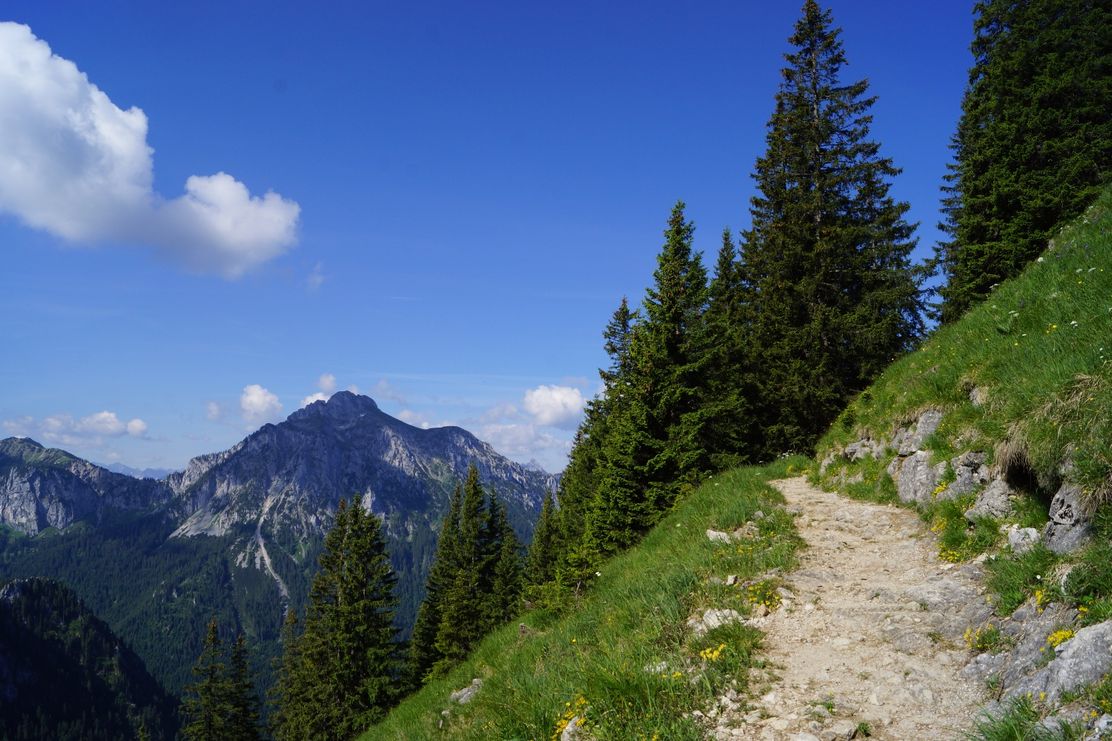
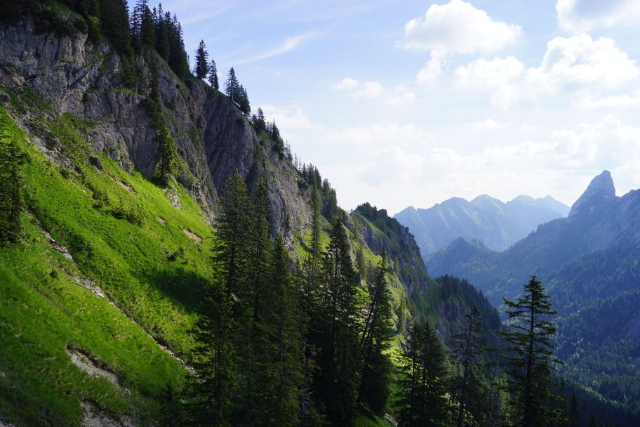
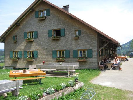
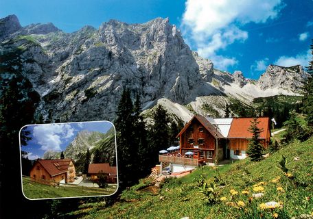
After the ascent with the Tegelberg Cable Car to the top station, the nature trail Ahornreitweg begins on an alpine path with intermittent views of the valley in the midst of the magnificent mountain world to the Branderfleck. From there, the actual bridle path leads you comfortably in a gently sloping hairpin bends to the end of the nature trail at the Bleckenau forest road. About 10 minutes short ascent, you can rest and strengthen yourself at mountain inn Bleckenau. Either you return via Neuschwanstein Castle to the valley Tegelberg cable car station or simply take the inn bus. The nature trail Ahornreitweg forms a unit with Schutzengelweg which leads from the Tegelberg down to the forest road Bleckenau. King Maximilian II had the grounds laid out around 1850 so as to enable his entourage to reach both the royal hunting grounds and hunting lodge Tegelberg comfortably on horsebacks.
Anfahrt
You have to look to the signs "Tegelbergbahn"Parken
Carpark near the cable car TegelbergbahnÖffentliche Verkehrsmittel
Busstop "Tegelbergbahn"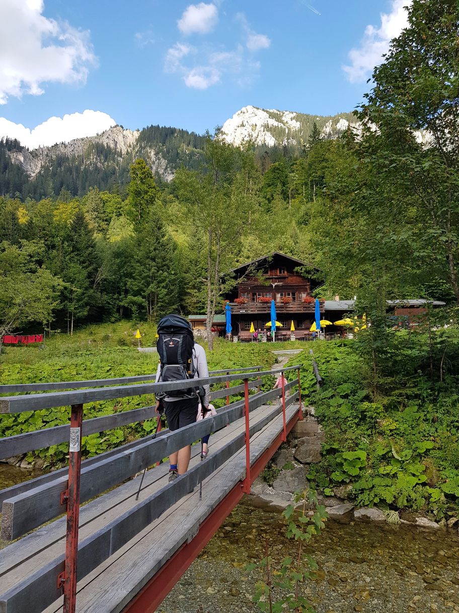
Tourist Information Schwangau
Tourist Information Schwangau
Tourist Information Schwangau
Tourist Information Schwangau
Ähnliche Touren
- Wandertour
Gerichtsweg "Freie Bauern von Eglofs"
© Outdooractive Redaktion
Der Gerichtsweg der "Freien Bauern von Eglofs" verläuft über 4 Etappen.
mehr dazuDistanz 50,7 km Dauer 14:35 h Aufstieg 1.305 m Schwierigkeit mittel - Wandertour
Füssener Hütte - Otto Mayr Hütte
© Tannheimer Tal
Rundtour mit großartigem Ausblick und beeindruckendem Blick auf die umliegende Tannheimer Berggruppe - Rot Flüh, Gimpel und Köllenspitze.
mehr dazuDistanz 11,1 km Dauer 4:30 h Aufstieg 973 m Schwierigkeit mittel - Wandertour
Rundwanderung zur Bärenmoosalpe im "Himmelreich"
© Pfronten Tourismus
Der Weg über die Bärenmoosalpe mit Blick auf Breitenberg, Aggenstein, Einstein und Schönkahler ist besonders genussreich. Ihr habt viel Zeit. Bewundert die herrlichen Alpwiesen und legt immer wieder kurze Rasten ein, um all das Schöne aufnehmen zu können. Ihr befindet...
mehr dazuDistanz 12,9 km Dauer 4:00 h Aufstieg 416 m Schwierigkeit mittel - Wandertour
Wanderrundweg 3: "Zu den Leupolzer Höhen und ins Tal der unteren Argen"
© Gästeamt - Tourist Information Wangen im Allgäu
Diese schöne Rundwanderung führt uns durch die abwechslungsreiche Landschaft in Wangens Norden. Ein Weiher mit Bademöglichkeit und mehrere Einkehrmöglichkeiten laden zum Verweilen ein.
mehr dazuDistanz 16,9 km Dauer 5:30 h Aufstieg 131 m Schwierigkeit mittel - Wandertour
Naturerlebnisweg: Bad Grönenbach blüht auf
© Fotostudio Zuchtriegel
Landschaft- und Naturbeobachtung, Wissenswertes für Groß und Klein kann in Aktion erlebt werden. Der Erlebnisweg kann in drei Routen aufgeteilt werden.
mehr dazuDistanz 10,2 km Dauer 3:30 h Aufstieg 215 m Schwierigkeit mittel - Wandertour
Großer Rundweg
© Landkreis Lindau (Bodensee)
Scheidegg - Blasenbergstraße - Hochgratstraße - Kurstraße - Ablers - Ruhmühle - Hagspiel - Häuslings - Forst - Alpenfreibad - Postferiendorf - Prinzregent-Luitpold-Straße
mehr dazuDistanz 9,3 km Dauer 2:30 h Aufstieg 137 m Schwierigkeit mittel - Wandertour
Rauf und Runter
© Landkreis Lindau (Bodensee)
Scheidegg - Bahnhofstraße - Haus - Allmannsried - Gretenmühle - Bieslings - Bräuhausstraße
mehr dazuDistanz 5,7 km Dauer 1:35 h Aufstieg 110 m Schwierigkeit mittel - Wandertour
Langstrecken Wanderung - Stiefenhofen
© Landkreis Lindau (Bodensee)
Stiefenhofen - Unterhalhofen - entlang der oberen Argen - Weißenbachmühle - Zell - Wolfsried - Ranzenried - Lautenberg - Stiefenhofen Ort
mehr dazuDistanz 10,5 km Dauer 4:00 h Aufstieg 151 m Schwierigkeit mittel - Wandertour
Über den Kapf zu den Eibele Wasserfällen
© Oberstaufen Tourismus Marketing GmbH
Diese Rundtour führt zuerst aussichtsreich über den Gipfel des Kapf und dann weiter über den Ortsteil Döbilisried zu den Eibele Wasserfällen an der Grenze zu Vorarlberg. Der Rückweg verläuft über Hinter- und Vorderhalden, dann geht es durch einen Wald zum Ferienclub in...
mehr dazuDistanz 12,9 km Dauer 4:00 h Aufstieg 458 m Schwierigkeit mittel - Wandertour
Aggenstein Variante 1
© Outdooractive Redaktion
Eine tolle Wanderung auf einen der beliebtesten Berge im Tannheimer Tal.
mehr dazuDistanz 9,7 km Dauer 5:30 h Aufstieg 836 m Schwierigkeit mittel

Die Inhalte dieser Seite werden in Kooperation mit Outdooractive bereitgestellt.