Parking Hohenschwangau - Neuschwanstein Castle - Hohenschwangau Castle - Schwansee - Calvary - Füssen - High Castle - Parking Hohenschwangau.
Tourist Information Schwangau
- Strecke13,22 km
- Dauer4:15 h
- Aufstieg413 Hm
- Abstieg413 Hm
- Schwierigkeit-
Höhenprofil
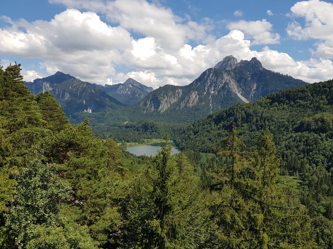
Until now, the trail connection between the town of Füssen and the village of Schwangau was considered the "unknown beauty" among hiking trails.
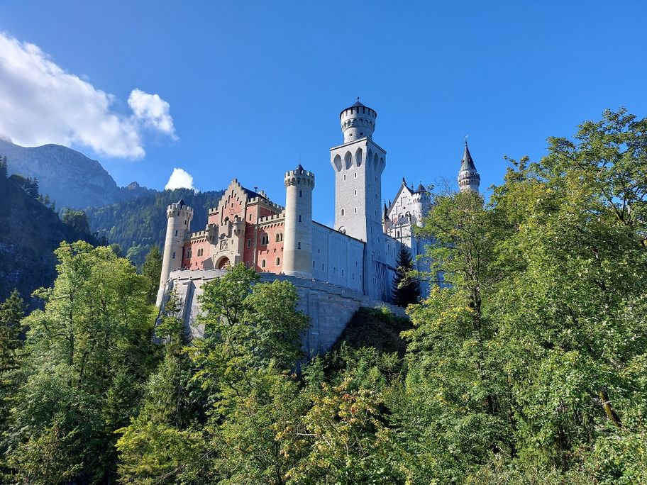
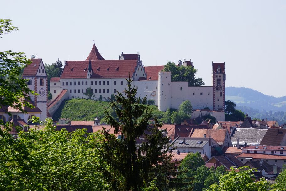
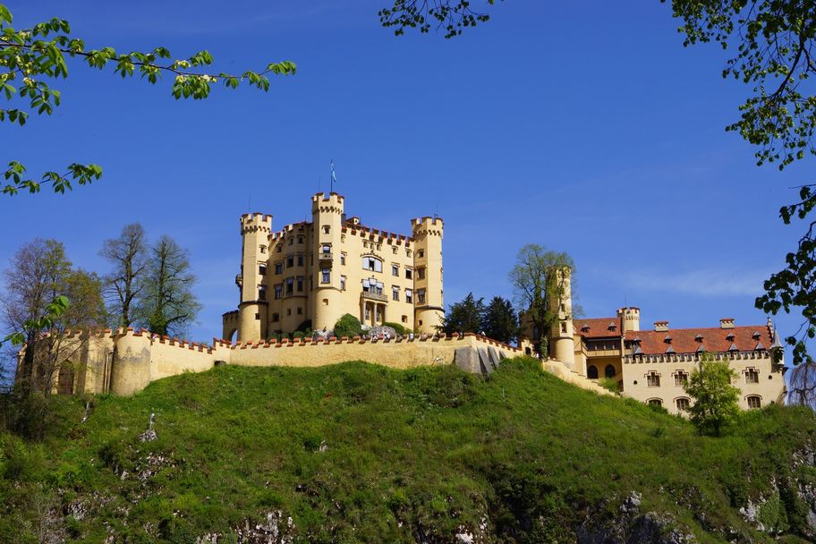
The hike starts from the Hohenschwangau parking lot. After a short distance you will see Neuschwanstein Castle (tickets for a tour must be purchased in advance in the valley at the ticket center or in the online ticket store). Continue on Schlossstraße into town and 10-minute climb to Hohenschwangau Castle. Then follow the signs to Schwansee. At Schwansee, continue on Königsstraße in the direction of Füssen. After a few hairpin bends, you come to the Kalvarienberg branch, which you should definitely climb, because from here a 360-degree panorama opens up on the three castles (Neuschwanstein, Hohenschwangau, Hohes Schloss, Füssen), the imposing mountain scenery and the Allgäu foothills of the Alps with its numerous lakes. The descent is via the Kreuzweg to Füssen, where the beautiful old town and the High Castle (gallery) invite you to visit. After crossing the old town, keep to the right at Kaiser-Maximilian-Platz out of town in the direction of Lech/Schwangau-Horn. After about 10 minutes you cross the Lech and walk on the footpath back to Hohenschwangau.
Anfahrt
Follow the signs Hohenschwangau/KönigsschlösserParken
Paid parking in Hohenschwangau (P1-P4)Öffentliche Verkehrsmittel
Nearest bus stop at the information point Hohenschwangau (Neuschwanstein-Hohenschwangau-Castles).
Easy tour, also suitable for children.
Tourist Information Schwangau
Tourist Information Schwangau
Tourist Information Schwangau
Ähnliche Touren
- Wandertour
Himmelsstürmer Route der Wandertrilogie Allgäu - Etappe 07 - Oy-Mittelberg - Rettenberg
© Allgäu GmbH, Gesellschaft für Standort und Tourismus
Eine Prachtetappe! Sie ist lang, entlohnt aber mit einer Wiesenspektakel, mit einem See, sagenhaften Ausblicken und Gipfelkreuzen und einer Riesen-Bank.
mehr dazuDistanz 23,8 km Dauer 7:30 h Aufstieg 593 m Schwierigkeit schwer - Wandertour
Stiefenhofen R17
© Landkreis Lindau (Bodensee)
Rundstrecke über das Kremlerbad
mehr dazuDistanz 4,3 km Dauer 1:00 h Aufstieg 54 m Schwierigkeit mittel - Wandertour
Große Denkmalrunde
In den ausgedehnten Waldgebieten östlich von Boos ist viel Platz für lange Wanderungen mit einer Garantie auf Ruhe und Erholung. Besonders schön gelegen sind ein paar kleine Fischweiher mitten im Wald, hier können Sie Seele und Geist baumeln lassen. Ebenfalls umringt...
mehr dazuDistanz 7,8 km Dauer 2:00 h Aufstieg 148 m Schwierigkeit mittel - Wandertour
Buchenberg
Buchenberg
mehr dazuDistanz 3,3 km Dauer 1:00 h Aufstieg 35 m Schwierigkeit - - Wandertour
Tulpenbaum Allee Runde
In unmittelbarer Nähe zum Parkplatz „Zum Waldgarten“ in Ferthofen beginnt die berühmte Tulpenbaum-Allee. Ein Naturdenkmal, das nicht nur zur Blütezeit (Juni, Juli) sehenswert ist. Eine Schautafel informiert über die Tulpenbaum- Allee; ihren Begründer und Schloss...
mehr dazuDistanz 5,0 km Dauer 1:15 h Aufstieg 29 m Schwierigkeit mittel - Wandertour
Zirmgrat-Runde
© Füssen
Highlight dieser abwechslungsreichen Tour ist Deutschlands höchste Burgruine auf dem Falkenstein.
mehr dazuDistanz 12,4 km Dauer 5:00 h Aufstieg 621 m Schwierigkeit mittel - Wandertour
Illerstausee Runde
In Ferthofen, links vor der Illerbrücke, führt eine Treppe zum Kraftwerksauslauf hinab. Zwischen steilem Uferhang und Stauseeufer führt ein idyllischer Fußweg (z.T. Pfad) am Waldrand entlang bis zum nächsten Kraftwerk am Illerstau bei Kardorf. Zahlreich benagte Bäume...
mehr dazuDistanz 7,6 km Dauer 2:00 h Aufstieg 86 m Schwierigkeit mittel - Wandertour
Dürrenbühl - Lachermoosrunde / Knollerhag-Runde
© Outdooractive Redaktion
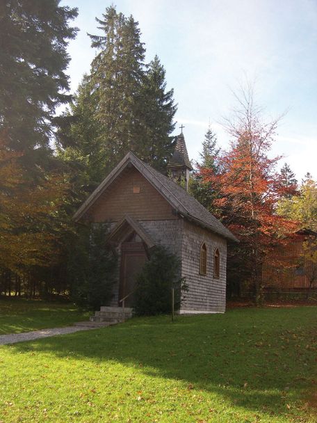
Zu den Höhepunkten unserer Tour gehören die Alte Jagd-Hütte mit Waldkapelle, die Wildfütterung "Dürrenbühl" und der Aussichtspunkt "Knollerhag". Außerdem verläuft ein Stück der Strecke auf dem "Jakobusweg".
mehr dazuDistanz 8,9 km Dauer 2:20 h Aufstieg 46 m Schwierigkeit mittel - Wandertour
"Maria Trost"-Route (N4)
Schöne Tour zur Kapelle Maria Trost. Nordic-Walking geeignet.
mehr dazuDistanz 6,2 km Dauer 1:45 h Aufstieg 344 m Schwierigkeit mittel - Wandertour
Stadtwald-Runde zwischen Dickenreishausen und Woringen
Ab dem Parkplatz „Trimm-Pfad“ (westlich Dickenreis) verläuft die Runde weitgehend auf Forstwegen durch abwechslungsreiche Waldbestände.
mehr dazuDistanz 10,9 km Dauer 2:22 h Aufstieg 83 m Schwierigkeit mittel
Die Inhalte dieser Seite werden in Kooperation mit Outdooractive bereitgestellt.