A beautiful hike for the whole family. .
Tannheimer Tal
- Strecke10,68 km
- Dauer3:56 h
- Aufstieg747 Hm
- Abstieg747 Hm
- Schwierigkeitmittel
Höhenprofil
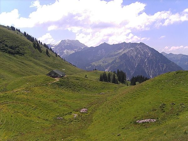
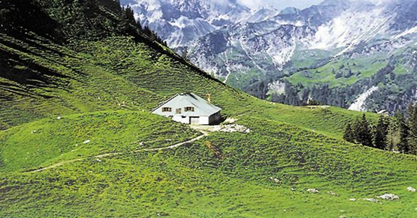
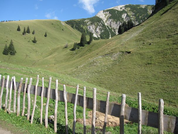
Through the beautiful Stuibental valley past the Wannenjoch into the Ostrach valley to the Zipfelsalpe. Enjoy the wonderful flora and fauna along the whole route. Behind us we have the probably most beautiful high valley in Europe and in front of us fantastic mountain peaks. Behind these lies the neighbouring Allgäu. Views and impressions say more than a thousand words. You can look forward to a beautiful natural scenery.
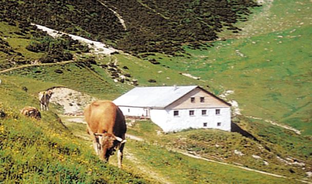
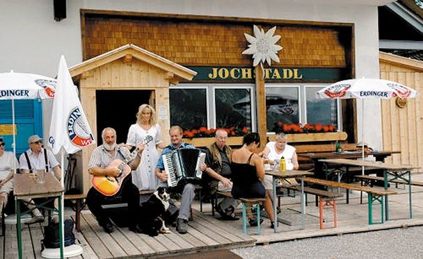
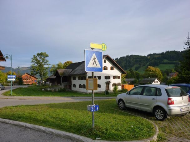
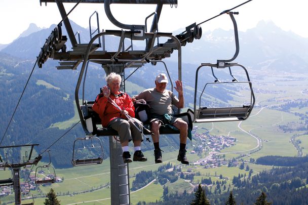
At the lift parking in Schattwald, head east, past the Kneipp facility, over a small bridge and uphill to the right. Through the Stuibental valley the gravel forest path leads nicely through the forest. Turn right at the Untere Stuiben Alpe (no hut), continue into the basin and climb up to the saddle. A beautiful plateau with the ruins of the Oberer Stuiben offers itself to the viewer's gaze. From here it goes slightly downhill to the Zipfelsalpe. The way back runs along the eastern flank of the Wannenjoch. The path is moderately steep first uphill, then downhill to the top station of the Wannenjochbahn cable car. Here in the Jochstadel, as well as on the Zipfelsalm, there is the possibility of a stop for refreshments. The descent runs a little along the hiking trail on the ski slope, then along a forest path through the forest towards the Stuibental valley, almost to the valley station of the Stuibenlift. To the left, downhill towards Schattwald, the path leads back to the starting point. It is possible to take the chair lift up or down and from the top station to the Zipfelsalpe with an easy ascent and descent.
Anfahrt
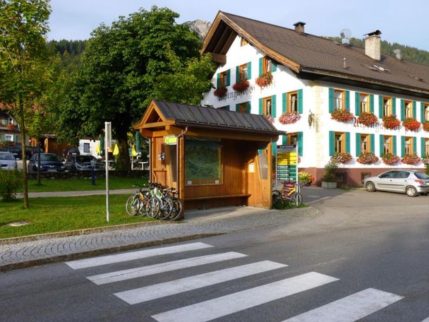
On the motorway A7 at the exit "Oy-Mittelberg" on the B310 towards Wertach and to Oberjoch. There follow the signs "Tannheimer Tal" B199, exit Schattwald, direction Wannenjoch Bergbahn.From the Tyrolean side via Reutte on the B198 towards Lechtal to Weißenbach, over the Gaichtpass along the B199 to the Schattwald exit, direction Wannenjoch Bergbahn.Parken
At the valley station of the Wannenjochbahn in Schattwald - parking feeÖffentliche Verkehrsmittel
By train to Sonthofen, Pfronten/Ried or Reutte, then by bus to Schattwald.
It should be noted that in mountaineering there is an increased risk of accidents and injuries. Despite careful route planning, a basic risk always remains. Tour preparation through endurance sports, appropriate technical training and further education as well as personal prudence reduces the danger of accidents and risks. However, please never forget that the weather in the mountains can change very quickly. Stay on the marked hiking trails.
The personal mountaineering equipment must be safe and serviceable and meet the relevant technical standards. Every hiker is recommended to obtain information about the planned tours from specialist alpine literature or on site.
Ähnliche Touren
- Wandertour
"Gutes vom Dorf" - Culinary hike through Ofterschwang
Tradition, untouched landscape and a lot of regional delicacies - that is what distinguishes Ofterschwang.
mehr dazuDistanz 11,8 km Dauer 3:30 h Aufstieg 309 m Schwierigkeit mittel - Wandertour
"Wiesengänger"-Trail
© Allgäu GmbH
The "Wasserläufer"-Route takes you through a beautiful hilly landscape on 463 km.
mehr dazuDistanz 424,8 km Dauer 107:30 h Aufstieg 5.300 m Schwierigkeit mittel - Wandertour
Alpine Meadows - hiking tour from Ofterschwang
Varied and cozy through forests and over meadows. Great views, varied nature and small playgrounds along the way with refreshments.
mehr dazuDistanz 8,3 km Dauer 3:00 h Aufstieg 427 m Schwierigkeit mittel - Wandertour
Border guard trail Oberreute/Allgaeu
© Thomas Gretler
Cross-border experience path for the whole family.
mehr dazuDistanz 9,1 km Dauer 2:30 h Aufstieg 173 m Schwierigkeit mittel - Wandertour
Castle ruin Falkenstein
© Tourismusverband Ostallgäu e.V.
Castle ruin Falkenstein
mehr dazuDistanz 7,8 km Dauer 3:00 h Aufstieg 530 m Schwierigkeit mittel - Wandertour
Family hike across Ochsenkopf via Riedberger Horn – climbing for kids
Family hike across Ochsenkopf via Riedberger Horn – climbing for kids
mehr dazuDistanz 12,9 km Dauer 4:23 h Aufstieg 591 m Schwierigkeit mittel - Wandertour
Hiking on the ridgeway ('Hoehenweg') from Scheidegg to the mountain Pfaender - the classic
© Scheidegg Tourismus
The wonderful hiking tour leads you from Scheidegg through the German-Austrian alpine upland to the mountain Pfaender heighted 1064 meters. There you will be rewarded with an impressive panoramic view.
mehr dazuDistanz 10,9 km Dauer 3:30 h Aufstieg 415 m Schwierigkeit mittel - Wandertour
Hiking trail from Ofterschwang via Ofterschwanger Horn and Sigiswang
Scenic mountain tour to the Ofterschwanger Horn (peak).
mehr dazuDistanz 11,3 km Dauer 4:30 h Aufstieg 678 m Schwierigkeit mittel - Wandertour
Hochwiesweg Hike
A gorgeous little loop with beautiful views.
(pram friendly tour)
mehr dazuDistanz 3,9 km Dauer 1:00 h Aufstieg 120 m Schwierigkeit mittel - Wandertour
Hörner Panorama Tour - lovely mountain hike from Bolsterlang or Ofterschwang
This fantastic tour can start either in Bolsterlang or Ofterschwang and takes you over the popular Hörner Panorama Tour along the Weiherkopf, Rangiswanger Horn, Sigiswanger Horn and Ofterschwanger Horn.
mehr dazuDistanz 16,3 km Dauer 7:45 h Aufstieg 1.017 m Schwierigkeit mittel


Tannheimer Tal
Tannheimer Tal
Tannheimer Tal
Tannheimer Tal
Tannheimer Tal
Tannheimer Tal
Tannheimer Tal
Tannheimer Tal
Die Inhalte dieser Seite werden in Kooperation mit Outdooractive bereitgestellt.