Cross-border experience path for the whole family.
- Strecke9,10 km
- Dauer2:30 h
- Aufstieg173 Hm
- Abstieg173 Hm
- Schwierigkeitmittel
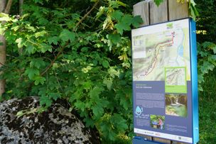
Höhenprofil
Smuggler-Pete knows how to do it.
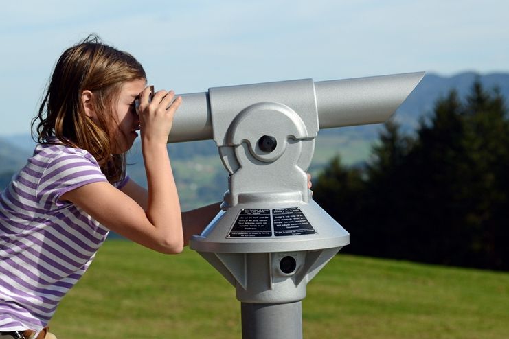
Adults are required to acquire knowledge about nature. Meanwhile, children are supposed to read the signs of nature and to sharpen their senses according to the instructions of Smuggler-Peter. Just the way, smugglers did it back in the days. So you can detect life-size animal figures in the undergrowth you can crack the treasure chest, capture the voices of the treetops with the ear trumpet or you can find shelter in the pine branches and much more. A set of very creative landscape furniture like so-called "Himmelguckerbänke" (benches on which you can watch the sky), hammocks in the woods, telescope platforms with view of the Nagelfluh mountain range are enrichments for the new path.
Stories of border guards, customs officers and smugglers
You can gain insight into the former life at the border at the little house of the border guards in the "Hochsträß"1050 metres above sea level, the highest point of the mountain Sulz-Berg. Countless legends, but also true and very dramatic incidents concerning border guards, customs officers and smugglers are known and documented at the path. Looking out of the window of the little border house, you can see how the officers did their patrols and older people among us will have certain memories.
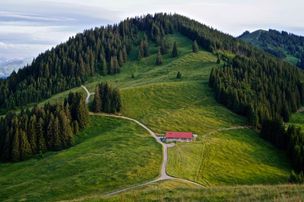
Simple hiking on forest and meadow paths for the whole family. The path leads you on wooden planks in the moors. Starting at the public swimming pool in Oberreute, you come across the path after approx. 2.5 kilometres. In order to keep the way to the actual trail interesting for our children, there are also quiz panels attached to it.
Starting point: public swimming pool Oberreute. Signpost: logo smuggler Pete - Sulzberg- Bruckmoos - Kalter Brunnen - Hochsträß/Wildrosenmoos - Sulzberg - Hochsträß - Kalter Brunnen - Oberreute
Walking time: 2 - 2.5 hours
Further entry opportunities:
- Wanderparkplatz Hinterschweinhöf Walking time 1.5 - 2 hours
- Parking lot Vorderschweinhöf/Schnellers: 2 hours.
Ähnliche Touren
- Wandertour
"Wiesengänger"-Trail
© Allgäu GmbH
The "Wasserläufer"-Route takes you through a beautiful hilly landscape on 463 km.
mehr dazuDistanz 424,8 km Dauer 107:30 h Aufstieg 5.300 m Schwierigkeit mittel - Wandertour
Castle ruin Falkenstein
Castle ruin Falkenstein
mehr dazuDistanz 7,8 km Dauer 3:00 h Aufstieg 530 m Schwierigkeit mittel - Wandertour
Hiking on the ridgeway ('Hoehenweg') from Scheidegg to the mountain Pfaender - the classic
The wonderful hiking tour leads you from Scheidegg through the German-Austrian alpine upland to the mountain Pfaender heighted 1064 meters. There you will be rewarded with an impressive panoramic view.
mehr dazuDistanz 10,9 km Dauer 3:30 h Aufstieg 415 m Schwierigkeit mittel - Wandertour
Kapellenwanderung in Stiefenhofen
Kapellenwanderung in Stiefenhofen
mehr dazuDistanz 14,0 km Dauer 4:00 h Aufstieg 326 m Schwierigkeit mittel - Wandertour
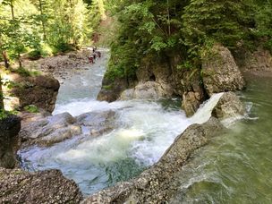
Nature reserve Eistobel: Circuit via the mountain Riedholzer Kugel - Westallgäu waterway 20
Nature reserve Eistobel - Wonder world made of water, rocks and iceRushing waterfalls and deep swirl holes, huge blocks of Nagelfluh, a conglomerate of rock, sand and calcareous binders and enormous rock faces - the nature reserve Eistobel with a total length of approx....
mehr dazuDistanz 9,2 km Dauer 3:45 h Aufstieg 399 m Schwierigkeit mittel - Wandertour
Villa parks, vineyards and orchards – the Lindau garden culture trail
Villa parks, vineyards and orchards – the Lindau garden culture trail
mehr dazuDistanz 9,3 km Dauer 2:30 h Aufstieg 65 m Schwierigkeit mittel - Wandertour
Wassererlebnisweg durch den Haldertobel
Schattige Wege mit schäumenden Wasserfällen und kleinen Strudeln führen Sie auf dieser Wanderung ins idyllische Örtchen Gunzesried.
mehr dazuDistanz 7,8 km Dauer 2:25 h Aufstieg 173 m Schwierigkeit mittel - Wandertour
Mountain hike from Ofterschwang to the Ofterschwanger Horn
Wonderful little mountain tour to Ofterschwanger Horn with a beautiful view and numerous possibilities to stop.
mehr dazuDistanz 8,6 km Dauer 3:45 h Aufstieg 500 m Schwierigkeit mittel - Wandertour
Ostertobel - idyllic hike from Ofterschwang through a picturesque ravine
Panoramic hiking tour from Ofterschwang with cable car trip with the Weltcup-Express to the mountain station. From here over a lovely route down via Gaisrücken and through the idyllic Oster ravine near Gunzesried Säge.
mehr dazuDistanz 11,1 km Dauer 3:30 h Aufstieg 294 m Schwierigkeit mittel - Wandertour
Hiking trail from Ofterschwang via Ofterschwanger Horn and Sigiswang
Scenic mountain tour to the Ofterschwanger Horn (peak).
mehr dazuDistanz 11,3 km Dauer 4:30 h Aufstieg 678 m Schwierigkeit mittel


Die Inhalte dieser Seite werden in Kooperation mit Outdooractive bereitgestellt.