A gorgeous little loop with beautiful views.
(pram friendly tour).
A gorgeous little loop with beautiful views.
(pram friendly tour).
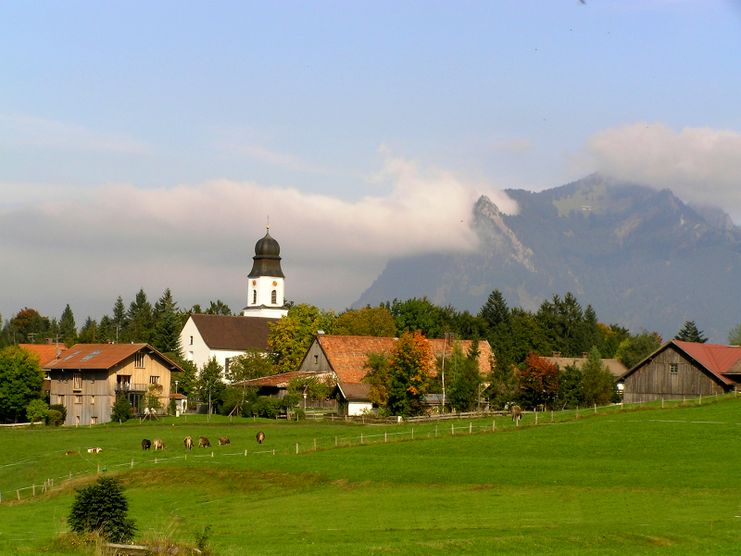
This tour takes you from Ofterschwang on a slightly elevated way south to Sigiswang. Back it goes via the village loop to Ofterschwang. The trail is also suited for children, afterwards you can enjoy a delicious ice cream.
From the parking lot of the base station you walk the short distance of the Panorama Street down to the corner and turn right and follow the street "Am Fahnen" upwarts. Follow the signposted route to Sigiswang where you head downhill to the main road. Follow the road to the left about 200m to Ofterschwang, turn right onto the "Dorfrunde". The village route leads in an arc directly heading to the St. Alexander Church and ends in Moosweg. Left downhill, it goes through the village center, the Panorama Street up to the starting point - the base station.
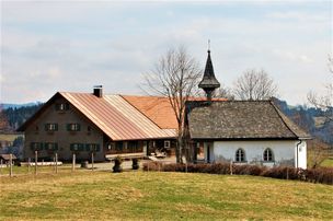
Tip: Visit the St. Alexander Church on this tour and enjoy a delicious ice in the ice cream shop in the village center of Ofterschwangs. If you are looking for some good food, the Wurzel Hütte, Schlitte Hitte and the Pizzeria Cortina at the base station and the Landhotel Alphorn near the church offer typical bavarian dishes.
Schedule for buses and trains in the southern Upper Allgäu (german)
Ofterschwang is located on the edge of the Nature Park Nagelfluhkette. A Nature Park is a protected landscape created by long-term use and cultivation. This valuable cultural landscape is to be preserved in its present form, but at the same time also to be used.
Please note the following recommendations:

Tradition, untouched landscape and a lot of regional delicacies - that is what distinguishes Ofterschwang.
| Distanz | 11,8 km |
| Dauer | 3:30 h |
| Aufstieg | 309 m |
| Schwierigkeit | mittel |

Allgäu GmbH
The "Wasserläufer"-Route takes you through a beautiful hilly landscape on 463 km.
| Distanz | 424,8 km |
| Dauer | 107:30 h |
| Aufstieg | 5.300 m |
| Schwierigkeit | mittel |

Varied and cozy through forests and over meadows. Great views, varied nature and small playgrounds along the way with refreshments.
| Distanz | 8,3 km |
| Dauer | 3:00 h |
| Aufstieg | 427 m |
| Schwierigkeit | mittel |

Cross-border experience path for the whole family.
| Distanz | 9,1 km |
| Dauer | 2:30 h |
| Aufstieg | 173 m |
| Schwierigkeit | mittel |

Castle ruin Falkenstein
| Distanz | 7,8 km |
| Dauer | 3:00 h |
| Aufstieg | 530 m |
| Schwierigkeit | mittel |

Family hike across Ochsenkopf via Riedberger Horn – climbing for kids
| Distanz | 12,9 km |
| Dauer | 4:23 h |
| Aufstieg | 591 m |
| Schwierigkeit | mittel |

The wonderful hiking tour leads you from Scheidegg through the German-Austrian alpine upland to the mountain Pfaender heighted 1064 meters. There you will be rewarded with an impressive panoramic view.
| Distanz | 10,9 km |
| Dauer | 3:30 h |
| Aufstieg | 415 m |
| Schwierigkeit | mittel |

Scenic mountain tour to the Ofterschwanger Horn (peak).
| Distanz | 11,3 km |
| Dauer | 4:30 h |
| Aufstieg | 678 m |
| Schwierigkeit | mittel |

This fantastic tour can start either in Bolsterlang or Ofterschwang and takes you over the popular Hörner Panorama Tour along the Weiherkopf, Rangiswanger Horn, Sigiswanger Horn and Ofterschwanger Horn.
| Distanz | 16,3 km |
| Dauer | 7:45 h |
| Aufstieg | 1.017 m |
| Schwierigkeit | mittel |
Kapellenwanderung in Stiefenhofen
| Distanz | 14,0 km |
| Dauer | 4:00 h |
| Aufstieg | 326 m |
| Schwierigkeit | mittel |
Die Inhalte dieser Seite werden in Kooperation mit Outdooractive bereitgestellt.