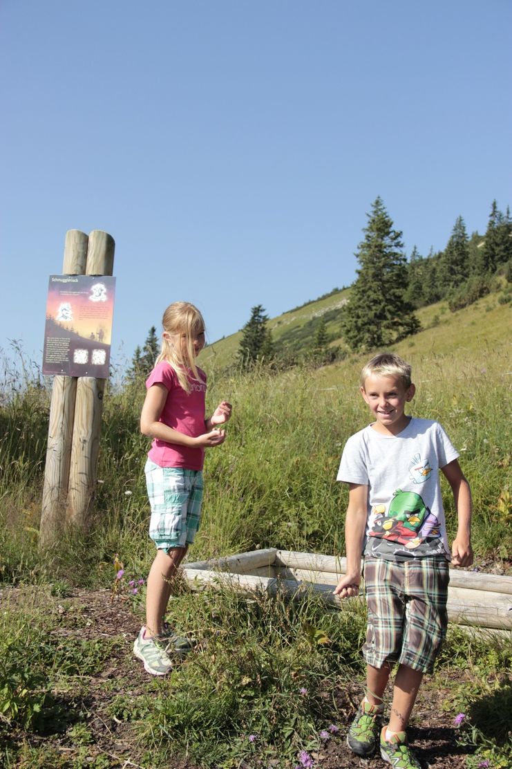
The smugglers' trail from Wannenjoch to Iseler - great fun for the whole family!.
- Strecke4,31 km
- Dauer1:39 h
- Aufstieg228 Hm
- Abstieg227 Hm
- Schwierigkeitmittel
Höhenprofil
The hiking trail called "Schmugglersteig" from Wannenjoch to the Iseler. This path was a popular smuggler's path because of its proximity to the border, and you can still feel all kinds of smugglers' footsteps today. A unique adventure for young and old. Already at the valley station you will be welcomed by the so-called "black man" and you decide which role you want to take on: that of smuggler or that of border guard. Once you arrive at the top station, you will receive the smuggler's or border guard's paraphernalia and be initiated into the respective task. You now walk through the smuggler's path and as a smuggler you are supposed to transport the smuggled goods from Tyrol to Bavaria and as a border guard you are supposed to track down as many smugglers as possible. Once you have completed the task, all hikers, whether smugglers or border guards, receive the "Smuggler Pass".And if it doesn't work out immediately at the beginning, there is the possibility to come back again!Start at the Wannenjochbahn valley station in Schattwald (Tyrol) or at the Iselerbahn valley station in Oberjoch (Allgäu). The hiking bus between Oberjoch and Schattwald runs every hour.
Accordingly hidden and wildly romantic, the route is still today - to be completed. After the successful ascent with the Wannenjochbahn cable car from Schattwald, the trail starts directly at the mountain station. It leads in an airy ridge walk across the Tyrolean border to the top station of the Iseler cable car. Many an exciting "Allgäu border experience" surprises you on the way.
After the descent to nearby Oberjoch you can take the hiking bus back to the Tannheimer Tal.
Anfahrt
On the motorway A7 at the exit "Oy-Mittelberg" on the B310 towards Wertach and to Oberjoch. There follow the signposting "Tannheimer Tal" B199, exit Schattwald, direction Wannenjoch Bergbahn.From the Tyrolean side via Reutte on the B198 towards Lechtal to Weißenbach, over the Gaichtpass along the B199 to the Schattwald exit, towards Wannenjoch Bergbahn.Parken
At the valley station of the Wannenjochbahn in Schattwald - with costsÖffentliche Verkehrsmittel
By train to Sonthofen, Pfronten/Ried or Reutte, then by bus to SchattwaldThe path is partly gravelled and partly grazed with grass. With healthy personal responsibility this theme trail is certainly a great experience for the whole family.
It should be noted that in mountain sports there is an increased risk of accidents and injuries. Despite careful tour planning, a basic risk always remains. Tour preparation through endurance sports, appropriate technical training and further education as well as personal prudence reduces the danger of accidents and risks. But please never forget that the weather in the mountains can change very quickly. Stay on the marked hiking trails.
TourismPersonal mountaineering equipment must be safe and serviceable and must meet the relevant technical standards. Every hiker is recommended to obtain information about the planned tours from alpine technical literature or on site.usverband Tannheimer TalTannheimer BergbahnenBergbahnen in Oberjoch
Ähnliche Touren
- Wandertour
"Gutes vom Dorf" - Culinary hike through Ofterschwang
Tradition, untouched landscape and a lot of regional delicacies - that is what distinguishes Ofterschwang.
mehr dazuDistanz 11,8 km Dauer 3:30 h Aufstieg 309 m Schwierigkeit mittel - Wandertour
"Wiesengänger"-Trail
© Allgäu GmbH
The "Wasserläufer"-Route takes you through a beautiful hilly landscape on 463 km.
mehr dazuDistanz 424,8 km Dauer 107:30 h Aufstieg 5.300 m Schwierigkeit mittel - Wandertour
Alpine Meadows - hiking tour from Ofterschwang
Varied and cozy through forests and over meadows. Great views, varied nature and small playgrounds along the way with refreshments.
mehr dazuDistanz 8,3 km Dauer 3:00 h Aufstieg 427 m Schwierigkeit mittel - Wandertour
Border guard trail Oberreute/Allgaeu
Cross-border experience path for the whole family.
mehr dazuDistanz 9,1 km Dauer 2:30 h Aufstieg 173 m Schwierigkeit mittel - Wandertour
Castle ruin Falkenstein
Castle ruin Falkenstein
mehr dazuDistanz 7,8 km Dauer 3:00 h Aufstieg 530 m Schwierigkeit mittel - Wandertour
Family hike across Ochsenkopf via Riedberger Horn – climbing for kids
Family hike across Ochsenkopf via Riedberger Horn – climbing for kids
mehr dazuDistanz 12,9 km Dauer 4:23 h Aufstieg 591 m Schwierigkeit mittel - Wandertour
Hiking on the ridgeway ('Hoehenweg') from Scheidegg to the mountain Pfaender - the classic
The wonderful hiking tour leads you from Scheidegg through the German-Austrian alpine upland to the mountain Pfaender heighted 1064 meters. There you will be rewarded with an impressive panoramic view.
mehr dazuDistanz 10,9 km Dauer 3:30 h Aufstieg 415 m Schwierigkeit mittel - Wandertour
Hiking trail from Ofterschwang via Ofterschwanger Horn and Sigiswang
Scenic mountain tour to the Ofterschwanger Horn (peak).
mehr dazuDistanz 11,3 km Dauer 4:30 h Aufstieg 678 m Schwierigkeit mittel - Wandertour
Hochwiesweg Hike
A gorgeous little loop with beautiful views.
(pram friendly tour)
mehr dazuDistanz 3,9 km Dauer 1:00 h Aufstieg 120 m Schwierigkeit mittel - Wandertour
Hörner Panorama Tour - lovely mountain hike from Bolsterlang or Ofterschwang
This fantastic tour can start either in Bolsterlang or Ofterschwang and takes you over the popular Hörner Panorama Tour along the Weiherkopf, Rangiswanger Horn, Sigiswanger Horn and Ofterschwanger Horn.
mehr dazuDistanz 16,3 km Dauer 7:45 h Aufstieg 1.017 m Schwierigkeit mittel


Die Inhalte dieser Seite werden in Kooperation mit Outdooractive bereitgestellt.