A panoramic tour from the district of Langenschwand along the panorama path to Reuter Wanne.
- Strecke8,99 km
- Dauer4:30 h
- Aufstieg460 Hm
- Abstieg460 Hm
- Schwierigkeitmittel
Höhenprofil
Brief characteristic of young wood:
Jungholz came to Tyrol in 1342 by the sale of the Wertacher Hermann Häselin to Heinz Lochpühler from the Tannheimer Tal as an enclave in the German territory. The 300 inhabitants community is Tyrol's first herbal mountain village. In summer it is mainly the hiking tours and the herbs that make Jungholz attractive. In winter the snow enchants the mountain village. Hiking and skiing is the order of the day. With the help of the modern snowmaking system, snow is guaranteed.
Translated with www.DeepL.com/Translator (free version)
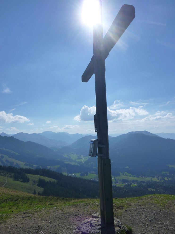
The parking lot in Jungholz in the district of Langenschwand is the starting point of the hike. Only a short distance towards the centre of Jungholz, then the path branches off to the right behind the chapel. A short ascent brings us to the panoramic path over Jungholz. Passing the Kneipp facility, the idyllic moor pond and the water basin for snow production, we reach the Reuter Wanne turnoff. The path runs beautifully through the forest and across clearings, which always offer new views. The gravel path is constantly rising and has several junctions, which are all well signposted. Further up, the wide road turns into a simple hiking trail, but it is still easy to walk on. Then comes a somewhat steeper section through the forest. After this passage, the summit cross is already visible, and after a short time it is reached. Despite the low altitude of the summit, there is a beautiful panoramic view. The descent is over the grass slope which seems to lead directly to Jungholz. But then the path turns left and relatively quickly the hut of the Obere Reuter Wanne is reached. After a few meters on the road, one should not miss the turnoff to Alpe Stubental. Mostly through forest the path leads us at the flank of the Pfeifferberg to the alp Stubental. After a rest we walk the rest of the way on the asphalt road back to Langenschwand. With many positive impressions we leave Jungholz. To the left of us we see the Sorgschrofen, the only connection of Jungholz with the Tannheimer Tal, and so we get some ideas.
Anfahrt
On the motorway A7 at the exit "Oy-Mittelberg" on the B310 towards Wertach and Oberjoch. At the sign "Jungholz" turn left towards Jungholz, to the district Langenschwand.From the Tyrolean side via Reutte on the B198 towards Lechtal to Weißenbach, over the Gaichtpass along the B199 through the Tannheimer Tal to Oberjoch. There turn right towards Wertach and at the sign "Jungholz" turn right towards Jungholz, to the district Langenschwand.
Parken
Car park LangenschwandÖffentliche Verkehrsmittel
By train to Sonthofen, Pfronten/Ried or Reutte, then by bus to Jungholz.
It should be noted that in mountaineering there is an increased risk of accidents and injuries. Despite careful route planning, a basic risk always remains. Tour preparation through endurance sports, appropriate technical training and further education as well as personal prudence reduces the danger of accidents and risks. However, please never forget that the weather in the mountains can change very quickly. Stay on the marked hiking trails.
The personal mountaineering equipment must be safe and serviceable and meet the relevant technical standards. Every hiker is recommended to obtain information about the planned tours from specialist alpine literature or on site.
Ähnliche Touren
- Wandertour
"Gutes vom Dorf" - Culinary hike through Ofterschwang
Tradition, untouched landscape and a lot of regional delicacies - that is what distinguishes Ofterschwang.
mehr dazuDistanz 11,8 km Dauer 3:30 h Aufstieg 309 m Schwierigkeit mittel - Wandertour
"Wiesengänger"-Trail
© Allgäu GmbH
The "Wasserläufer"-Route takes you through a beautiful hilly landscape on 463 km.
mehr dazuDistanz 424,8 km Dauer 107:30 h Aufstieg 5.300 m Schwierigkeit mittel - Wandertour
Alpine Meadows - hiking tour from Ofterschwang
Varied and cozy through forests and over meadows. Great views, varied nature and small playgrounds along the way with refreshments.
mehr dazuDistanz 8,3 km Dauer 3:00 h Aufstieg 427 m Schwierigkeit mittel - Wandertour
Border guard trail Oberreute/Allgaeu
Cross-border experience path for the whole family.
mehr dazuDistanz 9,1 km Dauer 2:30 h Aufstieg 173 m Schwierigkeit mittel - Wandertour
Castle ruin Falkenstein
Castle ruin Falkenstein
mehr dazuDistanz 7,8 km Dauer 3:00 h Aufstieg 530 m Schwierigkeit mittel - Wandertour
Family hike across Ochsenkopf via Riedberger Horn – climbing for kids
Family hike across Ochsenkopf via Riedberger Horn – climbing for kids
mehr dazuDistanz 12,9 km Dauer 4:23 h Aufstieg 591 m Schwierigkeit mittel - Wandertour
Hiking on the ridgeway ('Hoehenweg') from Scheidegg to the mountain Pfaender - the classic
The wonderful hiking tour leads you from Scheidegg through the German-Austrian alpine upland to the mountain Pfaender heighted 1064 meters. There you will be rewarded with an impressive panoramic view.
mehr dazuDistanz 10,9 km Dauer 3:30 h Aufstieg 415 m Schwierigkeit mittel - Wandertour
Hiking trail from Ofterschwang via Ofterschwanger Horn and Sigiswang
Scenic mountain tour to the Ofterschwanger Horn (peak).
mehr dazuDistanz 11,3 km Dauer 4:30 h Aufstieg 678 m Schwierigkeit mittel - Wandertour
Hochwiesweg Hike
A gorgeous little loop with beautiful views.
(pram friendly tour)
mehr dazuDistanz 3,9 km Dauer 1:00 h Aufstieg 120 m Schwierigkeit mittel - Wandertour
Hörner Panorama Tour - lovely mountain hike from Bolsterlang or Ofterschwang
This fantastic tour can start either in Bolsterlang or Ofterschwang and takes you over the popular Hörner Panorama Tour along the Weiherkopf, Rangiswanger Horn, Sigiswanger Horn and Ofterschwanger Horn.
mehr dazuDistanz 16,3 km Dauer 7:45 h Aufstieg 1.017 m Schwierigkeit mittel


Die Inhalte dieser Seite werden in Kooperation mit Outdooractive bereitgestellt.