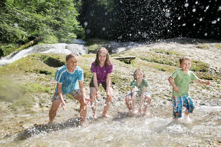
Nature reserve Eistobel - Wonder world made of water, rocks and iceRushing waterfalls and deep swirl holes, huge blocks of Nagelfluh, a conglomerate of rock, sand and calcareous binders and enormous rock faces - the nature reserve Eistobel with a total length of approx.
- Strecke9,21 km
- Dauer3:45 h
- Aufstieg399 Hm
- Abstieg399 Hm
- Schwierigkeitmittel
Höhenprofil
Amongst others, the highlights of the canyon are the "Great waterfall" and the so-called Zwinger, a tangle of enormous rocks. Through these rocks, the waters of the stream "Obere Argen" have to squeeze through. The undercut slope "Hohe Wand" and the "Große Nagelfluhwand" rise approx. 50 metres out of the stream. Numerous specialists of the flora and fauna are living in the "Eistobel". The dipper or water ouzel for example, searches for food in the turbulent waters of the stream "Obere Argen". It is the only songbird in Europe that is able to swim and dive. The "Eistobel" owes its name to the bizarr ice formations in winter that turn the Eistobel into a fairytale world made of snow, rocks and ice.
Information pavillon – Eistobel – Riedholzer Kugel – Riedholz – bridge Argentobelbrücke – Information pavillon
The nature reserve Eistobel can be explored on the waterway tours 17-20. The overall walking time is between 1.5 and 4 hours.
The well secured path through the ravine Eistobel seems like a stroll at some stages. At others, it seems like a hike in the low mountain range with an alpine appearance. The path can be partly slippery when wet. The tour over the mountain "Riedholzer Kugel" includes some ups and downs.
Ähnliche Touren
- Wandertour
"Gutes vom Dorf" - Culinary hike through Ofterschwang
Tradition, untouched landscape and a lot of regional delicacies - that is what distinguishes Ofterschwang.
mehr dazuDistanz 11,8 km Dauer 3:30 h Aufstieg 309 m Schwierigkeit mittel - Wandertour
"Wiesengänger"-Trail
© Allgäu GmbH
The "Wasserläufer"-Route takes you through a beautiful hilly landscape on 463 km.
mehr dazuDistanz 424,8 km Dauer 107:30 h Aufstieg 5.300 m Schwierigkeit mittel - Wandertour
Alpine Meadows - hiking tour from Ofterschwang
Varied and cozy through forests and over meadows. Great views, varied nature and small playgrounds along the way with refreshments.
mehr dazuDistanz 8,3 km Dauer 3:00 h Aufstieg 427 m Schwierigkeit mittel - Wandertour
Border guard trail Oberreute/Allgaeu
Cross-border experience path for the whole family.
mehr dazuDistanz 9,1 km Dauer 2:30 h Aufstieg 173 m Schwierigkeit mittel - Wandertour
Castle ruin Falkenstein
Castle ruin Falkenstein
mehr dazuDistanz 7,8 km Dauer 3:00 h Aufstieg 530 m Schwierigkeit mittel - Wandertour
Family hike across Ochsenkopf via Riedberger Horn – climbing for kids
Family hike across Ochsenkopf via Riedberger Horn – climbing for kids
mehr dazuDistanz 12,9 km Dauer 4:23 h Aufstieg 591 m Schwierigkeit mittel - Wandertour
Hiking on the ridgeway ('Hoehenweg') from Scheidegg to the mountain Pfaender - the classic
The wonderful hiking tour leads you from Scheidegg through the German-Austrian alpine upland to the mountain Pfaender heighted 1064 meters. There you will be rewarded with an impressive panoramic view.
mehr dazuDistanz 10,9 km Dauer 3:30 h Aufstieg 415 m Schwierigkeit mittel - Wandertour
Hiking trail from Ofterschwang via Ofterschwanger Horn and Sigiswang
Scenic mountain tour to the Ofterschwanger Horn (peak).
mehr dazuDistanz 11,3 km Dauer 4:30 h Aufstieg 678 m Schwierigkeit mittel - Wandertour
Hochwiesweg Hike
A gorgeous little loop with beautiful views.
(pram friendly tour)
mehr dazuDistanz 3,9 km Dauer 1:00 h Aufstieg 120 m Schwierigkeit mittel - Wandertour
Hörner Panorama Tour - lovely mountain hike from Bolsterlang or Ofterschwang
This fantastic tour can start either in Bolsterlang or Ofterschwang and takes you over the popular Hörner Panorama Tour along the Weiherkopf, Rangiswanger Horn, Sigiswanger Horn and Ofterschwanger Horn.
mehr dazuDistanz 16,3 km Dauer 7:45 h Aufstieg 1.017 m Schwierigkeit mittel


Die Inhalte dieser Seite werden in Kooperation mit Outdooractive bereitgestellt.