West of the valley Halblechtal is an extensive hiking area.
- Strecke9,49 km
- Dauer3:30 h
- Aufstieg587 Hm
- Abstieg103 Hm
- Schwierigkeitmittel
Höhenprofil
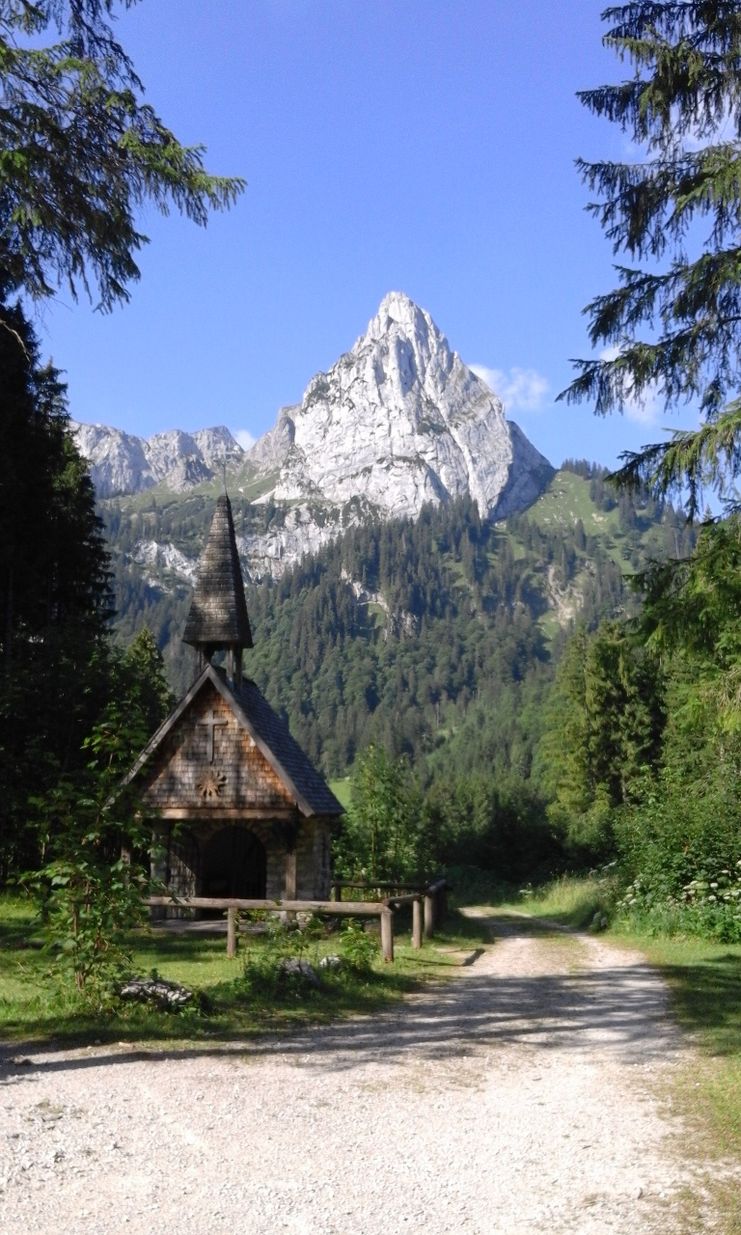
At the pasture called Alpe Ebene you have already almost reached the maximum hiking height of the tour. The Geiselstein, as the "Allgäu Matterhorn" a climbing destination, and the Hochplatte in the south always in sight, you reach the Lobental via the Leiterau. The route section through the Bockstallschlucht gorge to the small Bockstallsee lake and on to the Wankerfleck is outstanding in terms of scenery. For the last steeper ascent to the Kenzen hub you reward yourself at least with a cool drink.
Descent to Halblech by hiking bus.
Ähnliche Touren
- Wandertour
"Gutes vom Dorf" - Culinary hike through Ofterschwang
Tradition, untouched landscape and a lot of regional delicacies - that is what distinguishes Ofterschwang.
mehr dazuDistanz 11,8 km Dauer 3:30 h Aufstieg 309 m Schwierigkeit mittel - Wandertour
"Wiesengänger"-Trail
© Allgäu GmbH
The "Wasserläufer"-Route takes you through a beautiful hilly landscape on 463 km.
mehr dazuDistanz 424,8 km Dauer 107:30 h Aufstieg 5.300 m Schwierigkeit mittel - Wandertour
Alpine Meadows - hiking tour from Ofterschwang
Varied and cozy through forests and over meadows. Great views, varied nature and small playgrounds along the way with refreshments.
mehr dazuDistanz 8,3 km Dauer 3:00 h Aufstieg 427 m Schwierigkeit mittel - Wandertour
Border guard trail Oberreute/Allgaeu
Cross-border experience path for the whole family.
mehr dazuDistanz 9,1 km Dauer 2:30 h Aufstieg 173 m Schwierigkeit mittel - Wandertour
Castle ruin Falkenstein
Castle ruin Falkenstein
mehr dazuDistanz 7,8 km Dauer 3:00 h Aufstieg 530 m Schwierigkeit mittel - Wandertour
Family hike across Ochsenkopf via Riedberger Horn – climbing for kids
Family hike across Ochsenkopf via Riedberger Horn – climbing for kids
mehr dazuDistanz 12,9 km Dauer 4:23 h Aufstieg 591 m Schwierigkeit mittel - Wandertour
Hiking on the ridgeway ('Hoehenweg') from Scheidegg to the mountain Pfaender - the classic
The wonderful hiking tour leads you from Scheidegg through the German-Austrian alpine upland to the mountain Pfaender heighted 1064 meters. There you will be rewarded with an impressive panoramic view.
mehr dazuDistanz 10,9 km Dauer 3:30 h Aufstieg 415 m Schwierigkeit mittel - Wandertour
Hiking trail from Ofterschwang via Ofterschwanger Horn and Sigiswang
Scenic mountain tour to the Ofterschwanger Horn (peak).
mehr dazuDistanz 11,3 km Dauer 4:30 h Aufstieg 678 m Schwierigkeit mittel - Wandertour
Hochwiesweg Hike
A gorgeous little loop with beautiful views.
(pram friendly tour)
mehr dazuDistanz 3,9 km Dauer 1:00 h Aufstieg 120 m Schwierigkeit mittel - Wandertour
Hörner Panorama Tour - lovely mountain hike from Bolsterlang or Ofterschwang
This fantastic tour can start either in Bolsterlang or Ofterschwang and takes you over the popular Hörner Panorama Tour along the Weiherkopf, Rangiswanger Horn, Sigiswanger Horn and Ofterschwanger Horn.
mehr dazuDistanz 16,3 km Dauer 7:45 h Aufstieg 1.017 m Schwierigkeit mittel


Die Inhalte dieser Seite werden in Kooperation mit Outdooractive bereitgestellt.