The „Alpenfreiheit“ takes you right into the middle of the largest cohesive alpine area in Bavaria. Here you can experience the varied and valuable cultural landscape created by centuries of alpine farming.
Naturpark Nagelfluhkette e.V.
- Strecke13,39 km
- Dauer4:20 h
- Aufstieg463 Hm
- Abstieg463 Hm
- Schwierigkeitmittel
Höhenprofil
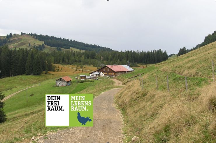
The trail leads from the mountain station of the Imbergbahn cable car first down to the Lanzenbach and back up über the Stieg Alps to close below the central Nagelfluhkette. Staying at medium altitude, the trail crosses the slope and leads to the Hörmoos-Alpe. From there it goes via the Häderichmoos and the south side of Glutschwendereck and Fluh back to the top station of the Imbergbahn.
While hiking along the narrow paths or enjoying a snack in one of the numerous alpine huts and mountain inns, you can experience life in the mountains, far from the hustle and bustle, but with a great deal of enjoyment.
Nature experience site: Sycamore maple garden between Oberstiegalpe and Schneeloch-Alpe (1)
.A typical alpine pasture includes at least one old sycamore maple. Behind the Oberstiegalpe, however, the path leads into a veritable garden of these venerable, often bizarrely shaped character trees. Many particularly beautiful and old specimens have been preserved here, including the imposing so-called „hollow tree“. It has a circumference of 6.5 m, making it the second strongest maple in Germany, and is probably about 350 years old.
Früne and old.
In the past, sycamores provided important shade for grazing cattle and the leaves were also used as bedding. Today they provide a park-like, varied landscape and are also a valuable habitat for rare lichens, mosses and ferns, some of which only grow on sycamores – a single tree as a whole habitat!
Überhaupt seems to be this part of the nature park for Bäume particularly worth living, because here is an amazing collection of old and particularly mächtiger Bäume. You should also not miss the giant white fir, which also measures 6.5 m in circumference, between Mittlerer Stiegalpe and Oberstiegalpe.
Kräuter-Alp in the Hörmoos area (2)
It's hard to believe, but on the Hörmoos the path leads straight past a colourful herb garden. Michel Schneider demonstrates that many plants can still thrive at 1,300 m above sea level if you know them well and know what they need to grow. Most of the plants grown there go directly to the highest distillery in the Allgäu, right next door. The range of fine spirits and regional products directly from the Hörmoos is correspondingly diverse!
The distillery is the highest in the Allgäu, right next door.
The Alpine Adventure Trail (3)
The last part of the trail leads along the Alpine Adventure Trail. At numerous stations along the way, you can experience and learn interesting facts about the region with its alpine economy – fun for the whole family. The trail also leads through the Häderichmoor, one of the best-preserved raised bogs in this area.
Anfahrt
Variant 1: Take the B19 towards Oberstdorf, at Immenstadt take the exit to Oberstaufen. Through Immenstadt, follow the signs to Oberstaufen. Leave the B308 in the direction of Hittisau/Krumbach (turn left). Drive through Weiß and finally turn left at Höfen to Steibis.
Variant 2: Leave the Rheintal motorway at Dornbirn Nord. Follow the B200 to Müselbach. Now drive either via Lingenau and Hittisau or via Langenegg towards Oberstaufen. At Höfen, turn right in the direction of Steibis.
Parken
Parking area of the Imbergbahn
Öffentliche Verkehrsmittel
Take the train to the station in Oberstaufen. Continue with line 95 to the Imbergbahn.
Alpine, long tour.
Sturdy shoes are recommended.
Ähnliche Touren
- Wandertour
"Gutes vom Dorf" - Culinary hike through Ofterschwang
Tradition, untouched landscape and a lot of regional delicacies - that is what distinguishes Ofterschwang.
mehr dazuDistanz 11,8 km Dauer 3:30 h Aufstieg 309 m Schwierigkeit mittel - Wandertour
"Wiesengänger"-Trail
© Allgäu GmbH
The "Wasserläufer"-Route takes you through a beautiful hilly landscape on 463 km.
mehr dazuDistanz 424,8 km Dauer 107:30 h Aufstieg 5.300 m Schwierigkeit mittel - Wandertour
Alpine Meadows - hiking tour from Ofterschwang
Varied and cozy through forests and over meadows. Great views, varied nature and small playgrounds along the way with refreshments.
mehr dazuDistanz 8,3 km Dauer 3:00 h Aufstieg 427 m Schwierigkeit mittel - Wandertour
Border guard trail Oberreute/Allgaeu
Cross-border experience path for the whole family.
mehr dazuDistanz 9,1 km Dauer 2:30 h Aufstieg 173 m Schwierigkeit mittel - Wandertour
Castle ruin Falkenstein
Castle ruin Falkenstein
mehr dazuDistanz 7,8 km Dauer 3:00 h Aufstieg 530 m Schwierigkeit mittel - Wandertour
Family hike across Ochsenkopf via Riedberger Horn – climbing for kids
Family hike across Ochsenkopf via Riedberger Horn – climbing for kids
mehr dazuDistanz 12,9 km Dauer 4:23 h Aufstieg 591 m Schwierigkeit mittel - Wandertour
Hiking on the ridgeway ('Hoehenweg') from Scheidegg to the mountain Pfaender - the classic
The wonderful hiking tour leads you from Scheidegg through the German-Austrian alpine upland to the mountain Pfaender heighted 1064 meters. There you will be rewarded with an impressive panoramic view.
mehr dazuDistanz 10,9 km Dauer 3:30 h Aufstieg 415 m Schwierigkeit mittel - Wandertour
Hiking trail from Ofterschwang via Ofterschwanger Horn and Sigiswang
Scenic mountain tour to the Ofterschwanger Horn (peak).
mehr dazuDistanz 11,3 km Dauer 4:30 h Aufstieg 678 m Schwierigkeit mittel - Wandertour
Hochwiesweg Hike
A gorgeous little loop with beautiful views.
(pram friendly tour)
mehr dazuDistanz 3,9 km Dauer 1:00 h Aufstieg 120 m Schwierigkeit mittel - Wandertour
Hörner Panorama Tour - lovely mountain hike from Bolsterlang or Ofterschwang
This fantastic tour can start either in Bolsterlang or Ofterschwang and takes you over the popular Hörner Panorama Tour along the Weiherkopf, Rangiswanger Horn, Sigiswanger Horn and Ofterschwanger Horn.
mehr dazuDistanz 16,3 km Dauer 7:45 h Aufstieg 1.017 m Schwierigkeit mittel


Die Inhalte dieser Seite werden in Kooperation mit Outdooractive bereitgestellt.