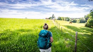
Hike in the footsteps of the Bavarian kings from castle to castle with panoramas to enjoy.

Füssen Tourismus und Marketing
- Strecke14,52 km
- Dauer5:30 h
- Aufstieg671 Hm
- Abstieg671 Hm
- Schwierigkeitmittel
Höhenprofil
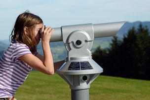
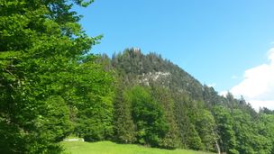
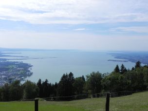
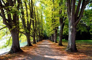
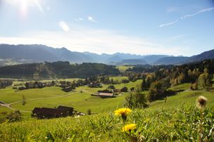
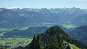
On this beginner's tour, all the sightseeing highlights of the Schlosspark region are just along the way. And views to melt away. The route is particularly beautiful in autumn, when the leaves have begun to change color. From the "Kalvarienberg" vantage point, you can enjoy a 360-degree panoramic view of the old town of Füssen, the foothills of the Alps, many lakes and the royal castles of Hohenschwangau and Neuschwanstein with an imposing mountain backdrop. From the "Maxsteg" you have a good view into the narrow gorge of the Lech Falls. The last highlight of the route is the High Castle, landmark of the old town of Füssen, with colorful frescoes on the courtyard facades.
Anfahrt
You can reach Füssen directly via the A7 freeway and the B310, B16 and B17 federal roads.Parken
The parking guidance system in Füssen offers you several parking options.Öffentliche Verkehrsmittel
From the long-distance train stations Ulm, Augsburg and Munich you will find regular train connections to Füssen. The starting point of the tour at the Tourist Information is about 5 minutes walk from the train station.From Hopfen you can reach the starting point by bus line 56 to Füssen (train station).
From Weißensee you can reach the starting point by bus line 56 to Füssen (train station).
Ähnliche Touren
- Wandertour
"Wiesengänger"-Trail
© Allgäu GmbH
The "Wasserläufer"-Route takes you through a beautiful hilly landscape on 463 km.
mehr dazuDistanz 424,8 km Dauer 107:30 h Aufstieg 5.300 m Schwierigkeit mittel - Wandertour
Border guard trail Oberreute/Allgaeu
Cross-border experience path for the whole family.
mehr dazuDistanz 9,1 km Dauer 2:30 h Aufstieg 173 m Schwierigkeit mittel - Wandertour
Castle ruin Falkenstein
Castle ruin Falkenstein
mehr dazuDistanz 7,8 km Dauer 3:00 h Aufstieg 530 m Schwierigkeit mittel - Wandertour
Hiking on the ridgeway ('Hoehenweg') from Scheidegg to the mountain Pfaender - the classic
The wonderful hiking tour leads you from Scheidegg through the German-Austrian alpine upland to the mountain Pfaender heighted 1064 meters. There you will be rewarded with an impressive panoramic view.
mehr dazuDistanz 10,9 km Dauer 3:30 h Aufstieg 415 m Schwierigkeit mittel - Wandertour
Kapellenwanderung in Stiefenhofen
Kapellenwanderung in Stiefenhofen
mehr dazuDistanz 14,0 km Dauer 4:00 h Aufstieg 326 m Schwierigkeit mittel - Wandertour
Nature reserve Eistobel: Circuit via the mountain Riedholzer Kugel - Westallgäu waterway 20
Nature reserve Eistobel - Wonder world made of water, rocks and iceRushing waterfalls and deep swirl holes, huge blocks of Nagelfluh, a conglomerate of rock, sand and calcareous binders and enormous rock faces - the nature reserve Eistobel with a total length of approx....
mehr dazuDistanz 9,2 km Dauer 3:45 h Aufstieg 399 m Schwierigkeit mittel - Wandertour
Villa parks, vineyards and orchards – the Lindau garden culture trail
Villa parks, vineyards and orchards – the Lindau garden culture trail
mehr dazuDistanz 9,3 km Dauer 2:30 h Aufstieg 65 m Schwierigkeit mittel - Wandertour
Alpine Meadows - hiking tour from Ofterschwang
Varied and cozy through forests and over meadows. Great views, varied nature and small playgrounds along the way with refreshments.
mehr dazuDistanz 8,3 km Dauer 3:00 h Aufstieg 427 m Schwierigkeit mittel - Wandertour
Hochwiesweg Hike
A gorgeous little loop with beautiful views.
(pram friendly tour)
mehr dazuDistanz 3,9 km Dauer 1:00 h Aufstieg 120 m Schwierigkeit mittel - Wandertour
Hörner Panorama Tour - lovely mountain hike from Bolsterlang or Ofterschwang
This fantastic tour can start either in Bolsterlang or Ofterschwang and takes you over the popular Hörner Panorama Tour along the Weiherkopf, Rangiswanger Horn, Sigiswanger Horn and Ofterschwanger Horn.
mehr dazuDistanz 16,3 km Dauer 7:45 h Aufstieg 1.017 m Schwierigkeit mittel
Die Inhalte dieser Seite werden in Kooperation mit Outdooractive bereitgestellt.

