Schnitzerweg - Alpe Stubental - Panorama Höhenweg

Brief characteristic of Jungholz:

Jungholz came to Tyrol in 1342 through the sale of the Wertacher Hermann Häselin to Heinz Lochpühler from the Tannheimer Tal as an enclave in the German territory. The 294 inhabitant community is Tyrol's first herbal mountain village.

  • Strecke
    8,08 km
  • Dauer
    2:23 h
  • Aufstieg
    239 Hm
  • Abstieg
    238 Hm
  • Schwierigkeit
    leicht

Höhenprofil

Auf der Allgäu Karte

Um diesen Inhalt sehen zu können, musst Du unseren Cookies zustimmen. Cookie-Einwilligung ändern
Karte öffnen

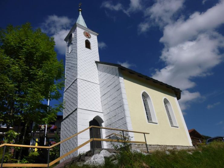
From the parking lot at the ski lifts you walk towards the church. At the music pavilion turn right onto the Schnitzerweg. Follow this "art mile" to the district Langenschwand and further to the end of the village. Here the path turns left to the Stubental Alpe. After a break either on foot or with the toboggan, which can be rented at the hut, back to Langenschwand, where the signpost at the chapel points to the right onto the panorama trail. The panorama trail leads above Jungholz to the district of Giessenschwand and always offers a beautiful view. Shortly before Giessenschwand, the path goes downhill, down into the village. Through the district and at the main road to the left, further to the church. To the right are the parking lots and the starting point of the hike. Several places to stop for refreshments give us the opportunity to bear the cool winter temperatures more easily.

This winter hike takes place on well cleared and if necessary also gritted paths. There is no gritting on the way to the Stubental Alpe, as there is also tobogganing.

Anfahrt

On the motorway A7 at the exit "Oy-Mittelberg" on the B310 towards Wertach and Oberjoch. At the sign "Jungholz" turn left in the direction of Jungholz, to the parking lots at the ski lifts Jungholz.From the Tyrolean side via Reutte on the B198 towards Lechtal to Weißenbach, over the Gaichtpass along the B199 through the Tannheimer Tal to Oberjoch. There turn right in the direction of Wertach and at the signposting "Jungholz" turn right in the direction of Jungholz, to the car park at the ski lifts Jungholz.

Parken

At the ski lifts in Jungholz

Öffentliche Verkehrsmittel

By train to Sonthofen, Oy or Reutte, then by bus to Jungholz.

Cross-country ski run and winter map Tannheimer Tal . Available in all tourist offices of the Tannheimer Tal and Jungholz.

It should be noted that winter hiking also involves an increased risk of accidents and injuries. Especially in winter, special attention must be paid to the condition of the paths. Depending on the length and choice of route, good tour planning and physical fitness are essential. Suitable clothing, good shoes and possibly hiking sticks provide additional safety. Stay on the marked paths.

An up-to-date and well-kept/maintained equipment (shoes, sticks and clothes) not only provides a considerable degree of safety but also makes winter hiking much easier. Sun protection (high protection factor and possibly sunglasses) as well as sufficient liquid should not be forgotten.

Ähnliche Touren

  • Wandertour
    1

    Alp hike Söllereck - Riezlern

    ©

    Kleinwalsertal Tourismus eGen

    Söllereckbahn - Alpe Schrattenwang - Mittelalp - Bergstüble - Westeggtobel - Riezlern.

    Distanz5,6 km
    Dauer2:25 h
    Aufstieg51 m
    Schwierigkeitleicht
    mehr dazu
  • Wandertour
    2

    Around the lake Schwansee (swan lake) in the Schwansee park

    hike around the lake Schwansee

    duration: 1 hour

    length: 2 kilometers

    Distanz3,2 km
    Dauer1:30 h
    Aufstieg29 m
    Schwierigkeitleicht
    mehr dazu
  • Wandertour
    3

    Bridge building river Leiblach: Hiking along the border river - Waterway no.30 in the Western Allgaeu

    ©

    Thomas Gretler

    Tour no.30 of the waterways in the Western Allgaeu invites you to a cross-border expedition into the valley of the river Leiblach. According to the motto "bridge building".

    Distanz11,5 km
    Dauer3:50 h
    Aufstieg207 m
    Schwierigkeitleicht
    mehr dazu
  • Wandertour
    4

    Bridge building river Leiblach: Hiking along the border river - Waterways in the Western Allgaeu

    ©

    Thomas Gretler

    Three tours of the waterways of the Western Allgaeu (29,30 and 31) invite you to a cross-border discovery journey to the valley of the Leiblach. According  to the motto 'building bridges'. The valley's lifeline is the river Leiblach, a near-natural river of the low...

    Distanz7,6 km
    Dauer2:00 h
    Aufstieg99 m
    Schwierigkeitleicht
    mehr dazu
  • Wandertour
    5

    Golfplatztour – Rundwanderung durch die Hörnerdörfer

    Golfplatztour – Rundwanderung durch die Hörnerdörfer

    Distanz11,3 km
    Dauer3:04 h
    Aufstieg168 m
    Schwierigkeitleicht
    mehr dazu
  • Wandertour
    6

    Hike from Ofterschwang to Wittelsbacher Höhe

    A varied circular route from Ofterschwang to the Wittelsbacher Höhe near Schweineberg over meadows and through forests and with fantastic views.

    Distanz6,1 km
    Dauer2:00 h
    Aufstieg127 m
    Schwierigkeitleicht
    mehr dazu
  • Wandertour
    7

    Moosrundweg - walk around the Tiefenberger bog near Ofterschwang

    Family-friendly circular route through the ancient and idyllic bog. 

    Distanz6,7 km
    Dauer2:00 h
    Aufstieg63 m
    Schwierigkeitleicht
    mehr dazu
  • Wandertour
    8

    Nature Trail - Ofterschwang

    With information signs and stations on the natural development and cultivation of the cultural landscape.

    Distanz6,2 km
    Dauer2:00 h
    Aufstieg153 m
    Schwierigkeitleicht
    mehr dazu
  • Wandertour
    9

    Oberreute: Upper "Hausbachklamm"

    Oberreute: Upper "Hausbachklamm"

    Distanz4,4 km
    Dauer1:15 h
    Aufstieg52 m
    Schwierigkeitleicht
    mehr dazu
  • Wandertour
    10

    Ofterschwanger Horn - a comfortable walk round the peak

    A nice and easy walk with great views of the Alps at Oberstdorf.

    (suiteable for prams)

    Distanz2,4 km
    Dauer1:00 h
    Aufstieg70 m
    Schwierigkeitleicht
    mehr dazu

Die Inhalte dieser Seite werden in Kooperation mit Outdooractive bereitgestellt.