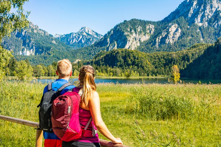
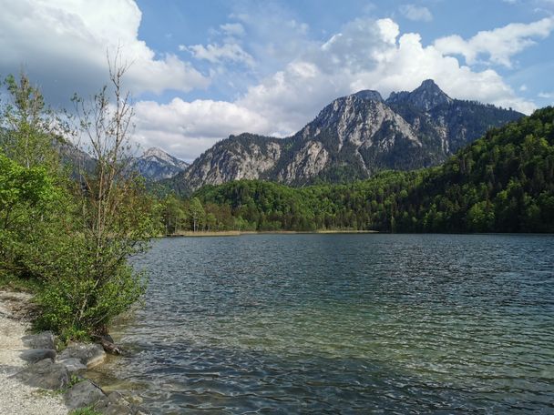
hike around the lake Schwansee
duration: 1 hour
length: 2 kilometers.
Tourist Information Schwangau
hike around the lake Schwansee
duration: 1 hour
length: 2 kilometers.
Fantastically beautiful welcomes us the landscape around the 'Schwansee' (swan lake) at the foot of the castle Hohenschwangau. And that's no coincidence! Already in the 13th century a castle had stood on the hill overlooking the picturesque lake. The Schwanstein castle by the Knights of Schwangau became famous. After the Napoleonic Wars, however, the building was badly damaged and uninhabited. 1829 discovered the then crown prince Maximilian the ruins on a journey on foot and was thrilled by the romantic location. The future King Maximilian II of Bavaria., It acquired and had them restored. The designs for it gave Dominik Quaglio, one of the great painters of the Romantic period. The neo-Gothic Hohenschwangau Castle was the summer residence of the royal family. At whose feet was Maximilian II. Creating a landscape park. For that he had hired two famous landscape architect Peter Joseph Lenne, who worked at the Prussian court in Berlin and Carl August Sckell who designed the English Gardens in Munich. Meanwhile declared a landscape conservation area, the special atmosphere in the historic park is clearly felt today.

Kleinwalsertal Tourismus eGen
Söllereckbahn - Alpe Schrattenwang - Mittelalp - Bergstüble - Westeggtobel - Riezlern.
| Distanz | 5,6 km |
| Dauer | 2:25 h |
| Aufstieg | 51 m |
| Schwierigkeit | leicht |

Thomas Gretler
Tour no.30 of the waterways in the Western Allgaeu invites you to a cross-border expedition into the valley of the river Leiblach. According to the motto "bridge building".
| Distanz | 11,5 km |
| Dauer | 3:50 h |
| Aufstieg | 207 m |
| Schwierigkeit | leicht |

Thomas Gretler
Three tours of the waterways of the Western Allgaeu (29,30 and 31) invite you to a cross-border discovery journey to the valley of the Leiblach. According to the motto 'building bridges'. The valley's lifeline is the river Leiblach, a near-natural river of the low...
| Distanz | 7,6 km |
| Dauer | 2:00 h |
| Aufstieg | 99 m |
| Schwierigkeit | leicht |

Golfplatztour – Rundwanderung durch die Hörnerdörfer
| Distanz | 11,3 km |
| Dauer | 3:04 h |
| Aufstieg | 168 m |
| Schwierigkeit | leicht |

A varied circular route from Ofterschwang to the Wittelsbacher Höhe near Schweineberg over meadows and through forests and with fantastic views.
| Distanz | 6,1 km |
| Dauer | 2:00 h |
| Aufstieg | 127 m |
| Schwierigkeit | leicht |

Family-friendly circular route through the ancient and idyllic bog.
| Distanz | 6,7 km |
| Dauer | 2:00 h |
| Aufstieg | 63 m |
| Schwierigkeit | leicht |

With information signs and stations on the natural development and cultivation of the cultural landscape.
| Distanz | 6,2 km |
| Dauer | 2:00 h |
| Aufstieg | 153 m |
| Schwierigkeit | leicht |

Landratsamt Lindau (Bodensee)
Oberreute: Upper "Hausbachklamm"
| Distanz | 4,4 km |
| Dauer | 1:15 h |
| Aufstieg | 52 m |
| Schwierigkeit | leicht |

A nice and easy walk with great views of the Alps at Oberstdorf.
(suiteable for prams)
| Distanz | 2,4 km |
| Dauer | 1:00 h |
| Aufstieg | 70 m |
| Schwierigkeit | leicht |
Outdooractive Editors
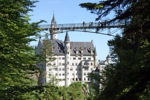
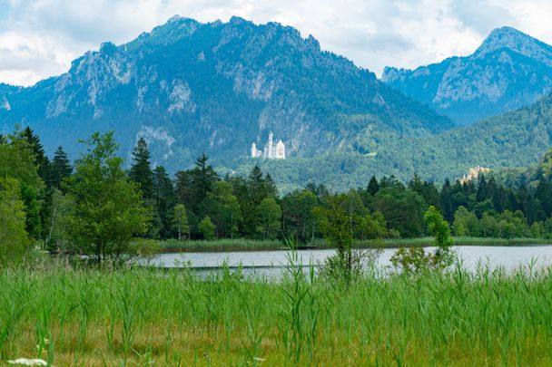
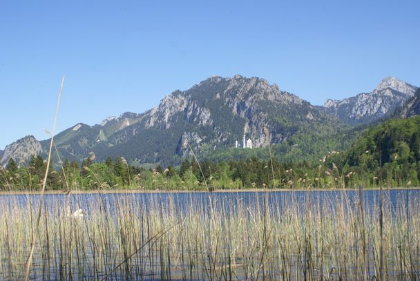
Hohenschwangau car park P1-P4 - Ticket Centre - Neuschwansteinstraße - Neuschwanstein Castle - Marienbrücke (closed until approx. autumn 2022) - Neuschwansteinstraße - car park
| Distanz | 1,9 km |
| Dauer | 0:43 h |
| Aufstieg | 147 m |
| Schwierigkeit | leicht |
Tourist Information Schwangau
Tourist Information Schwangau
Tourist Information Schwangau
Tourist Information Schwangau
Tourist Information Schwangau
Tourist Information Schwangau

Tourist Information Schwangau
Die Inhalte dieser Seite werden in Kooperation mit Outdooractive bereitgestellt.