With information signs and stations on the natural development and cultivation of the cultural landscape.

- Strecke6,17 km
- Dauer2:00 h
- Aufstieg153 Hm
- Abstieg148 Hm
- Schwierigkeitleicht
Höhenprofil
A delightful walk along the nature trail through tranquil woods and meadows with beautiful views of the Allgäu Alps. Charts and interactive stations tell you about the origin of mountains by glaciers and ice age, about the Allgäu cultural landscape by cultivation, about the blue and green Allgäu and the advantages and disadvantages of spruce and mixed forests. Connect the walk with a visit to the mountain dairy in Hüttenberg. All dairy products come from own production.
From the parking lot at the base of the Weltcup-Express, the trail takes you behind the Ofterschwanger Haus right down a path and you arrive at a small village on the nature trail. This the trail signs to "Hüttenberg". The mountain dairy in Hüttenberg (please check opening hours) is located in the village center, opposite is a beautiful place to rest. Follow the road to Bettenried. In Bettenried a road leads right and then immediately left onto a forest road back to nature trail. On the nature trail you reach Ofterschwang to the left.
Refreshments: Schlitte Hitte, Pizzeria Cortina, and the Wurzel Hütte at the valley station in Ofterschwang. During the summer months, you can enjoy very good ice cream at the ice cream parlour in the village centre of Ofterschwang.
Anfahrt
The journey to Ofterschwang is possible via the B19, with exit to Sigishofen at Sonthofen or further on south in Tiefenberg.Parken
Parking at the base station Weltcup-Express in OfterschwangÖffentliche Verkehrsmittel
From Sonthofen train and bus station by bus to Ofterschwang (bus Sonthofen - Ofterschwang - Bolsterlang) or Fischen (via Bolsterlang)Schedule for buses and trains in the southern Upper Allgäu (german)
Ofterschwang is located on the edge of the Nature Park Nagelfluhkette. A Nature Park is a protected landscape created by long-term use and cultivation. This valuable cultural landscape is to be preserved in its present form, but at the same time also to be used.
Please note the following recommendations:
- Please do not make noise.
- Please do not go off the road.
- Please do not make an open fire.
- Please only camp on marked areas.
- Please do not resettle plants or animals.
- Please do not pick plants and flowers.
- Please do not collect mushrooms.
- Please do not collect stones or minerals.
- Please do not feed animals.
- Please do not leave any rubbish.
- Please dispose of dog droppings in public dog kennels or at home
The right equipment for your tour consists of proper hiking boots and clothing appropriate to the weather. This tour takes you along a partially exposed ridge. Take sun cream and water along. Note that you are in the mountains and weather changes can be expected at any time.
Ähnliche Touren
- Wandertour
Alp hike Söllereck - Riezlern
© Kleinwalsertal Tourismus eGen
Söllereckbahn - Alpe Schrattenwang - Mittelalp - Bergstüble - Westeggtobel - Riezlern.
mehr dazuDistanz 5,6 km Dauer 2:25 h Aufstieg 51 m Schwierigkeit leicht - Wandertour
Around the lake Schwansee (swan lake) in the Schwansee park
© Tourist Information Schwangau
hike around the lake Schwansee
duration: 1 hour
length: 2 kilometers
mehr dazuDistanz 3,2 km Dauer 1:30 h Aufstieg 29 m Schwierigkeit leicht - Wandertour
Bridge building river Leiblach: Hiking along the border river - Waterway no.30 in the Western Allgaeu
© Thomas Gretler
Tour no.30 of the waterways in the Western Allgaeu invites you to a cross-border expedition into the valley of the river Leiblach. According to the motto "bridge building".
mehr dazuDistanz 11,5 km Dauer 3:50 h Aufstieg 207 m Schwierigkeit leicht - Wandertour
Bridge building river Leiblach: Hiking along the border river - Waterways in the Western Allgaeu
© Thomas Gretler
Three tours of the waterways of the Western Allgaeu (29,30 and 31) invite you to a cross-border discovery journey to the valley of the Leiblach. According to the motto 'building bridges'. The valley's lifeline is the river Leiblach, a near-natural river of the low...
mehr dazuDistanz 7,6 km Dauer 2:00 h Aufstieg 99 m Schwierigkeit leicht - Wandertour
Golfplatztour – Rundwanderung durch die Hörnerdörfer
Golfplatztour – Rundwanderung durch die Hörnerdörfer
mehr dazuDistanz 11,3 km Dauer 3:04 h Aufstieg 168 m Schwierigkeit leicht - Wandertour
Hike from Ofterschwang to Wittelsbacher Höhe
A varied circular route from Ofterschwang to the Wittelsbacher Höhe near Schweineberg over meadows and through forests and with fantastic views.
mehr dazuDistanz 6,1 km Dauer 2:00 h Aufstieg 127 m Schwierigkeit leicht - Wandertour
Moosrundweg - walk around the Tiefenberger bog near Ofterschwang
Family-friendly circular route through the ancient and idyllic bog.
mehr dazuDistanz 6,7 km Dauer 2:00 h Aufstieg 63 m Schwierigkeit leicht - Wandertour
Oberreute: Upper "Hausbachklamm"
© Landratsamt Lindau (Bodensee)
Oberreute: Upper "Hausbachklamm"
mehr dazuDistanz 4,4 km Dauer 1:15 h Aufstieg 52 m Schwierigkeit leicht - Wandertour
Ofterschwanger Horn - a comfortable walk round the peak
A nice and easy walk with great views of the Alps at Oberstdorf.
(suiteable for prams)
mehr dazuDistanz 2,4 km Dauer 1:00 h Aufstieg 70 m Schwierigkeit leicht - Wandertour
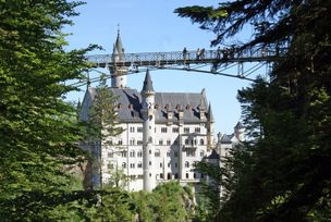
Walk to Neuschwanstein castle
© Outdooractive Editors
Hohenschwangau car park P1-P4 - Ticket Centre - Neuschwansteinstraße - Neuschwanstein Castle - Marienbrücke (closed until approx. autumn 2022) - Neuschwansteinstraße - car park
mehr dazuDistanz 1,9 km Dauer 0:43 h Aufstieg 147 m Schwierigkeit leicht


Die Inhalte dieser Seite werden in Kooperation mit Outdooractive bereitgestellt.