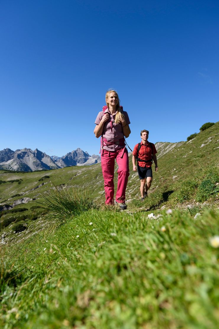
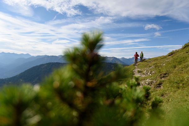
A wonderful hike and in the background a fantastic mountain scenery.
Tannheimer Tal
- Strecke11,71 km
- Dauer6:20 h
- Aufstieg964 Hm
- Abstieg962 Hm
- Schwierigkeitmittel
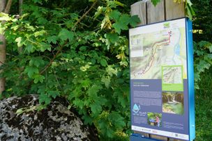
Höhenprofil
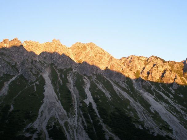
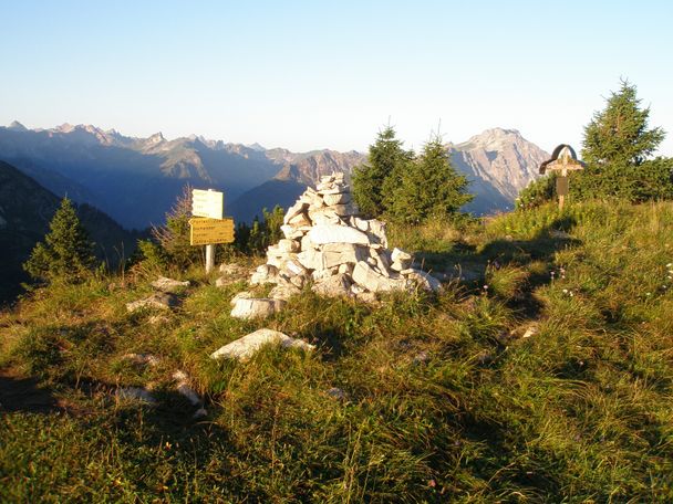
A promising tour is waiting for you. Enjoy a wonderful, not too extremely difficult ascent. However, the last part of the path is a little bit strenuous but the view from the summit makes you forget the effort of the ascent.
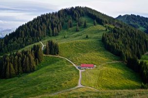
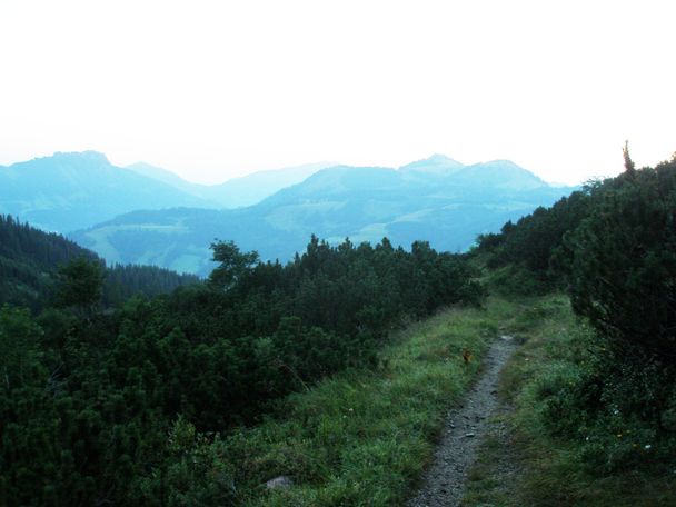
We start the hike at the lift car park in Zöblen and walk past the Restaurant Auszeit and the Augsburger Hütte, almost always through the forest. This way we quickly reach the entrance of the Pontental valley. More and more the path loses its steepness to be completely flat at the end of the valley. After that, it climbs relatively steeply, but the height meters to Zirleseck have to be managed somehow. Only for a short time we enjoy the gorgeous view before we continue to the right. The way up to the summit is beautiful. Downhill we walk on the western side of the Ponten. On the saddle between Ponten and Bscheißer, the Güntle, we turn right. We can already see the Stuiben Sennalpe below us. The path leads us first on an asphalt road, then on a gravel path, down the Stuibental valley to Schattwald. At the first houses we turn right. Past the sports field and shooting range, further through the forest back to Zöblen.
Anfahrt
On the motorway A7 at the exit "Oy-Mittelberg" on the B310 towards Wertach and to Oberjoch. There follow the signposting "Tannheimer Tal" B199, exit Zöblen, lift car park Zöblen.From the Tyrolean side via Reutte on the B198 in the direction of Lechtal to Weißenbach, over the Gaichtpass along the B199 to the exit Zöblen, lift car park Zöblen.Parken
Lift parking place in Zöblen - parking feeÖffentliche Verkehrsmittel
By train to Sonthofen, Pfronten/Ried or Reutte, then by bus to Zöblen.
It should be noted that in mountaineering there is an increased risk of accidents and injuries. Despite careful route planning, a basic risk always remains. Tour preparation through endurance sports, appropriate technical training and further education as well as personal prudence reduces the danger of accidents and risks. However, please never forget that the weather in the mountains can change very quickly. Stay on the marked hiking trails.
The personal mountaineering equipment must be safe and serviceable and meet the relevant technical standards. Every hiker is recommended to obtain information about the planned tours from specialist alpine literature or on site.
Ähnliche Touren
- Wandertour
"Wiesengänger"-Trail
© Allgäu GmbH
The "Wasserläufer"-Route takes you through a beautiful hilly landscape on 463 km.
mehr dazuDistanz 424,8 km Dauer 107:30 h Aufstieg 5.300 m Schwierigkeit mittel - Wandertour
Border guard trail Oberreute/Allgaeu
© Thomas Gretler
Cross-border experience path for the whole family.
mehr dazuDistanz 9,1 km Dauer 2:30 h Aufstieg 173 m Schwierigkeit mittel - Wandertour
Castle ruin Falkenstein
© Tourismusverband Ostallgäu e.V.
Castle ruin Falkenstein
mehr dazuDistanz 7,8 km Dauer 3:00 h Aufstieg 530 m Schwierigkeit mittel - Wandertour
Hiking on the ridgeway ('Hoehenweg') from Scheidegg to the mountain Pfaender - the classic
© Scheidegg Tourismus
The wonderful hiking tour leads you from Scheidegg through the German-Austrian alpine upland to the mountain Pfaender heighted 1064 meters. There you will be rewarded with an impressive panoramic view.
mehr dazuDistanz 10,9 km Dauer 3:30 h Aufstieg 415 m Schwierigkeit mittel - Wandertour
Kapellenwanderung in Stiefenhofen
© Landratsamt Lindau (Bodensee)
Kapellenwanderung in Stiefenhofen
mehr dazuDistanz 14,0 km Dauer 4:00 h Aufstieg 326 m Schwierigkeit mittel - Wandertour
Nature reserve Eistobel: Circuit via the mountain Riedholzer Kugel - Westallgäu waterway 20
© Rolf Brenner
Nature reserve Eistobel - Wonder world made of water, rocks and iceRushing waterfalls and deep swirl holes, huge blocks of Nagelfluh, a conglomerate of rock, sand and calcareous binders and enormous rock faces - the nature reserve Eistobel with a total length of approx....
mehr dazuDistanz 9,2 km Dauer 3:45 h Aufstieg 399 m Schwierigkeit mittel - Wandertour
Villa parks, vineyards and orchards – the Lindau garden culture trail
© Lindau Tourismus und Kongress GmbH
Villa parks, vineyards and orchards – the Lindau garden culture trail
mehr dazuDistanz 9,3 km Dauer 2:30 h Aufstieg 65 m Schwierigkeit mittel - Wandertour
Wassererlebnisweg durch den Haldertobel
© Tourenportal Oberallgäu
Schattige Wege mit schäumenden Wasserfällen und kleinen Strudeln führen Sie auf dieser Wanderung ins idyllische Örtchen Gunzesried.
mehr dazuDistanz 7,8 km Dauer 2:25 h Aufstieg 173 m Schwierigkeit mittel - Wandertour
Hochwiesweg Hike
A gorgeous little loop with beautiful views.
(pram friendly tour)
mehr dazuDistanz 3,9 km Dauer 1:00 h Aufstieg 120 m Schwierigkeit mittel - Wandertour
Mountain hike from Ofterschwang to the Ofterschwanger Horn
Wonderful little mountain tour to Ofterschwanger Horn with a beautiful view and numerous possibilities to stop.
mehr dazuDistanz 8,6 km Dauer 3:45 h Aufstieg 500 m Schwierigkeit mittel


Tannheimer Tal
Tannheimer Tal

Tannheimer Tal
Tannheimer Tal
Tannheimer Tal
Tannheimer Tal
Die Inhalte dieser Seite werden in Kooperation mit Outdooractive bereitgestellt.