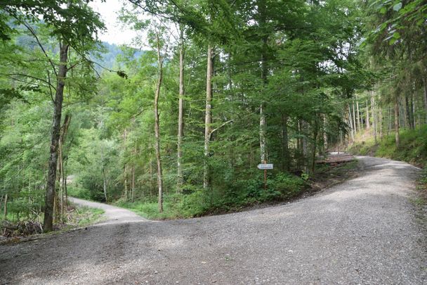
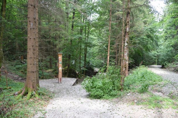
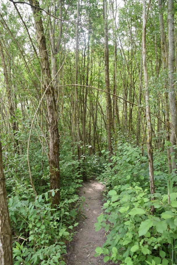
This easy route is well suited for families with children with the mostly easy trail format.
Füssen Tourismus und Marketing
- Strecke7,52 km
- Dauer2:45 h
- Aufstieg316 Hm
- Abstieg316 Hm
- Schwierigkeitleicht
Höhenprofil
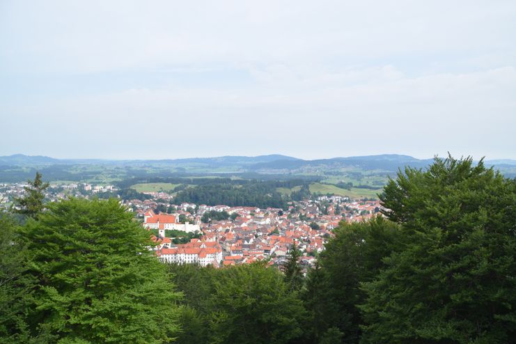
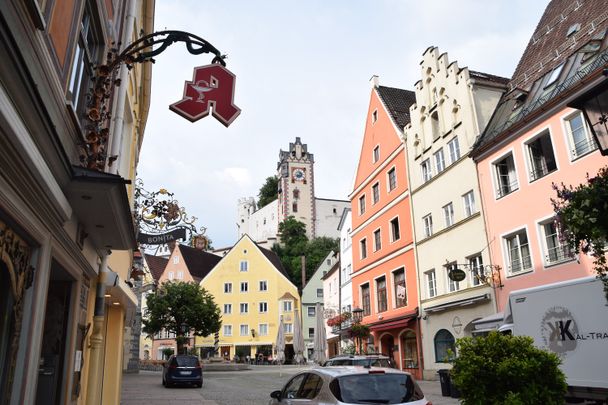
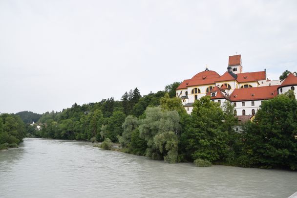
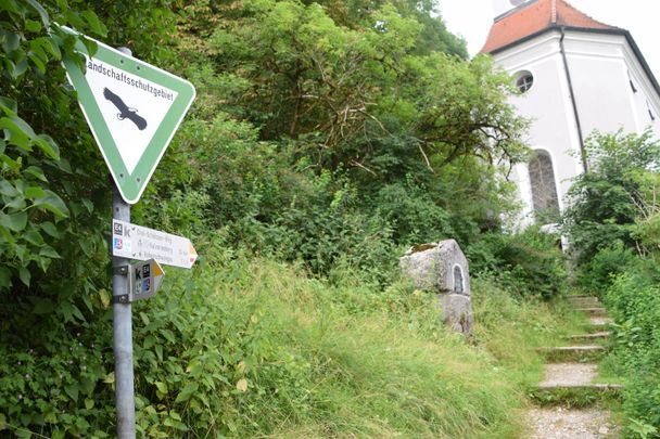
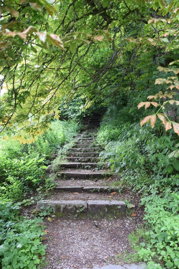
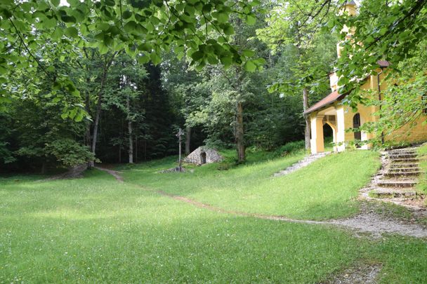
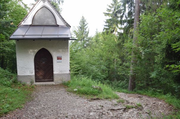
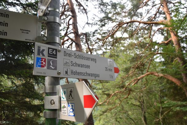
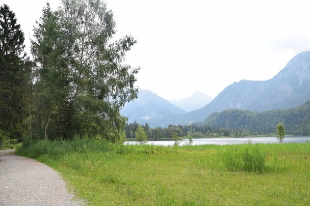
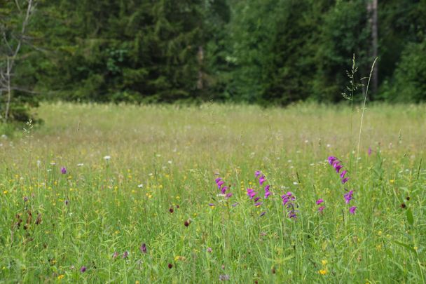
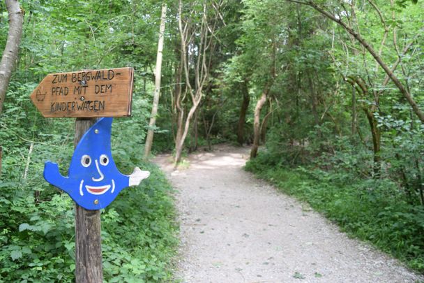
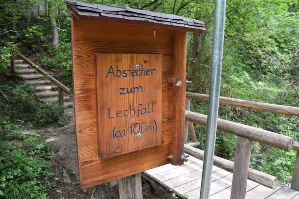
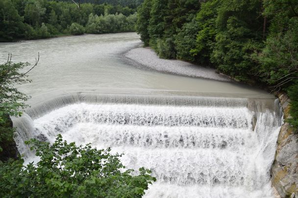
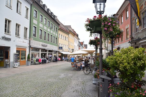
On the ascent from the "Frau-am-Berg-Kirche" (Church of Our Lady on the Mountain), take time for the small chapels, on whose altarpieces the Passion of Christ is traced. Like many people in Füssen today, King Ludwig II also liked to walk along the station path to Calvary mountain - for the last time on Good Friday in 1886, the year of his death. From the top of Calvary mountain you reach one of the best photo points for the old town of Füssen and the royal castles of Neuschwanstein and Hohenschwangau. Around the Schwansee lake stretches the Schwanseepark with its species-rich flower meadows, where rare orchids can be found. On the way back via the Königssträßchen, you should plan enough extra time with children at the Ziegelwies Forest Adventure Center and also make a photo stop at the Lech Falls.
Ähnliche Touren
- Wandertour
Alp hike Söllereck - Riezlern
© Kleinwalsertal Tourismus eGen
Söllereckbahn - Alpe Schrattenwang - Mittelalp - Bergstüble - Westeggtobel - Riezlern.
mehr dazuDistanz 5,6 km Dauer 2:25 h Aufstieg 51 m Schwierigkeit leicht - Wandertour
Around the lake Schwansee (swan lake) in the Schwansee park
© Tourist Information Schwangau
hike around the lake Schwansee
duration: 1 hour
length: 2 kilometers
mehr dazuDistanz 3,2 km Dauer 1:30 h Aufstieg 29 m Schwierigkeit leicht - Wandertour
Bridge building river Leiblach: Hiking along the border river - Waterway no.30 in the Western Allgaeu
© Thomas Gretler
Tour no.30 of the waterways in the Western Allgaeu invites you to a cross-border expedition into the valley of the river Leiblach. According to the motto "bridge building".
mehr dazuDistanz 11,5 km Dauer 3:50 h Aufstieg 207 m Schwierigkeit leicht - Wandertour
Bridge building river Leiblach: Hiking along the border river - Waterways in the Western Allgaeu
© Thomas Gretler
Three tours of the waterways of the Western Allgaeu (29,30 and 31) invite you to a cross-border discovery journey to the valley of the Leiblach. According to the motto 'building bridges'. The valley's lifeline is the river Leiblach, a near-natural river of the low...
mehr dazuDistanz 7,6 km Dauer 2:00 h Aufstieg 99 m Schwierigkeit leicht - Wandertour
Golfplatztour – Rundwanderung durch die Hörnerdörfer
Golfplatztour – Rundwanderung durch die Hörnerdörfer
mehr dazuDistanz 11,3 km Dauer 3:04 h Aufstieg 168 m Schwierigkeit leicht - Wandertour
Hike from Ofterschwang to Wittelsbacher Höhe
A varied circular route from Ofterschwang to the Wittelsbacher Höhe near Schweineberg over meadows and through forests and with fantastic views.
mehr dazuDistanz 6,1 km Dauer 2:00 h Aufstieg 127 m Schwierigkeit leicht - Wandertour
Moosrundweg - walk around the Tiefenberger bog near Ofterschwang
Family-friendly circular route through the ancient and idyllic bog.
mehr dazuDistanz 6,7 km Dauer 2:00 h Aufstieg 63 m Schwierigkeit leicht - Wandertour
Nature Trail - Ofterschwang
With information signs and stations on the natural development and cultivation of the cultural landscape.
mehr dazuDistanz 6,2 km Dauer 2:00 h Aufstieg 153 m Schwierigkeit leicht - Wandertour
Oberreute: Upper "Hausbachklamm"
© Landratsamt Lindau (Bodensee)
Oberreute: Upper "Hausbachklamm"
mehr dazuDistanz 4,4 km Dauer 1:15 h Aufstieg 52 m Schwierigkeit leicht - Wandertour
Ofterschwanger Horn - a comfortable walk round the peak
A nice and easy walk with great views of the Alps at Oberstdorf.
(suiteable for prams)
mehr dazuDistanz 2,4 km Dauer 1:00 h Aufstieg 70 m Schwierigkeit leicht


Füssen Tourismus und Marketing
Füssen Tourismus und Marketing
Füssen Tourismus und Marketing
Füssen Tourismus und Marketing
Füssen Tourismus und Marketing
Füssen Tourismus und Marketing

Füssen Tourismus und Marketing
Füssen Tourismus und Marketing

Füssen Tourismus und Marketing
Füssen Tourismus und Marketing
Füssen Tourismus und Marketing
Füssen Tourismus und Marketing
Füssen Tourismus und Marketing
Füssen Tourismus und Marketing
Füssen Tourismus und Marketing
Füssen Tourismus und Marketing
Füssen Tourismus und Marketing
Füssen Tourismus und Marketing
Die Inhalte dieser Seite werden in Kooperation mit Outdooractive bereitgestellt.