Beautiful 3-summit tour.
- Strecke14,66 km
- Dauer6:00 h
- Aufstieg1491 Hm
- Abstieg1490 Hm
- Schwierigkeitschwer
Höhenprofil
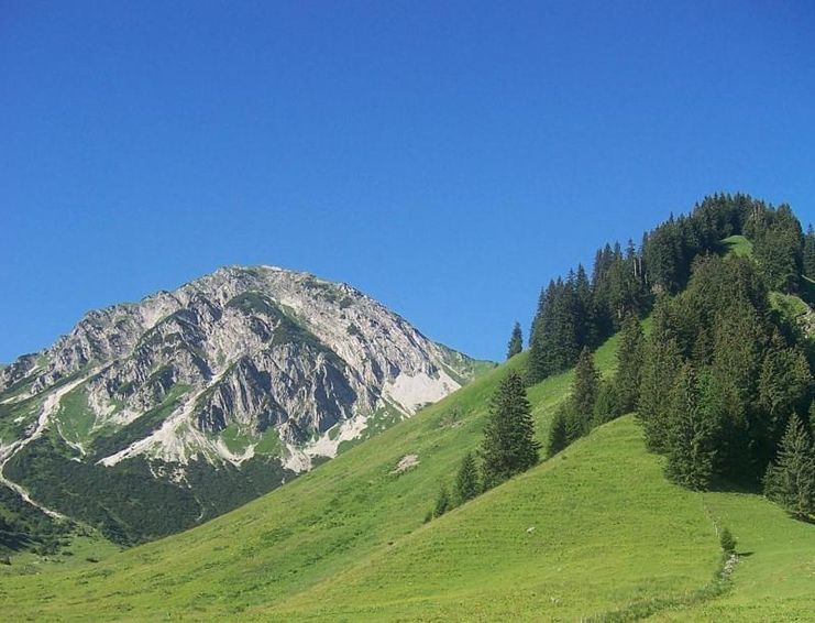
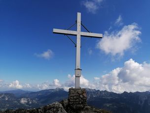
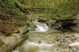
Bscheisser, Ponten and the Rohnenspitze. Three very impressive mountains in the Tannheimer Tal. Each peak hides a wonderful view as well as an indescribable feeling.
"The peak only belongs to you when you are down again, otherwise you belong to it" - Kammerlander
Starting from Schattwald, take the 3-seater chairlift to the Wannenjoch mountain station, Jochstadl, continue to the Stuiben Sennalpe and the Bscheisser. Descent to Güntle and short ascent to Ponten. From there descent to Zirleseck and ascent to Rohnenspitze. Attention! At the beginning there is rope protection, but surefootedness is necessary. Descent to Ponten valley and further on the forest path to Schattwald.
2 further descent possibilities:
Anfahrt
On the motorway A7 at the exit "Oy-Mittelberg" on the B310 towards Wertach and to Oberjoch. There follow the signposting "Tannheimer Tal" B199, exit Schattwald.From the Tyrolean side via Reutte on the B198 towards Lechtal until Weißenbach, over the Gaichtpass along the B199 until exit Schattwald.
Parken
At the valley station of the Wannenjochbahn - with costsÖffentliche Verkehrsmittel
By train to Sonthofen, Pfronten/Ried or Reutte, then by bus to Schattwald
General valid and customary rules of conduct
It should be noted that in mountaineering there is an increased risk of accidents and injuries. Despite careful route planning, a basic risk always remains. Tour preparation through endurance sports, appropriate technical training and further education as well as personal prudence reduces the danger of accidents and risks. However, please never forget that the weather in the mountains can change very quickly. Stay on the marked hiking trails.
It should be noted that in mountaineering there is an increased risk of accidents and injuries. Despite careful route planning, a basic risk always remains. Tour preparation through endurance sports, appropriate technical training and further education as well as personal prudence reduces the danger of accidents and risks. However, please never forget that the weather in the mountains can change very quickly. Stay on the marked hiking trails.
The personal mountaineering equipment must be safe and serviceable and meet the relevant technical standards. Every hiker is recommended to obtain information about the planned tours from specialist alpine literature or on site.
Ähnliche Touren
- Wandertour
"Himmelstürmer"-Trail
© Allgäu GmbH
The "Himmelsstürmer"-Route consists of 24 stage (not counting access routes) and is 342 km long.
mehr dazuDistanz 432,5 km Dauer 148:35 h Aufstieg 17.980 m Schwierigkeit schwer - Wandertour
"Wasserläufer"-Trail
© Allgäu GmbH
The "Wasserläufer"-Route consists of 26 stages (not counting access routes) and is 384 km long.
mehr dazuDistanz 381,6 km Dauer 110:10 h Aufstieg 11.237 m Schwierigkeit schwer - Wandertour
Bridge building river Leiblach: Hiking along the border river - Waterway no.31 in the Western Allgaeu
Three tours of the waterways of the Western Allgaeu (29,30 and 31) invite you to a cross-border discovery journey to the valley of the Leiblach. According to the motto 'building bridges'. The valley's lifeline is the river Leiblach, a near-natural river of the low...
mehr dazuDistanz 21,5 km Dauer 6:20 h Aufstieg 539 m Schwierigkeit schwer - Wandertour
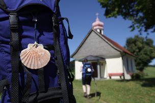
Camino de Santiago from Missen to Lindau, respectively Nonnenhorn (main route)
Going on a pilgrimage between the Allgaeu and the Lake ConstanceThe Camino de Santiago in the district of Lindau is part of the Munich, respectively the Augsburg Camino de Santiago.You're accompanied by neat chapels, lush green meadows in the pre-alpine landscape of the...
mehr dazuDistanz 64,6 km Dauer 17:20 h Aufstieg 758 m Schwierigkeit schwer - Wandertour
Camino de Santiago from Missen via Lindenberg to Lindau, respectively Nonnenhorn (variant)
A pilgrimage walk between the Allgaeu and the Lake ConstanceThe Camino de Santiago leading through the district of Lindau is part of Camino de Santiago of Munich respectively Augsburg. You will be accompanied by neat chapels, rich green meadows in the pre-alpine...
mehr dazuDistanz 63,6 km Dauer 17:50 h Aufstieg 658 m Schwierigkeit schwer - Wandertour
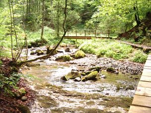
Creeks, ravines, moors - waterway 9 in the western Allgaeu - entry Oberreute
© Thomas Gretler
Roaring mountain streams and deep ravines, green meadows and idyllic moors, fertile forests and picturesque villages - on this demanding cross-border one-day-hike (tour 9) you can explore the whole diversity of the western Allgaeu and the Bregenz forest.
mehr dazuDistanz 23,6 km Dauer 7:30 h Aufstieg 631 m Schwierigkeit schwer - Wandertour
From Haldensee to Litnisschrofen
© Tannheimer Tal
Down from the valley the Litnisschrofen (2068m) is almost not visible. Seen from surrounding peaks such as the Krinnespitze or the Neunerköpfle, the isolated standing one with its distinctive Schrofen wall catches the eye.
mehr dazuDistanz 10,4 km Dauer 4:30 h Aufstieg 938 m Schwierigkeit schwer - Wandertour
rway 9 in the westCreeks, ravines, moors - via The "Hausbachklamm to the Wildrosenmoos - Westallgaeu waterways 9
© Thomas Gretler
Rushing mountain creeks and deep canyons, green meadows and idyllic moors, splendid forests and picturesque villages -on this demanding cross-border one-day-hike you can explore the whole diversity of the landscape of the Western Allgaeu and the Bregenzerwald. If you...
mehr dazuDistanz 20,3 km Dauer 7:30 h Aufstieg 479 m Schwierigkeit schwer - Wandertour
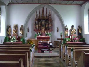
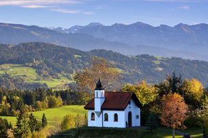
Scheidegg R1 Grand ecumenical chapel path
There are 13 chapels surrounding the spa resort Scheidegg, one of them ecumenical. All of them are great treasures. The grand ecumenical chapel path links ten of these chapels that are worth seeing on an expanded hiking tour.
mehr dazuDistanz 22,4 km Dauer 7:00 h Aufstieg 632 m Schwierigkeit schwer
Die Inhalte dieser Seite werden in Kooperation mit Outdooractive bereitgestellt.