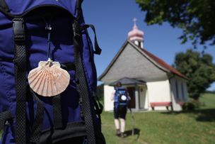
A pilgrimage walk between the Allgaeu and the Lake ConstanceThe Camino de Santiago leading through the district of Lindau is part of Camino de Santiago of Munich respectively Augsburg. You will be accompanied by neat chapels, rich green meadows in the pre-alpine landscape of the Western Allgaeu, blooming fruit and wine growing areas at Lake Constance with marvellous views:The Camino de Santiago between the Western Allgaeu and the Lake Constance invites you to come to peace, to reflect and to pray.
- Strecke63,63 km
- Dauer17:50 h
- Aufstieg658 Hm
- Abstieg1079 Hm
- Schwierigkeitschwer
Höhenprofil
Missen - Stiefenhofen - Weiler - Lindenberg - Hof Rappenfluh - Niederstaufen - Sigmarszell - Weißensberg - Lindau - Wasserburg - Nonnenhorn
Jugetach/Trabers - Stiefenhofen/Genhofen Nagelshub
Coming from Weitnau and Missen-Geratsried, we start our pilgrimage walk on the boundary Stiefenhofen in the district of Lindau (Lake Constance). We cross the stream Jugetach and reach the Alp "Rote Heide", passing "Abeles Alp" in a steep increase. On the small municipal road we continue our tour to the villages Trabers and Mutten.At the village exit of Mutten we turn left to the hiking trail Zell via the "Schwarzenbachtal". Then, the way leads us past the chapel Zell, situated on the boundary Oberstaufen, towards the mill Weißenbachmühle. We cross the railway bridge and reach the village Genhofen with the well-known St. Stephen's chapel, passing the village Wolfsried and the riding school. After that, we turn left into the chapel path.Passing the sawmill on the right hand side, we head towards Aich and then towards Iringshofen to the left. Having passed the last farmstead, our way branches off to the right through the floodplain towards Hopfen with its St. Martin's chapel.The path passes the alpine dairy through the forest via the village Hinteregg to the village Burkatshofen. From there on a path leads back to the road called "alte Salzstraße". After approx. 1 kilometre we reach Nagelshub.
Coming from Weitnau and Missen-Geratsried, we start our pilgrimage walk on the boundary Stiefenhofen in the district of Lindau (Lake Constance). We cross the stream Jugetach and reach the Alp "Rote Heide", passing "Abeles Alp" in a steep increase. On the small municipal road we continue our tour to the villages Trabers and Mutten.At the village exit of Mutten we turn left to the hiking trail Zell via the "Schwarzenbachtal". Then, the way leads us past the chapel Zell, situated on the boundary Oberstaufen, towards the mill Weißenbachmühle. We cross the railway bridge and reach the village Genhofen with the well-known St. Stephen's chapel, passing the village Wolfsried and the riding school. After that, we turn left into the chapel path.Passing the sawmill on the right hand side, we head towards Aich and then towards Iringshofen to the left. Having passed the last farmstead, our way branches off to the right through the floodplain towards Hopfen with its St. Martin's chapel.The path passes the alpine dairy through the forest via the village Hinteregg to the village Burkatshofen. From there on a path leads back to the road called "alte Salzstraße". After approx. 1 kilometre we reach Nagelshub.
Credentials:
Guest office Stiefenhofen, Hauptstraße 7
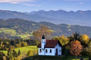
Genhofen (St. Stephen's chapel)
Hopfen (St. Martin's chapel)
Nagelshub - Altenburg/Erratic Block
Coming from Burkartshofen we reach Nagelshub. There, we follow the hiking trail R9/10 on the right hand side. Shortly after, we turn left towards Simmerberg. In the village centre near the inn "Gasthof Krone" we take the road "Rieder Straße" towards Weiler. Thereby, we pass under the alpine road "Deutsche Alpenstraße" and reach the centre of Weiler via Kapfmühle. In the area of the cemetery, the church St. Blaise and the Hausbach stream, the Camino de Santiago divides. We choose the variant via Scheidegg where you find a pilgrimage centre with overnight accomodations.The second variant leads you via Lindenberg.
Alternative: Continue the tour via Lindenberg (Main course via Scheidegg)
We follow the roads "Bahnhofstraße" and "Kristinusstraße" to the junction Eschweidstraße. We turn left there and straightaway we follow the hiking trail R5 on the right side. On the Erratic Block, an ice age boulder, we reach Manzen, a part of Lindenberg.
Credentials:
Gasthof Krone, Alte Salzstraße 50, Simmerberg
Chapel of St. Anthony, Rieder/Simmerberg
Catholic rectory St. Blaise, Schulstr. 11, Weiler
Tourist Information, Hauptstr.14, Weiler
Gasthof Engel, Kirchplatz 5, Weiler
Erratic Block/Manzen - Lindenberg - Kinberg
Coming from the Erratic Block, we soon climb steeply uphill to Manzen and further uphill to Kellershub. On the road "Auf der Hub" we hike straight ahead to the road Alemannenstraße. We turn left into the road Staufner Straße and after crossing it, we hike past the estate "Lindenhof" to the road Bergstraße.
The road leads us steeply downhill on the right side to the town centreand the church of St. Augustin. We pass the Elementary School from there and, crossing the road Loewenstraße, we reach the town hall and tourist information. We come across the parish church of St. Peter and Paul. At the end of the road Rathausstraße we cross the road Blumenstraße and turn right into a small sideway (towards the grammar school). We follow the sideway until we come to the foot and bicycle path. We turn left into the path.
Along the north side, we get to the foot and bicycle path into which we turn to the left. At the crossroad with the road Martinstraße we climb right and immediately left. We cross the little hill and next to the municipal services, we tun into the forest. We come across the shores of the idyllic lake Waldsee. Our route leads us past the hotel "Waldsee" and the public swimming pool and takes us to the village Allmannsried on a beautiful forest and meadow path.
At the northwestern edge of the village we continue our tour, staying slightly on the right side. Next to the farm "Rappenfluh" the road takes us into the forest. After 10 minutes we look down to the glittering Lake Constance and the mighty Alpstein massif with its main peaks Saentis and Altmann.
Credentials:
Catholic rectory, Goethestr. 4
Tourist information Lindenberg, Stadtplatz 1
Kinberg - Niederstaufen - Schlachters - Weißensberger Halde - Streitelsfingen
Behind the farm called "Kinberg", we turn right toward the forest. After 80 metres in the forest, we go left, following a steep downhill footpath, with stairs. We come across a broad forest path and follow it turning left. After 400 metres we reach a fork. Here we turn right along a meadow. Steeply downhill we get to a hamlet called Adelberg. On the paved road we continue our way downhill. Shortly before we reach Niederstaufen we turn left into a little forest and afterwards we hike towards the church of Niederstaufen along the edge of the forest. We pass the church to our left and turn right, hiking on the road "Allgaeuer Straße". We reach the fork to the left towards the Leiblach river, passing a grocery. Here we come across the hiking trail along the Leiblach, called "Leiblach-Uferweg"on another signpost. We follow the signposts upstream. We cross the small river on a small steel bridge. On the other side of the riverwe walk an asphalted path 400 metres uphill and turn to the left in a piece of woodland. On a romantic forest and meadow path the hiking trail leads us southwards. Later on, there is a narrow pathway back to the river. Here, we cross a bridge over a creek's confluence into the Leiblach. Now we come across a broader forest path ´. We follow the river's course on this path.
Route through a ravine and the town Sigmarszell
(Scenic but more difficult)
We cross the road B 308 (a tunnel is supposed to be built) and follow the way straight ahead until we come across the houses of the village Dornach. Shortly after Dornach, we follow the right turn. We come across more houses of Dornach. At first, we turn right. After 150 metres we turn left, following the marks of the hiking trail on a small meadow path. This path leads us through a dingle with several stairs and a bridge to Sigmarszell. Note: the route through the ravine is not paved and dangerous when wet.
We directly come across the church. We turn right from here follow the straight road uphill to Biesings, a part of Sigmarszell. Before we reach the ramp to the road B 308, we turn left and follow the road for 300 metres until we reach the village Schlachters via an underpass.
Easier variant along the road B308:
After crossing the road B308 we hike on the bicycle and hiking trail along the B308 until we reach Biesings.
Continue the tour from Schlachters:
We hike along the main street, passing the town hall and, shortly before we reach the pharmacy, we turn left into the road Weiherstraße. The road leads us into the forest, passing the sports field and the pond "Schlachtener Weiher". We cross the motorway A96 on a bridge and turn right immediately into a forest path. This path leads us in a left turn near the railway tracks. We turn left here and hike slightly uphill to the viewpoint "Weißensberger Halde". The little ascent will be rewarded with a wonderful view on Lake Constance and the Alps. A panoramic board at the freestanding chapel helps us finding the names and heights of the mountains we can see. We descend from the hill on narrow footpath with handrails. We hike downhill until we come across a small, asphalted footpath following it to the left. It leads us to the connecting road we walk downhill rightwards. At the next junction we turn left, crossing under the B308 and at the fork we turn right towards the municipality Streitelsfingen. After 500 metres we turn right following this path to Streitelsfingen.
Credentials:
Town hall Sigmarszell-Schlachters, Hauptstraße 28
Streitelsfingen - Insel Lindau
In Streitelsfinge, we pass the little Montfort Castle hiking on the road. After approx. 100 metres we turn left into a meadow path which leads through orchards. At the end of the path, we descend to the right coming across the road Roentgenstraße which we follow. On this road, we come across a residential area. First we pass the junctions Baeuerlinshalde, Bantingstraßeand Otto-Hahn-Straße and then we turn right into a small meadow path. We follow the path to the road Oberreutiner Weg north of the former brewery "Steigbrauerei". We pass the cemetery and the church of St. Verena. The path leads us leftwards a little downhill, before we turn left again into a narrow footpath called "das Gängle". Attention: the footpath can be overlooked easily. We soon reach the road Koechlinstraße which we follow in a right turn. Soon, the road turns sharply left. We keep on following straight the street course, passing the savings bank until we reach the road "Kemptener Straße". We cross the road very carefully. On the other side of the street we reach the road Bleicheweg at the idlyyic pond "Koechlinweiher". Following a creek, we reach a market garden which we leave to our right. Passing the building yard to the left, we continue straight ahead and cross the Bleicheweg at the junction "Privatweg". Passing the savings bank we come across pedestrian lights where we cross the highly frequented road Bregenzer Straße. Behind the traffic lights we stay right passing the barrier system of the railway line from Lindau to Bregenz and follow the Bregenzer Straße towards he Island. After crossing a bridge over the river Ach we turn left into the area of the city administration. At the parking lot, we hike to the lake. We follow the shorepath to the right until we reach and cross the bridge. Behind the bridge we immediately turn left and follow the shorepath passing the casino. Behind a jetty we stay along the lake, turn right at the end of the shorepath until we reach the small road Fischergasse. We follow the Fischergasse shortly turning left and pass the in "Alte Post". A small passage marks the entry leftward to the Gerberschanze. A section of the shorepath begins here. We follow it, passing the sailing port until we come to the port of Lindau.
Continuation from the bridge crossing Lake Constance in Lindau to Wasserburg
After visiting of the island of Lindau, we turn westwards on the landside at the bridge crossing Lake Constance("Seebrücke"). First, we pass the minigolf course along the lake. Then we follow the lakeshore in Aeschach until we come across the railroad crossing we cross. We continue our tour on a combined foot and bicycle path along the lakeshore and afterwards on the road Giebelbachstraße to the road Schachener Straße. Here we follow the street course turning left and after approx. 500 metres, we turn left again, coming into the road Oelschlaenderweg. Soon, there are signposts leading us left to the hotel Bad Schachen. Passing the impressive hotel,we come to the Lindenhofpark. We cross the park along the lake for a while. Passing the seaside resort "Lindenhofbad" we reach the way "Lindenhofweg". Infront of the "Villa Alwind" (post recreation home) we turn left towards the lake. After having passed the maintained garden of the castle like building close to the lakeshore, the path leads us up to the roads Uli-Wieland-Straße and Reutener Straße.
Credentials:
Tourist information Lindau, Alfred-Nobel-Platz 1, opposite central station
Wasserburg - Reutenen - Nonnenhorn
Coming from Lindau we reach the Uli-Wieland-Straße at the town sign Wasserburg (district: Reutenen). We follow the road until it leads to the road Reutener Straße. Here, we look upon the gable end of the small St. James's chapel that is highly recommended to visit. However, our route takes us leftward through meadows until we come across a wayside shrine where we stick left to the unpaved hiking trail. It takes us back to the Reutener Straße passing the outdoor facilities of a public swimming pool. Shortly after, we turn left again at the entrance of the hall "Sumser-Halle" which is clearly visible. We now cross a park-like area with a statue of the "Lieber Augustin" at the lakeshore, the playground an the tennis courts. We reach the road Uferstraße when we come across the first houses. We follow the Uferstraße until it takes us to the road Halbinselstraße. We walk this road until we come across a fork at the hotel "Lieber Augustin. From here, the way leads us to the attractions of the Wasserburg peninsula. We stay right, passing the restaurant "Hege Strand 3" and the minigolf course and come across an avenue of poplar-trees. We stay on this route near the lake that is reserved for hikers and cyclists, passing a nature reserve to our left and soon we can see the town sign of Nonnenhorn.
Credentials:
Office of the rectory St.Georg, outside business hours on request from the local parish priest
Nonnenhorn
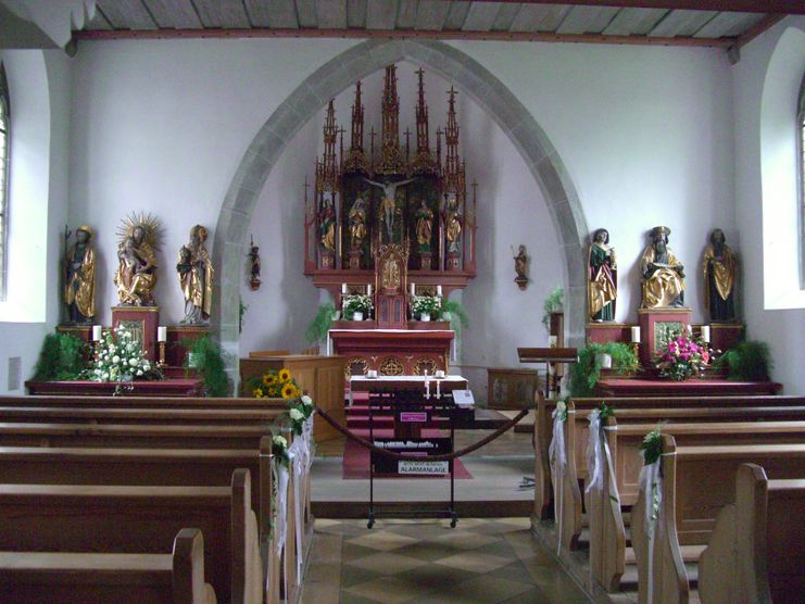
Coming from the Wasserburg peninsula, we reach the town sign of Nonnenhorn behind the beautiful avenue of poplar-trees. At the fork we stay left alongside the road and take a short side trip to a public lake access, called "Malerwinkel". There we have a wonderful view of the peninsula with Wasserburg Castle and St. George's church. Back on the road Wasserburger Straße after approx. 1.5 kilometres, we get to the 400 years old wine press "Weintorkel" in the central of Nonnenhorn that is highly recommended to visit. From the centre of Nonnenhorn we turn left again towards the lake. We pass the tourist information to our right and the pier to our left. We come to the lido and after a right turn we hike 150 metres uphill to the tavern "Weinstube Fürst". There we make a sharp right turn to the historic chapel square and there we stand infront of the entrance of St. James' chapel built in the 14th century. A display board infront of the entrance shows us the Camino de Santiago in Bavarian Swabia. At the wall of the inn "Kapelle" opposite the chapel we discover an old inn sign depicting St. James.
We can now drive to Rorschach by ship and continue our tour in Switzerland from Rorschach to Einsiedeln (shipping on Lake Constance from May to September).
Furthermore, you can hike to Friedrichshafen and drive to Konstanz by the catamaran.
Credentials:
Inn "Zur Kapelle" next to the chapel of St.James, Tel. 08382-8274
Tourist information Nonnenhorn, Seehalde 2, Tel. 08382-8250
Bruno Markowski, Im Gehren 6b, Tel. 08382-80
Ähnliche Touren
- Wandertour
"Himmelstürmer"-Trail
© Allgäu GmbH
The "Himmelsstürmer"-Route consists of 24 stage (not counting access routes) and is 342 km long.
mehr dazuDistanz 432,5 km Dauer 148:35 h Aufstieg 17.980 m Schwierigkeit schwer - Wandertour
"Wasserläufer"-Trail
© Allgäu GmbH
The "Wasserläufer"-Route consists of 26 stages (not counting access routes) and is 384 km long.
mehr dazuDistanz 381,6 km Dauer 110:10 h Aufstieg 11.237 m Schwierigkeit schwer - Wandertour
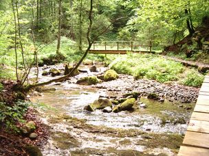
Bridge building river Leiblach: Hiking along the border river - Waterway no.31 in the Western Allgaeu
Three tours of the waterways of the Western Allgaeu (29,30 and 31) invite you to a cross-border discovery journey to the valley of the Leiblach. According to the motto 'building bridges'. The valley's lifeline is the river Leiblach, a near-natural river of the low...
mehr dazuDistanz 21,5 km Dauer 6:20 h Aufstieg 539 m Schwierigkeit schwer - Wandertour
Camino de Santiago from Missen to Lindau, respectively Nonnenhorn (main route)
Going on a pilgrimage between the Allgaeu and the Lake ConstanceThe Camino de Santiago in the district of Lindau is part of the Munich, respectively the Augsburg Camino de Santiago.You're accompanied by neat chapels, lush green meadows in the pre-alpine landscape of the...
mehr dazuDistanz 64,6 km Dauer 17:20 h Aufstieg 758 m Schwierigkeit schwer - Wandertour
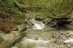
Creeks, ravines, moors - waterway 9 in the western Allgaeu - entry Oberreute
© Thomas Gretler
Roaring mountain streams and deep ravines, green meadows and idyllic moors, fertile forests and picturesque villages - on this demanding cross-border one-day-hike (tour 9) you can explore the whole diversity of the western Allgaeu and the Bregenz forest.
mehr dazuDistanz 23,6 km Dauer 7:30 h Aufstieg 631 m Schwierigkeit schwer - Wandertour
From Haldensee to Litnisschrofen
© Tannheimer Tal
Down from the valley the Litnisschrofen (2068m) is almost not visible. Seen from surrounding peaks such as the Krinnespitze or the Neunerköpfle, the isolated standing one with its distinctive Schrofen wall catches the eye.
mehr dazuDistanz 10,4 km Dauer 4:30 h Aufstieg 938 m Schwierigkeit schwer - Wandertour
rway 9 in the westCreeks, ravines, moors - via The "Hausbachklamm to the Wildrosenmoos - Westallgaeu waterways 9
© Thomas Gretler
Rushing mountain creeks and deep canyons, green meadows and idyllic moors, splendid forests and picturesque villages -on this demanding cross-border one-day-hike you can explore the whole diversity of the landscape of the Western Allgaeu and the Bregenzerwald. If you...
mehr dazuDistanz 20,3 km Dauer 7:30 h Aufstieg 479 m Schwierigkeit schwer - Wandertour
Scheidegg R1 Grand ecumenical chapel path
There are 13 chapels surrounding the spa resort Scheidegg, one of them ecumenical. All of them are great treasures. The grand ecumenical chapel path links ten of these chapels that are worth seeing on an expanded hiking tour.
mehr dazuDistanz 22,4 km Dauer 7:00 h Aufstieg 632 m Schwierigkeit schwer
Die Inhalte dieser Seite werden in Kooperation mit Outdooractive bereitgestellt.