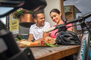
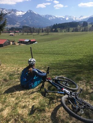
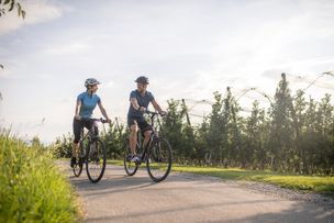
Difficult but varied tour through forests, crossing meadows and over the mountain-back of the Ofterschwanger Horn.

- Strecke14,77 km
- Dauer2:00 h
- Aufstieg556 Hm
- Abstieg556 Hm
- Schwierigkeitmittel
Höhenprofil
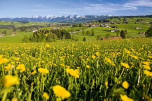
A difficult tour with partly steep ascents and gravel passages, which requires endurance and driving skills, but also provides great viewpoints and numerous retreats.
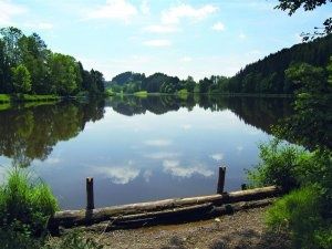
The tour begins at the valley station of the Weltcup-Express in Ofterschwang. The first climb to the Alpe Eck/Allgäu Berghof is quite steep but awesome. Once up, follow the downhill to the Geissrücken Alpe. Turn right into a forest path in the direction of the Allgäuer Berghof. Follow the road on the right along the "Salzhalde" / "Hüttenberger Eck" and take the exit towards Hüttenberg. In Hüttenberg, in the village center, turn right and take the road left down to Westerhofen. At the t-junction turn right to get to the main road. Follow right for a few meters up to the chapel. At the chapel turn left and head into the forest and follow the signpost to Wielenberg-Muderbolz. Enjoy the great mountain panorama and return from there to the starting point to Ofterschwang.
Anfahrt
The access to Ofterschwang is via the B19, with exit Sigishofen (OA5) at Sonthofen or via Tiefenberg.Parken
Free parking at the Weltcup-Express valley station in OfterschwangÖffentliche Verkehrsmittel
From the Sonthofen train station by bus to Ofterschwang (bus route Sonthofen - Ofterschwang - Bolsterlang) or via Fischen (via Bolsterlang)To avoid problems, we ask you to stick to the following code of honor:
- Only ride on paths! Please never cross country ver meadows, otherwise you harm nature.
- Do not leave any traces! Set your driving style according to the ground and the terrain.
- Keep your bike / mountain bike under control! Check your speed for each situation.
- Respect other nature users! Please make hikers ware of your passing. At narrow passages please climb off your bike.
- Take care of animals! Here in the Allgäu, all meadows are used as grazing for cows. Always close the gates.
- Plan in advance! Check your equipment, estimate your skills, and choose the area you want to go in. A helmet can protect, but is not life insurance.
Ähnliche Touren
- Radtour
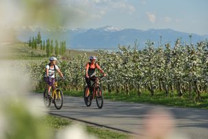
Biking on the the Allgaeu cheeseroad - cheese and beer
© Frederick Sams
Biking on the the Allgaeu cheeseroad - cheese and beer
mehr dazuDistanz 32,6 km Dauer 2:30 h Aufstieg 460 m Schwierigkeit mittel - Radtour
Cycling on the "Allgäuer Käsestraße" (Allgaeu cheese road) - cheese and water fun
© Kempten Tourismus
Water fun at its finest. Passing creeks and ponds, the tour leads to three dairies, producing the best Allgäu cheese. The "Burkwanger Baggersee" (Burkwang quarry pond) and the public pool in Rentershofen provide cooling occasionally and at the end of the tour. A special...
mehr dazuDistanz 42,7 km Dauer 3:22 h Aufstieg 454 m Schwierigkeit mittel - Radtour
Cycling on the "Allgäuer Käsestraße" (Allgaeu cheese road) - cheese with a view
© Dorfsennerei Böserscheidegg
Magnificent views of the Nagelfluh mountain range, Lake Constance, the Swiss mountains and the mountains of the Bregenzerwald - you will be amazed on this tour! A special treat: the tour can be combined ideally with a hiking tour on the "Josef-Rupp-Käsewanderweg"...
mehr dazuDistanz 30,7 km Dauer 2:44 h Aufstieg 558 m Schwierigkeit mittel - Mountainbike
Cycling tour from Ofterschwang over Alpe Eck and Geißrücken Alpe
The tour is not suitable for beginners, rather for endurance bikers with sufficient fitness and good driving skills.
mehr dazuDistanz 15,5 km Dauer 3:00 h Aufstieg 500 m Schwierigkeit mittel - Mountainbike
Moosrunde - bike tour between Ofterschwang and Bolsterlang
Easy tour to the starting point and for families, which offers beautiful viewpoints to the mountains.
mehr dazuDistanz 10,6 km Dauer 1:00 h Aufstieg 171 m Schwierigkeit mittel - Radtour
Smuggler tour
© Tourist-Information Wasserburg
Enjoy a 2,5 hour-bicycle-tour via Wasserburg, Lindau and the surrounding area. The tour provides wonderful views across Lake Constance, numerous rest stops and beautiful landscapes.
mehr dazuDistanz 33,4 km Dauer 2:20 h Aufstieg 288 m Schwierigkeit mittel - Radtour
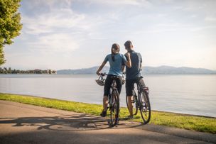
Tour no. 1 round Lake Constance. "Panoramic bicycle tour round Bavarian Lake Constance"
© Landratsamt Lindau (Bodensee)
This round tour leads you to the six most beautiful view points of Lindau's Lake Constance area, passing orchards, vine and picturesque villages.
mehr dazuDistanz 25,7 km Dauer 3:00 h Aufstieg 284 m Schwierigkeit mittel - Radtour
Tour of the three countries
© www.seeundberge.de
Cycle tour across Switzerland, Austria and Germany.
mehr dazuDistanz 61,4 km Dauer 4:30 h Aufstieg 30 m Schwierigkeit mittel - Radtour
Tour through the Leiblach valley
The tour through the Leiblach valley leads us from the island of Lindau to Hergensweiler. We can experience marvellous views and cross orchards and have not only the opportunity to set in, but also to swim.
mehr dazuDistanz 24,3 km Dauer 3:30 h Aufstieg 262 m Schwierigkeit mittel
Die Inhalte dieser Seite werden in Kooperation mit Outdooractive bereitgestellt.