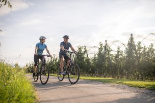
Magnificent views of the Nagelfluh mountain range, Lake Constance, the Swiss mountains and the mountains of the Bregenzerwald - you will be amazed on this tour! A special treat: the tour can be combined ideally with a hiking tour on the "Josef-Rupp-Käsewanderweg" (Josef-Rupp cheese hiking trail) lasting 90 minutes.

- Strecke30,68 km
- Dauer2:44 h
- Aufstieg558 Hm
- Abstieg558 Hm
- Schwierigkeitmittel
Höhenprofil
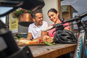
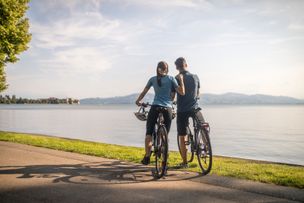
Starting point of the tour is "Baldaufs Käs- und Weinkeller" in Goßholz, Lindenberg. Tip: here you can try a good piece off Allgaeu's tradition already at the beginning of the tour. The "Baldauf Alpkäse" is the supreme product of the Baldauf cheese selection and an ideal refreshment for the tour. A special delight and perfect match for the cheese are the chutneys and the pesto of wild herbs by "sell g'machts" ("homemade things") that you can buy there. Coming from the cheese cellar, you dive a little bit left. After few metres the cycle way branches off right towards Lindenberg. Two cosy inns invite you to rest in the mountain town: the "Lindenberger Hof" is the district's award winner of the competition " Állgaeu/Bavarian Cuisine". In the inn "Bayerischer Hof" the kitchen team indulges you with regional delicacies from cheese soup to cheese skewer and cheeese schnitzel. Back on the cycle path, you drive on to Scheidegg. You can orient yourself by looking at the signposts of the "Allgäuer Käsestraße" (Allgaeu cheese route) respectively the "Radrunde Allgäu" (Allgaeu cycling tour). In the town centre of Scheidegg you turn right towards Bregenz at the bus stop. At the end of Scheidegg, there is a cycle path left to the road. You cross the Austrian boarder in the forest, have to return to the road and cross the hamlet Weienried until you reach the modern community office. You turn left there and follow the signposts "Eichenberg". You have to pedal a little harder for a while because the way leads you constantly uphill. After approx. 3 kilometres you will be rewarded with a long downhill stretch and a splendid view of Lake Constance, the Rhine valley and the Swiss mountains. Having reached Lutzenreute, you have to push your bikes on the left side for approx. 250 metres steeply uphill. There you have the opportunity to enter the "Josef Rupp Käse-Wanderweg" ("Josef Rupp cheese hiking trail")
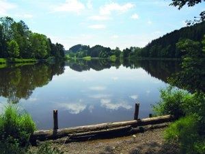
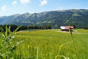
(Note: only parts of the hiking trail are suitable for cyclists. It is recommended to park the bicycles and walk.) The hiking trail extends on approx. 10 kilometres along the Pfänder ridge with a wonderful view of Lake Constance and the mountains of the Bregenzwerwald. A part of the trail is designed as cheese-educational-trail. There are 15 illustrated panels, explaining to the hiker the production of mountain cheese and other cheese specialties - from the meadow to the plate, so to speak. The walking time is about 90 minutes. After the tour, we drive leisurely on a straight non-asphalted, almost car-free way from the starting point, crossing a placid valley slightly downhill until we reach the street to Möggers. From Möggers, we drive back to Scheidegg on the known route. From Scheidegg, you can take the known route back to Lindenberg or you can take a side trip to the village dairie of Böserscheidegg (see map). You reach the dairie if you turn right towards Weiler at the village centre. You can follow the signposts "Allgäuer Käsestraße" respectively "Radrunde Allgäu". Tip: After nearly 1.5 kilometres, you can see the golf park "Scheidegg-Westallgäu" on the left side of the road. Crossing it, you come across the view point "Roderbühl" on a small road. After a few metres uphill on foot, you have a beautiful view of the Nagelfluh mountain range, the Alpine foreland and Lake Constance. Back on the road towards Weiler, after nearly one kilometre you reach the "Dorfsennerei Böserscheidegg" (village dairie Böserscheidegg). Every day, mountain cheese, butter, butter cheese and various her cheeses are produced from approx. 3500 litres milk. Behind the dairie, turn left. In Ried, you have to pedal hard - or push your bike. Here you have overcome a last steep section before you drive downhill back to Lindenberg and on the known route to Goßholz.
Ähnliche Touren
- Radtour
Biking on the the Allgaeu cheeseroad - cheese and beer
© Frederick Sams
Biking on the the Allgaeu cheeseroad - cheese and beer
mehr dazuDistanz 32,6 km Dauer 2:30 h Aufstieg 460 m Schwierigkeit mittel - Radtour
Cycling on the "Allgäuer Käsestraße" (Allgaeu cheese road) - cheese and water fun
© Kempten Tourismus
Water fun at its finest. Passing creeks and ponds, the tour leads to three dairies, producing the best Allgäu cheese. The "Burkwanger Baggersee" (Burkwang quarry pond) and the public pool in Rentershofen provide cooling occasionally and at the end of the tour. A special...
mehr dazuDistanz 42,7 km Dauer 3:22 h Aufstieg 454 m Schwierigkeit mittel - Mountainbike
Ofterschwang cycle tour Forest-Meadows-Mountain
Difficult but varied tour through forests, crossing meadows and over the mountain-back of the Ofterschwanger Horn.
mehr dazuDistanz 14,8 km Dauer 2:00 h Aufstieg 556 m Schwierigkeit mittel - Radtour
Tour no. 1 round Lake Constance. "Panoramic bicycle tour round Bavarian Lake Constance"
© Landratsamt Lindau (Bodensee)
This round tour leads you to the six most beautiful view points of Lindau's Lake Constance area, passing orchards, vine and picturesque villages.
mehr dazuDistanz 25,7 km Dauer 3:00 h Aufstieg 284 m Schwierigkeit mittel - Radtour
Tour through the Leiblach valley
The tour through the Leiblach valley leads us from the island of Lindau to Hergensweiler. We can experience marvellous views and cross orchards and have not only the opportunity to set in, but also to swim.
mehr dazuDistanz 24,3 km Dauer 3:30 h Aufstieg 262 m Schwierigkeit mittel
Die Inhalte dieser Seite werden in Kooperation mit Outdooractive bereitgestellt.