A beautiful tour to the neighbouring province of Vorarlberg.
- Strecke166,31 km
- Dauer8:00 h
- Aufstieg2033 Hm
- Abstieg2033 Hm
- Schwierigkeitschwer
Höhenprofil
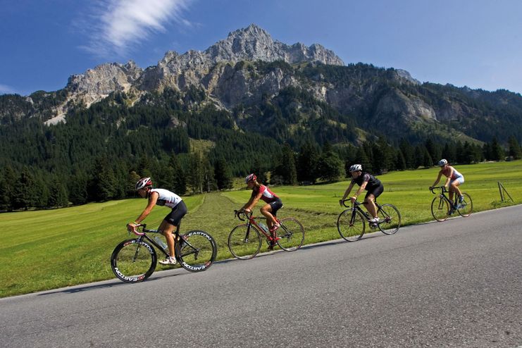
Tour of Bavaria at the opening stage on Tyrolean soil and were rewarded with the mountain classification Tannheimer Tal and the mountain classification Jungholz And even professionals noticed the scenic charms of the "probably most beautiful high valley in Europe". Lush green meadows, the Haldensee and a beautiful mountain scenery accompanied the cycling pros on their competition kilometres. And thus the Tannheimer Tal has also advertised itself as an ideal region for specific training or extended tours. "The Tannheimer Tal is an ideal starting point for long racing bike tours to the surrounding regions such as Lake Constance or the Arlberg", says Michael Keller, managing director of the tourism association Tannheimer Tal and former national mountain bike coach of Austria. Cyclists find in the Tannheimer Tal not only the ideal starting point but also a wide range of accommodation. You can choose your accommodation from a 5-star house to a private room. After a nice ride you can relax and recharge your batteries. - The Tannheimer Tal
Translated with www.DeepL.com/Translator (free version)
Start at the tourist information in Tannheim in eastern direction, past Nesselwängle over the Gaichtpass to Weißenbach. At the roundabout turn right into the Lechtal valley as far as Warth. There turn right and continue to the highest point of the tour, the Hochtannberg Pass at 1,676 metres above sea level. Then follows the fast and technically demanding descent through Schröcken and Schoppernau into the Bregenzerwald. From there to Schnepfau and turn right off the main road towards Schnepfau Ort and Bizau. A romantic, narrow road is followed by a 2.5 km long ascent, the following descent to Bizau is also very beautiful. Once in Bizau, continue towards Reuthe and turn left before Bezau to get back on the main road. Then at the roundabout follow the signs for Schwarzenberg and continue to Egg. There straight on at the main crossing to Egg-Großdorf and further to Lingenau. In the centre of the village (near the church) turn right onto the main road to Hittisau. At the end of Hittisau turn right towards Bolgenach and continue towards Riefensberg. Keep left here before entering the village and take the exit to the main road. There turn right to the border crossing Aach and further to Oberstaufen. After the ascent keep right in the direction of Immenstadt, past the Großer Alpsee and through the town. At the third roundabout turn right towards Blaichach, through the underpass and then turn left towards Sonthofen. Then follow the road straight on and through Sonthofen and further on towards Oberjoch/Reutte. In Bad Hindelang the ascent of the Jochpass begins, with a maximum 7% gradient, to Oberjoch. In Oberjoch turn right at the crossroads in the direction of Tannheimer Tal and follow the main road to the starting point in Tannheim.
Translated with www.DeepL.com/Translator (free version)
Anfahrt
On the motorway A7 at the exit "Oy-Mittelberg" on the B310 towards Wertach and to Oberjoch. There follow the signposting "Tannheimer Tal" B199, exit Tannheim. From the Tyrolean side via Reutte on the B198 towards Lechtal until Weißenbach, over the Gaichtpass along the B199 until exit Tannheim.Parken
Parking spaces at the Neunerköpfle gondola lift in Tannheim - subject to chargesÖffentliche Verkehrsmittel
By train to Sonthofen, Pfronten/Ried or Reutte, then by bus to Tannheim.The StVO applies. General valid and customary rules of conduct.
It should be noted that in road cycling there is an increased risk of accidents and injuries. Despite careful tour planning, a basic risk always remains. Tour preparation through endurance sports, appropriate training and further education as well as personal prudence reduces the risk of accidents and injuries.
The personal equipment must be safe and serviceable and meet the relevant technical standards. Every racing cyclist is recommended to obtain information about the planned tours from specialist literature or on site. Complete racing bike equipment is strongly recommended, even for experienced cyclists!
Ähnliche Touren
- Rennrad
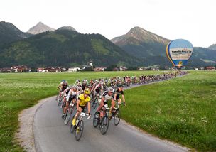
Rad-Marathon Tannheim Valley_224km
© Tannheimer Tal
Start in Tannheim, Rossberg, Sägerklause via Grän, Tannheim, Zöblen, Schattwald across the NATIONAL BORDER to Oberjoch and Unterjoch. After that, back on Austrian territory through Jungholz, before re-entering German soil...
mehr dazuDistanz 214,1 km Dauer 10:00 h Aufstieg 3.500 m Schwierigkeit schwer
Die Inhalte dieser Seite werden in Kooperation mit Outdooractive bereitgestellt.