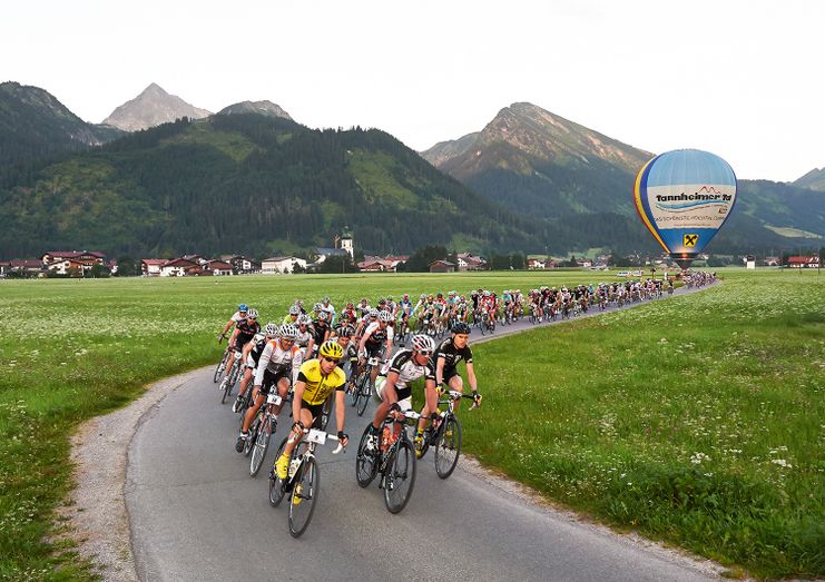
Start in Tannheim, Rossberg, Sägerklause via Grän, Tannheim, Zöblen, Schattwald across the NATIONAL BORDER to Oberjoch and Unterjoch. After that, back on Austrian territory through Jungholz, before re-entering German soil.
Tannheimer Tal
- Strecke214,07 km
- Dauer10:00 h
- Aufstieg3500 Hm
- Abstieg3500 Hm
- Schwierigkeitschwer
Höhenprofil
Start in Tannheim, Rossberg, Sägerklause via Grän, Tannheim, Zöblen, Schattwald across the NATIONAL BORDER to Oberjoch and Unterjoch. After that, back on Austrian territory through Jungholz, before re-entering German soil. Past Wertach to Oy-Mittelberg, Petersthal, Kranzegg (1st filling station), Rettenberg, Immenstadt, Bihlerdorf, via Hüttenberg to Ofterschwang, Bolsterlang up to Obermaiselstein to 2nd filling station. Germany’s highest mountain pass road begins here with the Riedbergpaß at 1,407 meters. After the challenging descent, reach Balderschwang and the 3rd filling station. After that, the NATIONAL BORDER is crossed into Vorarlberg and it goes on past towns in the Bregenzerwald, Hittisau, Lingenau, Großdorf, Egg, Andelsbuch, Mellau until Schoppernau (4th filling station). The Schröckenpass follows with a speedy descent to Warth to the 5th filling station. Further on to the STATE BORDER to Tyrol and on State Road B198 to Steeg, Holzgau, Stockach (6th filling station), Bach, Elbigenalp, Häselgehr, Elmen, Stanzach until Weißenbach where the 7th filling station is reached. From here turn left on to the Road B199 over the Gaichtpass, past Nesselwängle and the Haldensee back to Tannheim.
Anfahrt
The quickest and easiest and toll-free route to the Tannheim Valley by car leads via the A7 highway. Turn off at Exit "Oy-Mittelberg", turn right and follow the signs along state road B 310 heading toward Wertach/Oberjoch for ca. 15 kilometers. In Oberjoch turn left into the Tannheim Valley.Öffentliche Verkehrsmittel
Train stations in Germany are: Sonthofen (24 km, bus transfer) Pfronten/Ried (16 km, bus transfer) and in Austria at Reutte (24 km with bus connection)A Roadbike is recommended.
Wearing a crash helmet is compulsory.
HEADLIGHT is required through the tunnels on the Riedbergpaß and in Bregenzerwald (Vorarlberg).
Support vehicles are not welcome - please comply !!
Die Inhalte dieser Seite werden in Kooperation mit Outdooractive bereitgestellt.