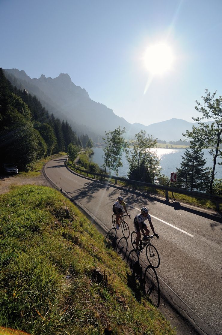
From Tannheim over the Gaichtpass past the beautiful Plansee, around the Ammergebirge through Füssen back to the Tannheimer Tal.
- Strecke151,43 km
- Dauer5:45 h
- Aufstieg1466 Hm
- Abstieg1466 Hm
- Schwierigkeitmittel
Höhenprofil
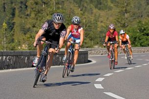
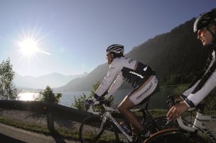
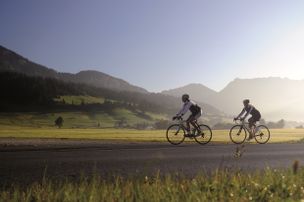
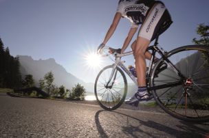
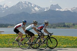
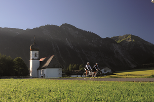
The Tannheimer Tal has been known among cyclists for quite some time, because in 2001 the retinue of the Tour of Austria Bicycle Tour went through the valley. In 2005 the cycling pros of the Tour of Bavaria came to Tyrolean soil at the opening stage and were rewarded with the mountain classification Tannheimer Tal and the mountain classification Jungholz. And even professionals noticed the scenic attractions of the "probably most beautiful high valley in Europe". Lush green meadows, the Haldensee and a beautiful mountain scenery accompanied the cycling pros on their competition kilometres. And thus the Tannheimer Tal has also advertised itself as an ideal region for specific training or extended tours. "The Tannheimer Tal is an ideal starting point for long racing bike tours to the surrounding regions such as Lake Constance or the Arlberg", says Michael Keller, managing director of the tourism association Tannheimer Tal and former national mountain bike coach of Austria. Cyclists find in the Tannheimer Tal not only the ideal starting point but also a wide range of accommodation. You can choose your accommodation from a 5-star house to a private room. After a nice ride you can relax and recharge your batteries. - The Tannheimer Tal
Start at the tourist information in Tannheim in eastern direction, passing Nesselwängle and the Gaichtpaß down the valley to Weißenbach. At the roundabout take the exit in the direction of Reutte. Follow the road via Höfen and Lechaschau to Reutte. At the roundabout take the exit in the direction of Fernpaß. At the end of Reutte turn left towards Breitenwang/Plansee. At the roundabout in Kerckelmoos straight on to Plansee. Along the shore of the Plansee. Past Linderhof Castle and through Graswang to the Ettal junction. Turn left through the villages of Ober- and Unterammergau to Bad Bayersoien. Continue on the B23 until the junction Steingaden. Turn left and follow the road to Steingaden. Turn left in the centre of the village and follow the B17 via Halblech and Buching towards Schwangau. Before Schwangau turn left to Hohenschwangau with a view of Neuschwanstein Castle. At the end of Hohenschwangau turn right to Alterschrofen and continue towards Füssen. Before the Lech bridge turn left in the direction of Vils. Before the Ulrich bridge turn left to Pinswang. There follows a short ascent over the Kniepaß and further over Pflach to Reutte. Follow the road to the left in the direction of the train station. At the roundabout take the first exit right, next roundabout straight on. At the main roundabout again straight on towards Lechtal, continue through Lechaschau and Höfen to Weißenbach. At the roundabout turn right into the Tannheimer Tal. Turn right before Nesselwängle, pass through Nesselwängle and back to the starting point.
Anfahrt
On the motorway A7 at the exit "Oy-Mittelberg" on the B310 towards Wertach and to Oberjoch. There follow the signposting "Tannheimer Tal" B199, exit Tannheim. From the Tyrolean side via Reutte on the B198 towards Lechtal until Weißenbach, over the Gaichtpass along the B199 until exit Tannheim.Parken
Parking spaces at the Neunerköpfle gondola lift in Tannheim - subject to chargesÖffentliche Verkehrsmittel
By train to Sonthofen, Pfronten/Ried or Reutte, then by bus to Tannheim.The StVO applies. General valid and customary rules of conduct.
It should be noted that in road cycling there is an increased risk of accidents and injuries. Despite careful tour planning, a basic risk always remains. Tour preparation through endurance sports, appropriate training and further education as well as personal prudence reduces the risk of accidents and injuries.
The personal equipment must be safe and serviceable and meet the relevant technical standards. Every racing cyclist is recommended to obtain information about the planned tours from specialist literature or on site. Complete racing bike equipment is strongly recommended, even for experienced cyclists!
Ähnliche Touren
- Rennrad
Gaichtpass Tour
Start at the Tourism Information Office in Tannheim towards the East. At the intersection Grän/Haldensee turn left on to the Road L261 through the Engetal (valley) downhill to Pfronten to...
mehr dazuDistanz 56,6 km Dauer 2:40 h Aufstieg 510 m Schwierigkeit mittel - Rennrad
Lake Tour
Start at the Tourism Information Office in Tannheim towards the East. At the intersection Grän/Haldensee turn left on to the Road L261 through the Engetal (valley) downhill to the former customs house "Fallmühle"…
mehr dazuDistanz 92,5 km Dauer 4:30 h Aufstieg 800 m Schwierigkeit mittel - Rennrad
Namlos Tour
Start at the Tourism Information Office in Tannheim towards the East, past Nesselwängle via the Gaichtpaß to Weißenbach. Turn right at the traffic circle in to the Lech Valley, past...
mehr dazuDistanz 87,3 km Dauer 3:30 h Aufstieg 1.303 m Schwierigkeit mittel - Rennrad
On the Trail of King Ludwig II
Start at the Tourism Information Office in Tannheim towards the East. At the intersection Grän/Haldensee turn left on to the Road L261 through the Engetal (valley) downhill to the former customs house "Fallmühle"…
mehr dazuDistanz 81,1 km Dauer 4:45 h Aufstieg 1.110 m Schwierigkeit mittel - Rennrad
Rottachsee Tour
© Tannheimer Tal
Start at the Tourism Information Office in Tannheim towards the East. At the intersection Grän/Haldensee turn left on to the Road L261 through the Engetal (valley) downhill to Pfronten to the main street...
mehr dazuDistanz 107,5 km Dauer 3:30 h Aufstieg 1.157 m Schwierigkeit mittel - Rennrad
Stanzach-Hinterhornbach
Start at the Tourism Information Office in Tannheim towards the East, past Nesselwängle via the Gaichtpaß to Weißenbach. Turn right at the traffic circle in to the Lech Valley, past...
mehr dazuDistanz 79,4 km Dauer 3:50 h Aufstieg 938 m Schwierigkeit mittel
Die Inhalte dieser Seite werden in Kooperation mit Outdooractive bereitgestellt.