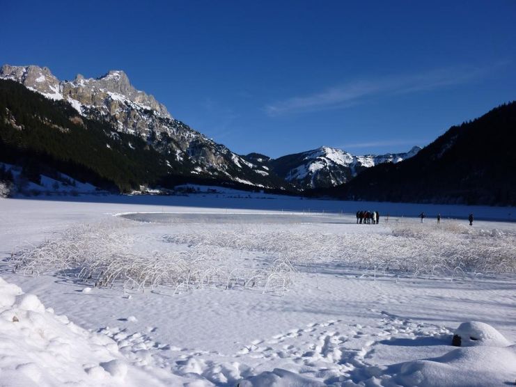
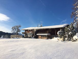
Beautiful winter hike along the Haldensee. Enjoy the winter flair along the lakeside promenade. If the lake is frozen, you can also walk across the lake.
- Strecke1,95 km
- Aufstieg18 Hm
- Abstieg12 Hm
- Schwierigkeitleicht
Höhenprofil
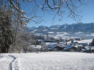
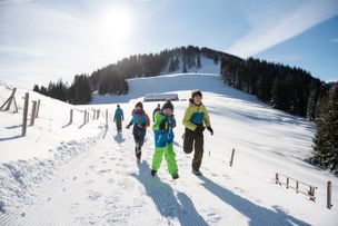
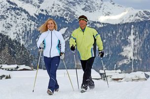
It does not always have to be skiing, snowboarding or cross-country skiing. On almost 81 kilometres of cleared paths, hikers roam through the snow-covered fairytale landscape. Along the way, cosy huts invite you to stop for a break. Sitting by the open fire, warming up with a Jaga tea or fortifying yourself with a snack for the next few kilometres - this is how you can enjoy snow walks to the full.
Because there is so much to discover and see along the approximately 81 kilometres of cleared hiking trails, so much fresh air to fill up with, that every step becomes a pleasure - whereby the inns and cafés along the routes offer extensive possibilities to strengthen and warm up. If you want to experience something really special, join a guided snowshoe hike. Those who want to reach high altitudes have two possibilities in the Tannheimer Tal to climb a peak in winter, too: the Neunerköpfle in Tannheim with the largest peak book of the Alps or the Gamskopf with the panorama information system in Grän.
From the village square in Haldensee, follow the sidewalk in an easterly direction. On the western shore of Haldensee the path leads into the lakeside promenade, which runs parallel to the main road. Along the shore of Haldensee to Haller.
Anfahrt
On the motorway A7 at the exit "Oy-Mittelberg" on the B310 towards Wertach and to Oberjoch. There follow the signposting "Tannheimer Tal" B199, centre of Haldensee.From the Tyrolean side via Reutte on the B198 in the direction of Lechtal to Weißenbach, over the Gaichtpass along the B199 to the centre of Haldensee.Parken
Parking in the center of Haldensee - with costsÖffentliche Verkehrsmittel
By train to Sonthofen, Pfronten/Ried or Reutte, then by bus to Haldensee.
It should be noted that winter hiking also involves an increased risk of accidents and injuries. Especially in winter, special attention must be paid to the condition of the paths. Suitable clothing, good shoes and possibly hiking sticks provide additional safety. Stay on the marked paths.
An up-to-date and well-kept/maintained equipment (shoes, sticks and clothes) not only provides a considerable degree of safety but also makes winter hiking much easier. Sun protection (high protection factor and possibly sunglasses) as well as sufficient liquid should not be forgotten.
Ähnliche Touren
- Winterwandern
Short Hochwiesweg trail - Winter hike in Ofterschwang
A small walk with only a slight ascent and a wonderful view of Ofterschwang.
mehr dazuDistanz 1,8 km Dauer 0:40 h Aufstieg 72 m Schwierigkeit leicht - Winterwandern
Sonnenplateau winter hike between Ofterschwang and Untermühlegg
Wonderful round tour through fairytale landscapes in the Oberallgäu between Bolsterlang and Ofterschwang. Fantastic view of the Allgäu main ridge.
mehr dazuDistanz 4,8 km Dauer 1:30 h Aufstieg 30 m Schwierigkeit leicht - Winterwandern
Winter walk around the Ofterschwanghorn
A nice and easy walk around the Ofterschwanger Horn (mountaintop) with great views of the Allgäu Alps.
mehr dazuDistanz 2,4 km Dauer 1:15 h Aufstieg 80 m Schwierigkeit leicht - Winterwandern
Winterspaziergang - Beste Aussichten zwischen Untermühlegg und Muderbolz
Winterspaziergang - Beste Aussichten zwischen Untermühlegg und Muderbolz
mehr dazuDistanz 5,4 km Dauer 1:20 h Aufstieg 88 m Schwierigkeit leicht - Winterwandern
Winterwandern Hochwiesweg Runde - Ofterschwang
A pleasant round trip with only a slight ascent and a magnificent view over Ofterschwang, the Iller Valley and the Allgäu Alps.
mehr dazuDistanz 3,6 km Dauer 1:15 h Aufstieg 93 m Schwierigkeit leicht
Die Inhalte dieser Seite werden in Kooperation mit Outdooractive bereitgestellt.