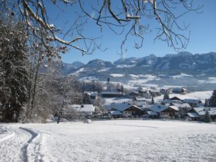
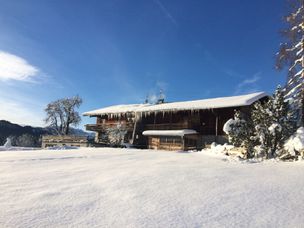
A pleasant round trip with only a slight ascent and a magnificent view over Ofterschwang, the Iller Valley and the Allgäu Alps.
- Strecke3,65 km
- Dauer1:15 h
- Aufstieg93 Hm
- Abstieg93 Hm
- Schwierigkeitleicht
Höhenprofil
An extensive walk along the western and southern outskirts of Ofterschwang along mostly groomed winter hiking trails and magnificent views.
From the valley station of the Weltcup-Express in Ofterschwang you walk a little bit downhill to the south and take the path right after the stream on the right and follow the Hochwiesweg to Sigiswang. From here, follow the road through the upper part of the village and then downhill to the main road. Follow the road about 200m left to Ofterschwang, until you reach the winter hiking trail to the right, taking you in an arch around a little forest towards the church in Ofterschwang. The path leads into the Moosweg in front of the church. Take the Kirchgasse to the left, until you reach the intersection. Opposite, the Panoramaweg leads back to the car park at the valley station.
Anfahrt
The access to Ofterschwang is via the B19, to exit OA5 to Ofterschwang near Sonthofen or via Tiefenberg.Parken
Free parking at the valley station Weltcup-Express in OfterschwangÖffentliche Verkehrsmittel
From the Sonthofen train station by bus to Ofterschwang (bus route Sonthofen - Ofterschwang - Bolsterlang) or via Fischen (via Bolsterlang)Ofterschwang is located on the edge of the Nature Park Nagelfluhkette. A Nature Park is a protected landscape created by long-term use and cultivation. This valuable cultural landscape is to be preserved in its present form, but at the same time also to be used.
Please note the following recommendations:
- Please do not make noise.
- Please do not go off the road.
- Please do not make an open fire.
- Please only camp on marked areas.
- Please do not resettle plants or animals.
- Please do not pick plants and flowers.
- Please do not collect mushrooms.
- Please do not collect stones or minerals.
- Please do not feed animals.
- Please do not leave any rubbish.
- Please dispose of dog droppings in public dog kennels or at home
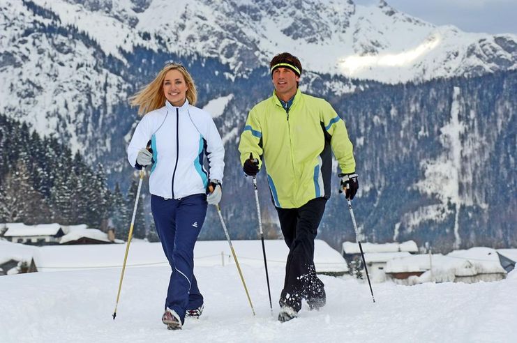
The right equipment for your tour consists of proper hiking boots and clothing appropriate to the weather. Take sun cream and water along. Note that you are in the mountains and weather changes can be expected at any time.
Ähnliche Touren
- Winterwandern
Short Hochwiesweg trail - Winter hike in Ofterschwang
A small walk with only a slight ascent and a wonderful view of Ofterschwang.
mehr dazuDistanz 1,8 km Dauer 0:40 h Aufstieg 72 m Schwierigkeit leicht - Winterwandern
Sonnenplateau winter hike between Ofterschwang and Untermühlegg
Wonderful round tour through fairytale landscapes in the Oberallgäu between Bolsterlang and Ofterschwang. Fantastic view of the Allgäu main ridge.
mehr dazuDistanz 4,8 km Dauer 1:30 h Aufstieg 30 m Schwierigkeit leicht - Winterwandern
Winter walk around the Ofterschwanghorn
A nice and easy walk around the Ofterschwanger Horn (mountaintop) with great views of the Allgäu Alps.
mehr dazuDistanz 2,4 km Dauer 1:15 h Aufstieg 80 m Schwierigkeit leicht - Winterwandern
Winterspaziergang - Beste Aussichten zwischen Untermühlegg und Muderbolz
Winterspaziergang - Beste Aussichten zwischen Untermühlegg und Muderbolz
mehr dazuDistanz 5,4 km Dauer 1:20 h Aufstieg 88 m Schwierigkeit leicht
Die Inhalte dieser Seite werden in Kooperation mit Outdooractive bereitgestellt.