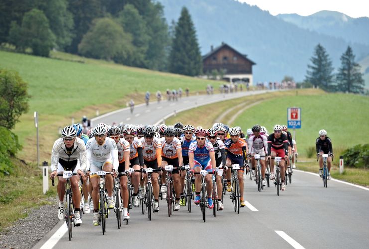
Bike-Marathon 230 km.
- Strecke225,14 km
- Dauer10:00 h
- Aufstieg2940 Hm
- Abstieg2940 Hm
- Schwierigkeitschwer
Höhenprofil
Start at the tourist information in Tannheim in eastern direction. At the crossing Grän/Haldensee turn left onto the L261 and through the Engetal down to Pfronten until the main road. Turn right and follow the sign Vils/Reutte. Continue to Ulrichsbrücke and turn right before the railway crossing and follow the road via Musau, Pflach to Reutte. Straight on through the traffic-calmed zone and at the roundabout turn right towards Lechtal, continue through Lechaschau and Höfen to Weißenbach. At the roundabout go straight on into the Lechtal and continue to Warth. Turn left there and continue to Lech, the famous winter sports resort. Now follows the ascent to Zürs and on to the Flexenpass at 1,773 metres above sea level. On the ascent and on the descent to Alpe Rauz you will pass through galleries again and again - sometimes dark and, depending on the weather, also wet and slippery - be careful! After the descent you will reach the Arlbergpass road. Turn left here and after a further 3 km ascent to the Arlbergpass summit at 1,793 m you will reach the ski resort of St. Christoph. Now follows a rapid descent to St. Anton and further through the Stanzer Tal to Landeck. In Landeck follow the signs "Imst - Schönwies" and via Zams parallel to the motorway to Imst. Once in Imst follow the signs "Hahntennjoch" and drive around the town. Turn right at the church (Hahntennjoch signposted) in the town, then follow the 16 kilometre long climb up to the Hahntennjoch. Here you have to climb 1,200 metres in altitude, with a maximum gradient of 12 - 15%. The highest point of the tour is reached at the top of the pass at 1,894 metres above sea level. There follows a great descent to Boden, then only a slight gradient to Bschlabs. This is followed by a rapid descent to Elmen. Arrived in Lechtal, turn right towards Reutte. In Weißenbach at the roundabout take the exit into the Tannheimer Tal and return to the starting point.
Anfahrt
On the motorway A7 at the exit "Oy-Mittelberg" on the B310 towards Wertach and to Oberjoch. There follow the signposting "Tannheimer Tal" B199, exit Tannheim, Neunerköpfle mountain railway.
From the Tyrolean side via Reutte on the B198 towards Lechtal to Weißenbach, over the Gaichtpass along the B199 to the exit Tannheim, Neunerköpfle Bergbahn
Parken
Parking directly at the start, Tannheim - Neunerköpfle mountain railwayÖffentliche Verkehrsmittel
By train to Sonthofen, Pfronten/Ried or Reutte, then by bus to Tannheim.
Wearing a crash helmet is mandatory.Every participant has to carry a spare tube himself.Escort vehicles are undesirable !!!
Ähnliche Touren
- Rennrad
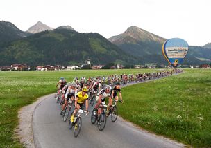
Rad-Marathon Tannheim Valley_224km
© Tannheimer Tal
Start in Tannheim, Rossberg, Sägerklause via Grän, Tannheim, Zöblen, Schattwald across the NATIONAL BORDER to Oberjoch and Unterjoch. After that, back on Austrian territory through Jungholz, before re-entering German soil...
mehr dazuDistanz 214,1 km Dauer 10:00 h Aufstieg 3.500 m Schwierigkeit schwer
Die Inhalte dieser Seite werden in Kooperation mit Outdooractive bereitgestellt.