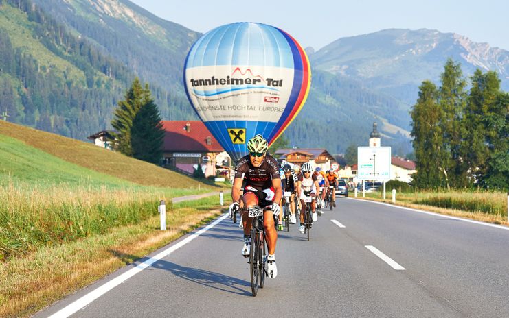
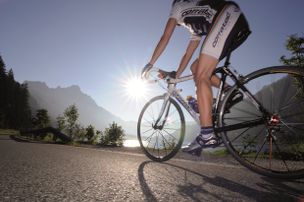
The 130 kilometres stretch leads from Tannheim via Grän to Pfronten in the Allgäu and further via Reutte into the Lechtal and back via the Gaichtpaß into the Tannheimer Tal.
- Strecke131,21 km
- Dauer5:00 h
- Aufstieg930 Hm
- Abstieg930 Hm
- Schwierigkeitmittel
Höhenprofil
From the start in the centre of Tannheim to Grän, then downhill to Pfronten in Ostallgäu and back to Tyrol. Through the small town of Vils, on to Musau and in the middle of the Lechauen to Lechaschau on the B198 and turn right to Weißenbach am Lech. From the Johannes bridge through the Schwarzwasser to Vorderhornbach to the first refreshment station. At the Martinauer Lechbrücke turn right, continue via Elmen, Elbigenalp, Bach to Holzgau. At the end of Holzgau you will reach the turning point before you reach the second refreshment stop in Stockach. The route leads back again via Bach, Elbigenalp, Elmen and through Stanzach to Weißenbach.
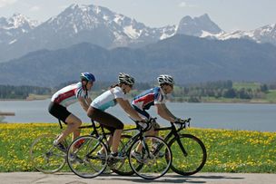
Start in Tannheim, Rossberg, Sägerklause in the direction of the village centre to the church, continue through the underpass and in the direction of Innergschwend to Grän/Lumberg. There turn left onto the L261 through the Engetal downhill to Pfronten until the main road in Pfronten Steinach. There turn right and follow the sign Vils/Reutte. After crossing the border through the small town of Vils and further to Stegen and turn right onto the L69 towards Musau, after Roßschläg/Bärenfalle onto the cycle path towards Oberletzten (motor vehicle ban) and in the middle of the Lechauen to Lechaschau. There, turn right in front of the church and through Höfen to Weißenbach am Lech. There at the roundabout straight on into the Lech Valley and before the Johannis Bridge turn right onto the cycle path into the Schwarzwasser (no motor vehicles allowed).The single-lane road rises slightly there and leads into the forest, where the cycle path leads along the Lech river. Scenically wonderful impressions and a diversified road until Stanzach, where the cycle path is left again and the village Vorderhornbach (1st refreshment stop) is passed. Continue to Martinau, then cross the Lech bridge and turn right. Continue on the B198 to Elmen, Häselgehr, Elbigenalp, Bach and Stockach through Holzgau. After Holzgau turn left and follow the Lechtal cycle path, along the Lech foot, towards Stockach to the second refreshment stop.Then again along the B198 through Elbigenalp in the direction of Elmen/Reutte. In Weißenbach parallel to the B198 there is still the third refreshment station before you have to take the exit into the Tannheimer Tal at the roundabout and follow the route via the Gaichtpaß along the Haldensee back to the starting point in Tannheim.
Anfahrt
On the motorway A7 at the exit "Oy-Mittelberg" on the B310 towards Wertach and to Oberjoch. There follow the signposting "Tannheimer Tal" B199, exit Tannheim, Neunerköpfle mountain railway.
From the Tyrolean side via Reutte on the B198 towards Lechtal to Weißenbach, over the Gaichtpass along the B199 to the exit Tannheim, Neunerköpfle Bergbahn.
Parken
Directly at the start (Tourismusinfo Tannheim) possible - parking lot of the Tannheimer Bergbahnen - with costsÖffentliche Verkehrsmittel
By train to Sonthofen, Pfronten/Ried or Reutte, then by bus to Tannheim.
It should be noted that in road cycling there is an increased risk of accidents and injuries. Despite careful tour planning, a basic risk always remains. Tour preparation through endurance sports, appropriate training and further education as well as personal prudence reduces the risk of accidents and injurie
Racing bike is recommendable, it can be ridden with any touring bike.
Wearing a crash helmet is mandatory.
Every participant has to carry a spare tube with him/herself.
Escort vehicles are undesirable - please keep to this!
!!! Motor vehicle driving ban through the black water !!
Ähnliche Touren
- Rennrad
Gaichtpass Tour
Start at the Tourism Information Office in Tannheim towards the East. At the intersection Grän/Haldensee turn left on to the Road L261 through the Engetal (valley) downhill to Pfronten to...
mehr dazuDistanz 56,6 km Dauer 2:40 h Aufstieg 510 m Schwierigkeit mittel - Rennrad
Lake Tour
Start at the Tourism Information Office in Tannheim towards the East. At the intersection Grän/Haldensee turn left on to the Road L261 through the Engetal (valley) downhill to the former customs house "Fallmühle"…
mehr dazuDistanz 92,5 km Dauer 4:30 h Aufstieg 800 m Schwierigkeit mittel - Rennrad
Namlos Tour
Start at the Tourism Information Office in Tannheim towards the East, past Nesselwängle via the Gaichtpaß to Weißenbach. Turn right at the traffic circle in to the Lech Valley, past...
mehr dazuDistanz 87,3 km Dauer 3:30 h Aufstieg 1.303 m Schwierigkeit mittel - Rennrad
On the Trail of King Ludwig II
Start at the Tourism Information Office in Tannheim towards the East. At the intersection Grän/Haldensee turn left on to the Road L261 through the Engetal (valley) downhill to the former customs house "Fallmühle"…
mehr dazuDistanz 81,1 km Dauer 4:45 h Aufstieg 1.110 m Schwierigkeit mittel - Rennrad
Rottachsee Tour
© Tannheimer Tal
Start at the Tourism Information Office in Tannheim towards the East. At the intersection Grän/Haldensee turn left on to the Road L261 through the Engetal (valley) downhill to Pfronten to the main street...
mehr dazuDistanz 107,5 km Dauer 3:30 h Aufstieg 1.157 m Schwierigkeit mittel - Rennrad
Stanzach-Hinterhornbach
Start at the Tourism Information Office in Tannheim towards the East, past Nesselwängle via the Gaichtpaß to Weißenbach. Turn right at the traffic circle in to the Lech Valley, past...
mehr dazuDistanz 79,4 km Dauer 3:50 h Aufstieg 938 m Schwierigkeit mittel
Die Inhalte dieser Seite werden in Kooperation mit Outdooractive bereitgestellt.