The Günztal cycle path leads from its source in the eastern Allgäu town of Günzach for about 92 km to Günzburg, where the Günz flows into the Danube. Along the route, magnificent churches and castles are embedded in the varied landscape.
Kneippland Unterallgäu
- Strecke92,70 km
- Dauer6:12 h
- Aufstieg43 Hm
- Abstieg410 Hm
- Schwierigkeitleicht
Höhenprofil
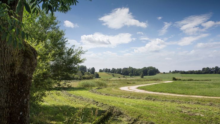
The Günztal Cycle Path has a length of approx. 92 km, of which we describe around 58 km here: Obergünzburg to Breitenthal. It runs mainly on low-traffic side roads and field paths. Since it mostly runs along the river valley, it is very suitable for children. There are no major climbs to contend with.
Günzach, the start of the Günztal Cycle Path is about 3 km from Obergünzburg, our starting point for the approx. 3-hour family-friendly cycle tour. We start at the historic market square of Obergünzburg with the Mohrenbrunnen. Opposite we see the imposing church of St. Martin from the 15th century. We first cycle along the street Unterer Markt, past the Südseemuseum and after about 150 m turn left into Krankenhausstraße. This road turns into the forest road, which we follow until we reach the allotment gardens. From here on the Günztal cycle path becomes gravelly, but very idyllic. The Günz has not been straightened here, it shows its natural charm. After about 3 km, we reach the listed mill of Liebenthann Castle. Here we can make a stopover with the whole family and have some refreshments in the excursion pub.
On the other side of the valley is the Teufelsküche, a geotope. Wildly stacked large blocks from the post-glacial period mark this area and gave the Teufelsküche its name. We follow the Günztal valley and arrive in the market town of Ronsberg. It is located in the foothills of the Günz Valley to the east. On the mountain of Ruom, on Ronsberg, the Lords of Ursin built a new ancestral castle around 1130. The Ronsbergers founded the Benedictine monastery of Irsee in 1183.
We enter the village on Mühlstraße, see a partially renovated mill on the right and reach Obergünzburger Straße. Here we turn left towards St. Ulrich Church and cycle across the market square on Engetrieder Straße to the end of the village until we rejoin the Günztal cycle path (Günzweg).
Passing the sports field and tennis courts, we cycle past a Günztal hydroelectric power station and can enjoy the blooming landscape, far from the state road, until we arrive in Engetried. Here we ride a short distance along the main road. The baroque church invites you to linger and take a rest, then we fortify ourselves in the good restaurant opposite. At the end of the village, before the traffic island, we turn left onto the cycle path. Shortly after Engetried, behind the public barbecue area, we may be able to observe the grass frog or other amphibians at the biotope. In the natural Günz we have the opportunity to refresh our feet at the Kneipp facility. Those who do not want to undress their legs - use the arm pool to cool down. The benches provided invite us to have a cosy chat or enjoy the murmur of the Günz.
This short detour has stimulated our senses and we continue on the curved cycle path, far from the district road. Recovered, we reach Markt Rettenbach after a small bridge on the Mühlweg. We follow the narrow road, the former castle mill of Markt Rettenbach with its splendidly preserved half-timbered gable is on the left, cross Ottobeurer Straße and cycle out of the town on the Riedweg.
We cycle along flowering meadows and the eastern Günz on the narrow, unpaved road in a northerly direction, keeping to the right at the fork until we reach Gottenau after about 1.5 km. The daughter church is dedicated to St. Leonhard, the patron saint of cattle. The saint appears in the ceiling painting from 1730 together with the Trinity and Mary as well as in a large painting on the outside of the choir and as a wooden figure from the 18th century. The chancel and tower date from the late medieval period.
At the entrance to the village, we turn left, leaving Gottenau on the right and continue cycling on the tarred field path through the agricultural fields. We cross the local connection road to Altisried, cycle along the gravel extraction area in the direction of Lindenhöf to the junction of Hochfürst and Hochstettener Straße at the hamlet of Hammerschmied. We follow the cycle path along the individual farmsteads of Lindenhöf. Soon our view falls on Sontheim, which was first mentioned in a document in 838 AD. In Sontheim, we pass the traffic island and follow Frechenriedener Straße, which leads into Hauptstraße.
We can stop off at one of the oldest inns still in operation in the area. The Adler inn was built in the 2nd half of the 15th century. In the past, it was common for the church to stand next to an inn, and this is also the case here in Sontheim. The parish church of St. Martin dates from the same period and was remodelled in baroque style in 1762. Our tour continues to the junction with Bahnhofstraße, where we turn left, cross the railway tracks and ride the busy road for a short distance to the turn-off to Schlegelsberg. Originally, only the ridge between Sontheim and Breitenbrunn was called Schlegelsberg. In 1954, a tooth of a prehistoric horse was found during earthworks. Keep your eyes open, maybe we'll be lucky and find something prehistoric!
The slightly ascending village road leads us through the village and further under the A96 motorway bridge to Erkheim. We ride along Schlegelsberger Straße, later Marktstraße, through the village to Arlesrieder Straße. Here we turn left and immediately right again into Babenhausener Straße. The Günz lies deep in its streambed here, but at high tide the adjacent buildings are threatened by its waters. We pass the church and the last houses and turn right into a quieter road at the junction on the edge of town. This flat stretch along the eastern Günz invites us to enjoy.
Ahead of us lies Daxberg, steeped in history, where we keep to the left. It is worth taking a detour straight up the mountain. The first thing you notice is the medieval tower of the Catholic Church of St. Nicholas. The nave at the core of this church probably dates from the 17th century. It is not only the church that is worth seeing - on the mountain you can recreate everyday school life, as the Allgäu-Swabian Village School Museum is faithfully reproduced in every detail. The visitors are amazed and fascinated by the one-class village school. A farmhouse with remains of the former castle barn, a town wall and much more are listed here.
We circle Daxberg, come to the Moosmühle and follow the Günz. Before the oil mill we turn left and after about 200 m we can observe the meeting of the western and eastern Günz. We turn right along the now united Günz for about 2.6 km until we reach Frickenhausener Straße and turn left to Egg. Egg produced a famous theologian in 1486, Johannes Eck, actually Johannes Mayer - he was named Eck (Egg) after his birthplace and was an opponent of Martin Luther in his day.
In Egg, we turn left onto Inneberger Straße and then right onto Sportplatzweg, past the tennis court and out into the open field again until we reach the connecting road to Engishausen. Here we turn left, but after 200 m we turn right again onto the paved field path over the Täuferbach. At the next turn we keep left and cycle along the meadows and fields, between the villages of Weinried and Klosterbeuren. Shortly before Babenhausen, we can turn left on Fabrikstraße to the bathing lake with kiosk and playground. We cycle to the Rechbergstraße junction and continue to the right to Fuggerschloss Castle. A visit to the baroque, former Fugger Church of St. Andreas and the Fugger Castle with the Fugger Museum is very worthwhile. The castle has been owned by the Fugger merchant family since the mid-16th century.
The Schrannenstraße leads us along below the imposing castle to the market square and further out to the left on the Ritter-von Rafflerstraße and the Gänsberg Orts. On the shady road, past individual farmsteads, we tour to the junction with Talstraße, where we turn right towards Bebenhausen. To the west of Bebenhausen is the Günzstausee Babenhausen, followed by other artificial lakes. We cycle along the edge of the village to the fork in the road An der Mühlstatt, keep left, cross the Günz again and after 200 m turn right onto the field path. We cycle through the fields of Kettershausen, which has belonged to the Kingdom of Bavaria since 1806 and was first mentioned in documents in 1162. For over 250 years, Kettershausen held the seat of the court of the dominion of the Princes Fugger-Babenhausen.
In Kettershausen we pass the sports field, cycle right, cross the Günz and turn left at the next junction into Waldstraße. We can make another cultural detour at the neo-Romantic St. Michaels Church and enjoy the silence. Our cycle tour takes us past the Günzstausee Kettershausen and Mohrenhausen. Approx. 1 km after Mohrenhausen we reach a fork, where we keep left along the Günz towards Tafertshofen. Following the path, we turn off about one km further towards Zaiertshofen. Before entering the village, we leave this road and continue to the next fork. Here we turn left, meet the natural old Günz river, pass the gravel extraction area and the fish ponds, keep left and can swim, relax or have a snack at the camping site at the Oberrieder Weiher on hot summer days. Children can let off steam at the playground in the middle of the recreation area. Opposite the quarry pond is the Günztalstausee Breitenthal, which is used to generate electricity. Recovered, we ride along the Oberrieder Weiherstraße to the fork and reach our destination: Breitenthal. Breitenthal takes its name from its location on the Günztal and refers to the Latin term "lata valle" meaning "wide valley".
Obergünzburg - Ronsberg - Markt Rettenbach - Sontheim - Erkheim - Egg - Babenhausen - Kettershausen - Breitenthal - Wisenbach - Ellzee - Waldstetten - Ichenhausen - Günzburg
Surface: approx. 75% asphalt, approx. 25% gravelled farm tracks
Die Inhalte dieser Seite werden in Kooperation mit Outdooractive bereitgestellt.