A fantastic Ferrata in the Tannheimer Tal.
Outdooractive Editors
- Strecke8,94 km
- Dauer7:00 h
- Aufstieg1176 Hm
- Abstieg1180 Hm
- Schwierigkeitschwer
Höhenprofil
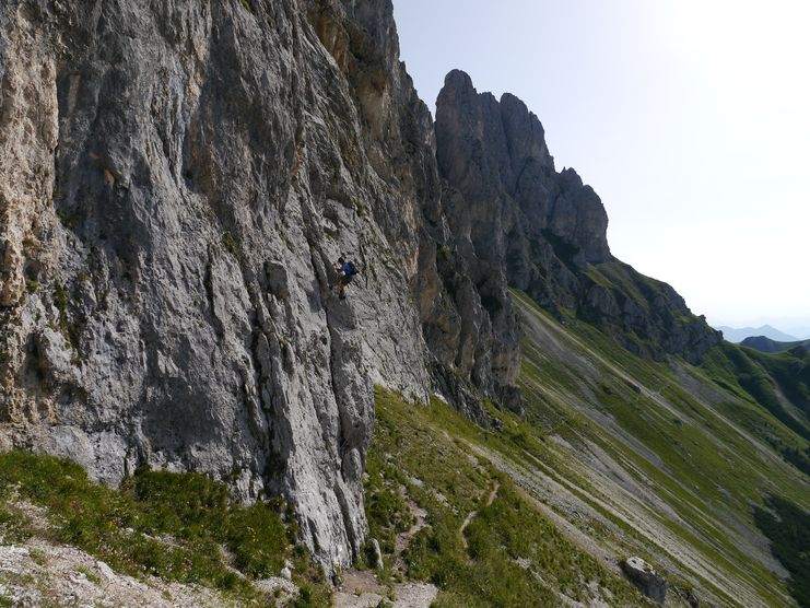
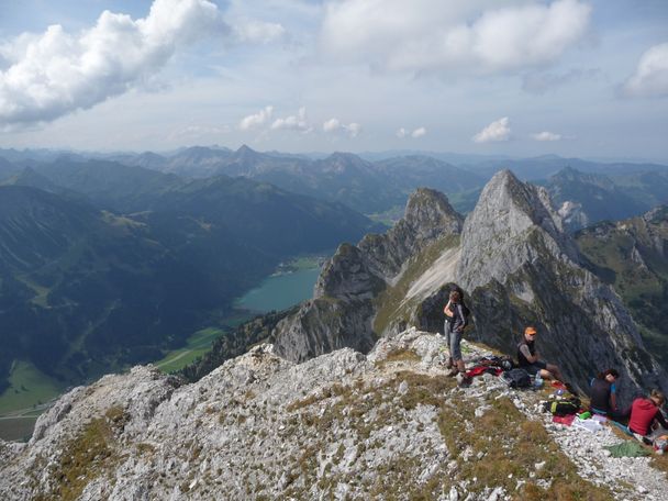
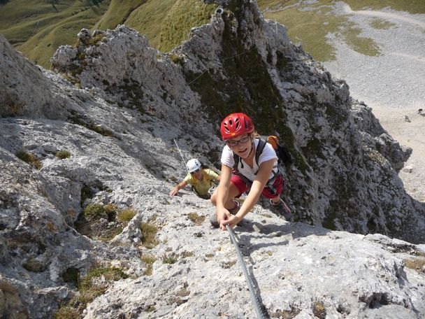
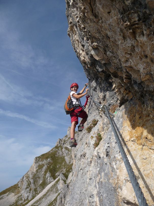
A beautiful, alpine via ferrata on the south side of the Köllenspitze - the route has class! Not only the difficulties, which are more in the upper range with passages up to difficulty level D, distinguish this Ferrata. The mix of a longer ascent, great, difficult sport via ferrata and alpine tricky descent make for the perfect adventure via ferrata day. On the summit you have both the rugged peaks of the Alps in the south and a wonderful view over the Tannheimer Tal.
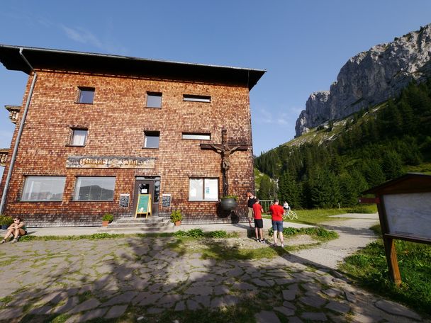
The access is via the Gimpelhaus. From there continue in the direction of Rote Flüh until you turn right after the Gimpelalpe to the Nesselwängler Scharte. Immediately before the Scharte, turn right to the foot of the Köllenspitze south face (red dot markings, at the end in the gravel field it is better to put on your helmet).
The via ferrata itself is in difficulty level D, but also has passages with A and B. There are two rest areas but no possibility to get off.
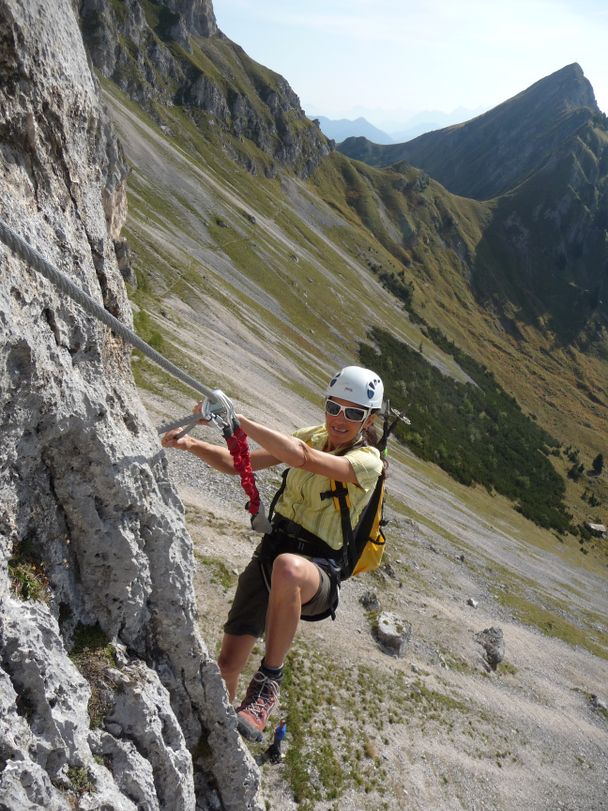
Descent: From the summit first north on climbing tracks into a channel, then descend left (west) in the channel until you reach a steep step (rope belay; C/D). Continue down in the gully until you cross a crag on the left and ascend again through a gully. Behind the edge, descend over partly steep gravel terrain (passages 1-) to the Nesselwängler Scharte (2007 m). There again on the south side and on the access path back to the valley.
Attention: The descent is alpine! Climbing spots up to 1, partly exposed and brittle. Dangerous in snowy and wet conditions (the snow lasts quite long on the north side in spring, ask the Gimpelhaus or the Tannheimer Hütte for information about the conditions). Long via ferrata tour which should only be done in stable weather.
Anfahrt
On the motorway A7 at the exit "Oy-Mittelberg" on the B310 towards Wertach and to Oberjoch. There follow the signs "Tannheimer Tal" B199, exit Nesselwängle Parkplatz Gimpelhaus. From the Tyrolean side via Reutte on the B198 towards Lechtal to Weißenbach, over the Gaichtpass along the B199, Nesselwängle to the exit Parkplatz Gimpelhaus.Parken
Gimpelhaus parking lot in Nesselwängle - subject to chargesÖffentliche Verkehrsmittel
By train to Sonthofen, Pfronten/Ried or Reutte, then by bus to Nesselwängle - bus stop Abzw. Krinnenalplift
General valid and usual rules of conduct!Please note that there is an increased risk of accidents and injuries in mountain sports. Despite careful route planning, a basic risk always remains. Tour preparation through endurance sports, appropriate technical training and further education as well as personal prudence reduces the risk of accidents and injuries. But please never forget that the weather in the mountains can change very quickly. Stay on the marked hiking trails.
Complete via ferrata equipment (via ferrata set, harness and helmet) also recommended for experienced climbers!
The personal mountaineering equipment must be safe and serviceable and meet the respective technical standards. Every hiker is recommended to obtain information about the planned tours from alpine specialist literature or on site.
Unknown
Tannheimer Tal
Tannheimer Tal
Tannheimer Tal
Tannheimer Tal
Die Inhalte dieser Seite werden in Kooperation mit Outdooractive bereitgestellt.